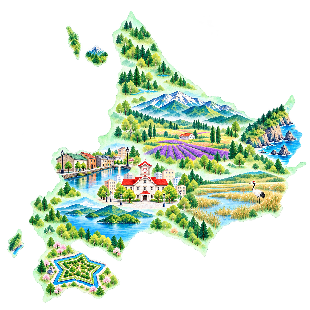
An illustrated introduction to Hokkaido · Symbols suggest places to explore; the illustration is not a route map.
Sapporo · Through the year
Average monthly temperature
Sapporo observation station · Climate normals, 1991–2020 · °C
Jan
-3.2°C
Feb
-2.7°C
Mar
1.1°C
Apr
7.3°C
May
13.0°C
Jun
17.0°C
Jul
21.1°C
Aug
22.3°C
Sep
18.6°C
Oct
12.1°C
Nov
5.2°C
Dec
-0.9°C
Source: Japan Meteorological Agency · Sapporo observation station. These are station averages, not an average across Hokkaido. Coastal, inland and mountain conditions differ; check your destination’s forecast.
Year-round travel ideas · Visitor information checked 28 October 2026. Photos show the seasons and dates in their captions; older event scenes are not the upcoming programme.
Which Hokkaido would you like to meet?
Hokkaido is snow country, with a long winter. Yet for all the freezing cold, a view turned completely white can leave you with a lovely, warm feeling.
How much snow falls, and when it settles, varies from place to place. Even within Hokkaido, winter on the Sea of Japan side looks different from winter on the Pacific side.
And there is so much to enjoy beyond the snowy months, too.
Fields rolling over gentle hills, lavender turning the landscape purple. A stroll beside a harbour sounds lovely, and I would like a day to slow down in a hot spring, too. Of course, we must leave time to find something delicious!
A city walk in Sapporo, a day watching the scenery in Furano and Biei, a little history in Hakodate: each promises a different kind of day.
Hokkaido is a big place, so let’s begin with one thing: ‘I’d love to see that,’ or ‘I’d like to spend some time here.’ Come along with me, and let’s find the beginning of your trip.
Sapporo and Otaru: begin with a walk through town
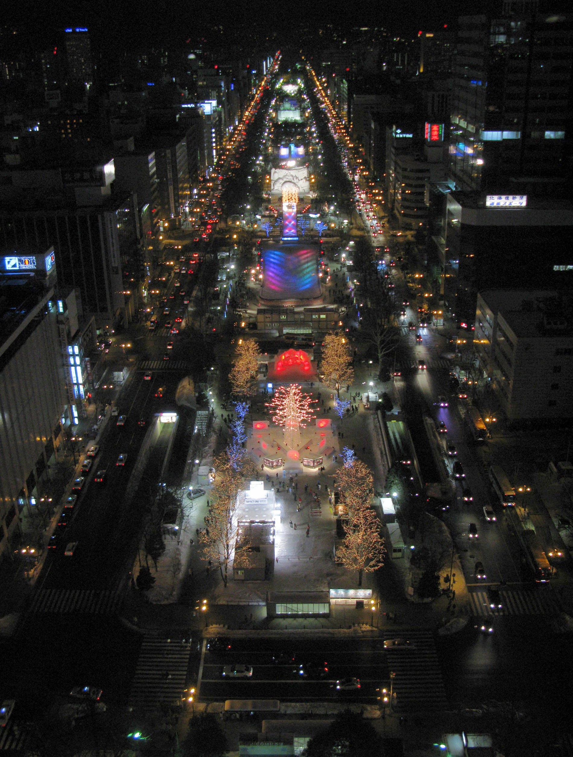
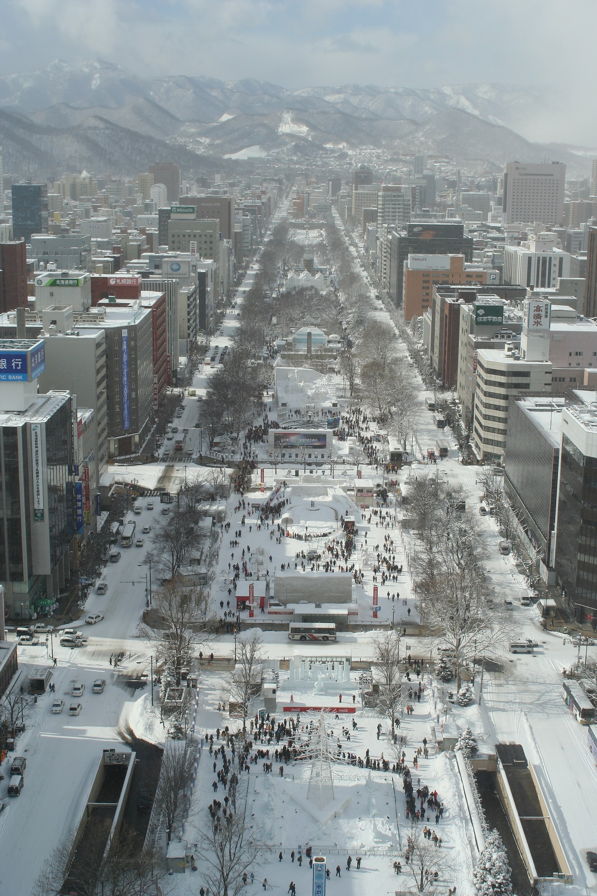
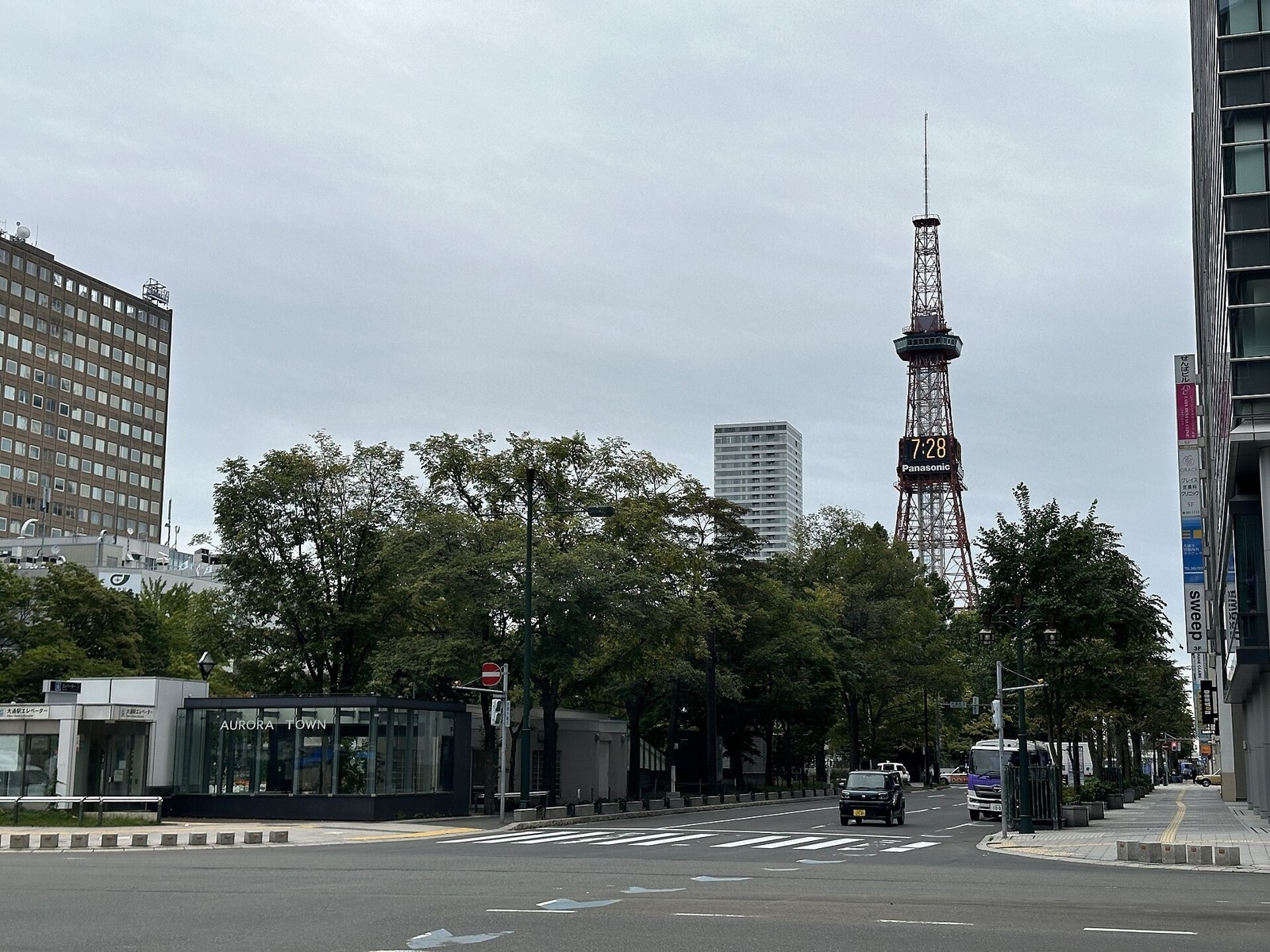
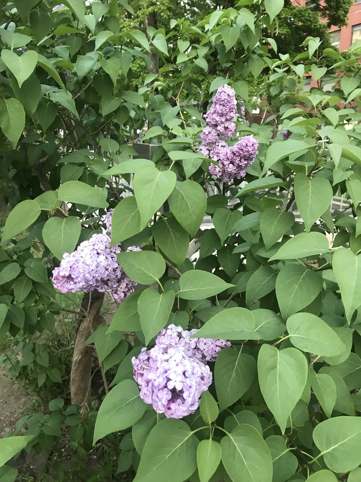
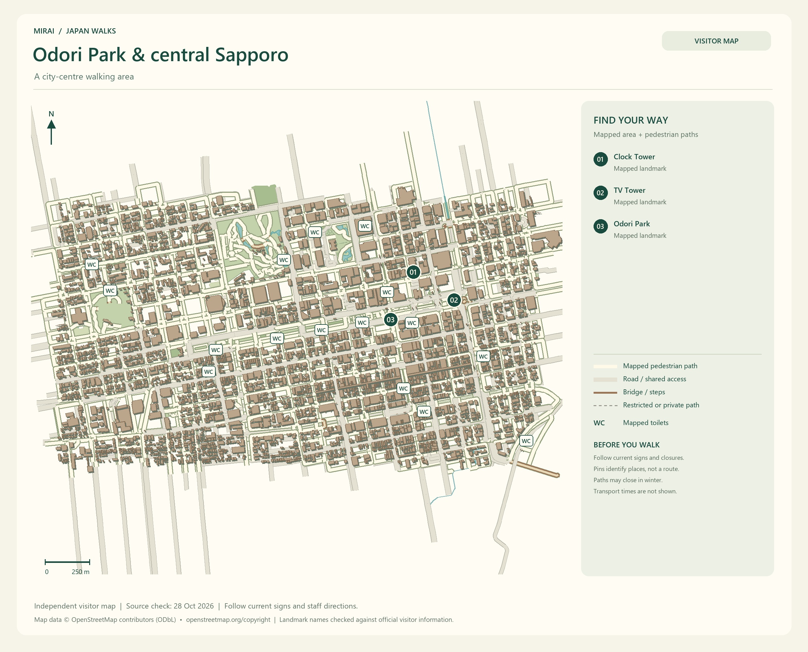
In Sapporo, use Odori Park and Sapporo TV Tower as your starting points. Look at the flowerbeds, peek into nearby shops, then take a little break in the park while you choose where to go next.
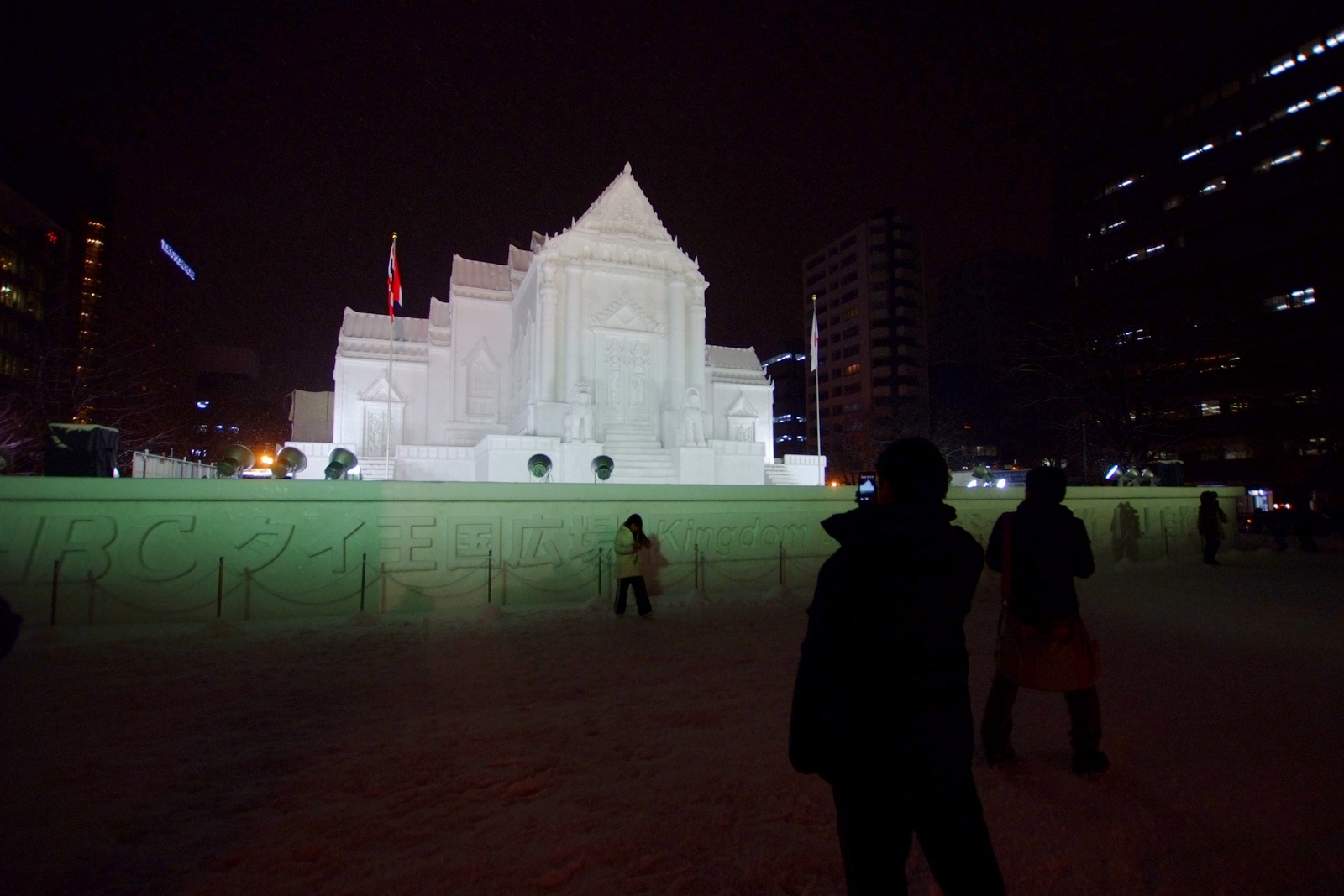
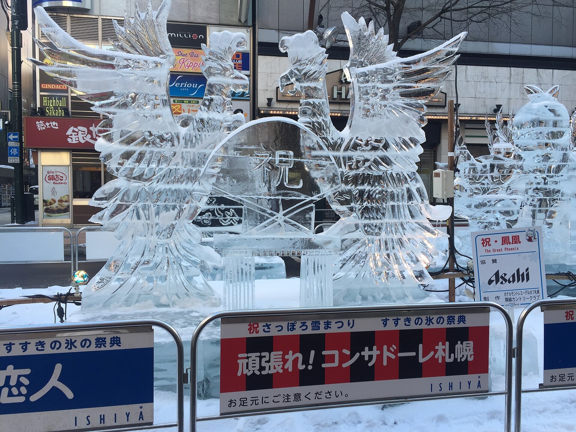
In winter, Odori Park is also one of the places to see the Sapporo Snow Festival. Its enormous snow sculptures give you a whole new reason to enjoy the snow. If the festival is your main attraction, plan around that year’s confirmed dates.
The red-roofed Sapporo Clock Tower was originally built as a drill hall for Sapporo Agricultural College. Knowing that students once trained and attended ceremonies here makes it easier to imagine the older city behind that charming exterior.
When you are hungry, look for a meal around Susukino. Miso ramen, or soup curry? I have a feeling our food list might grow along with our walking plans.
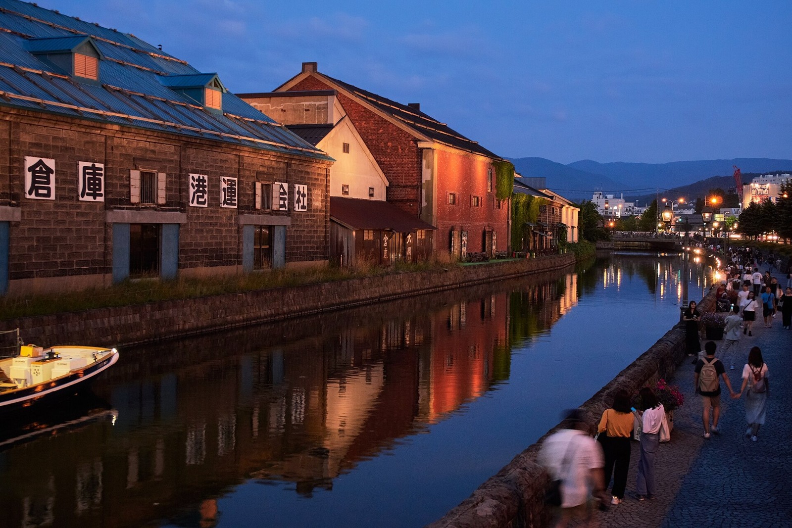
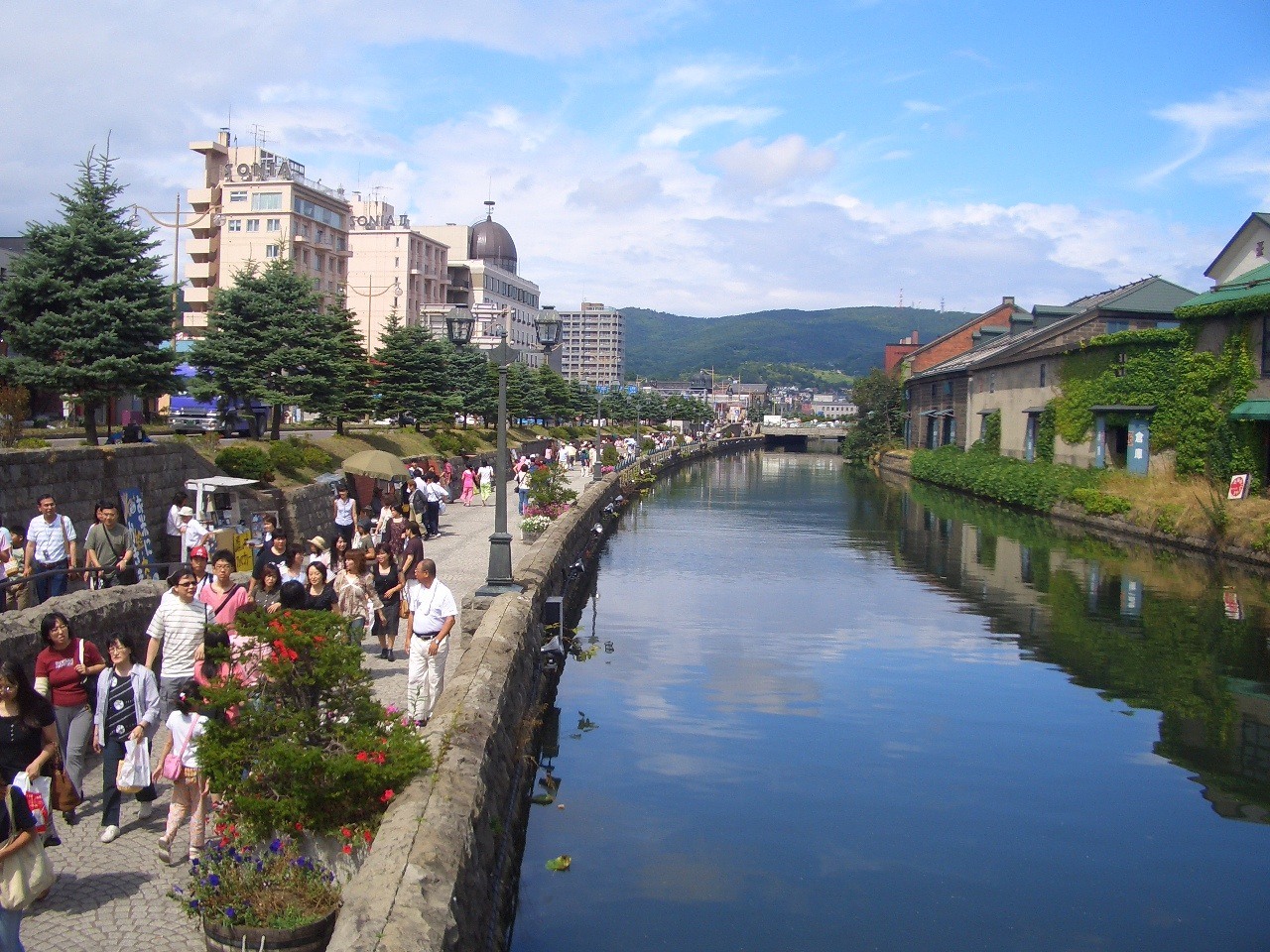
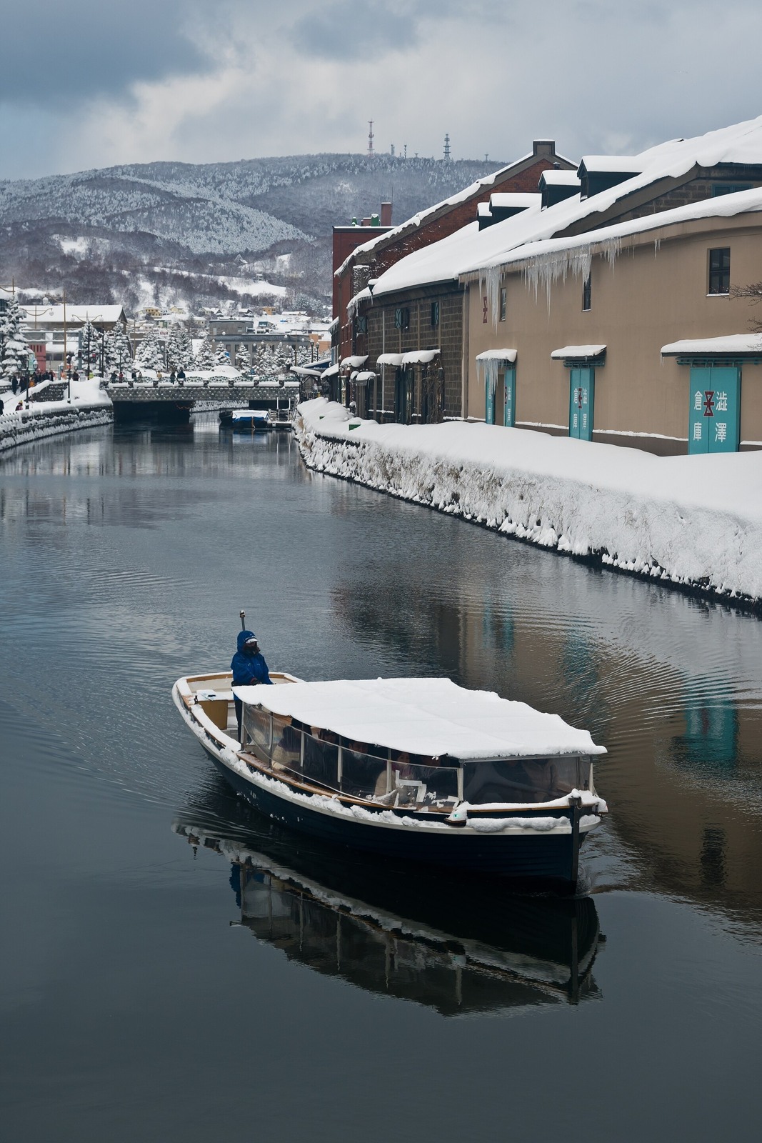
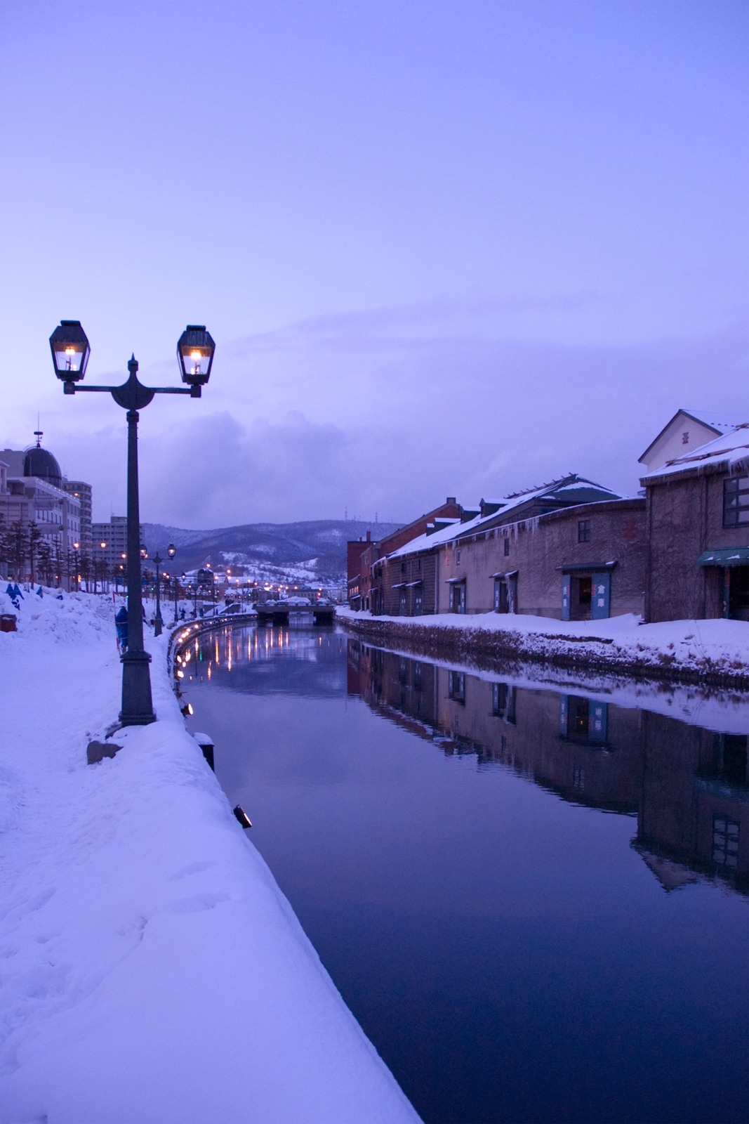
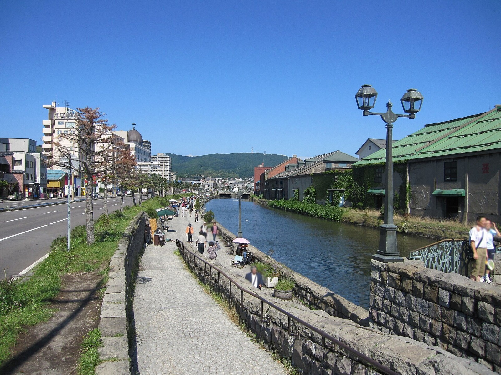
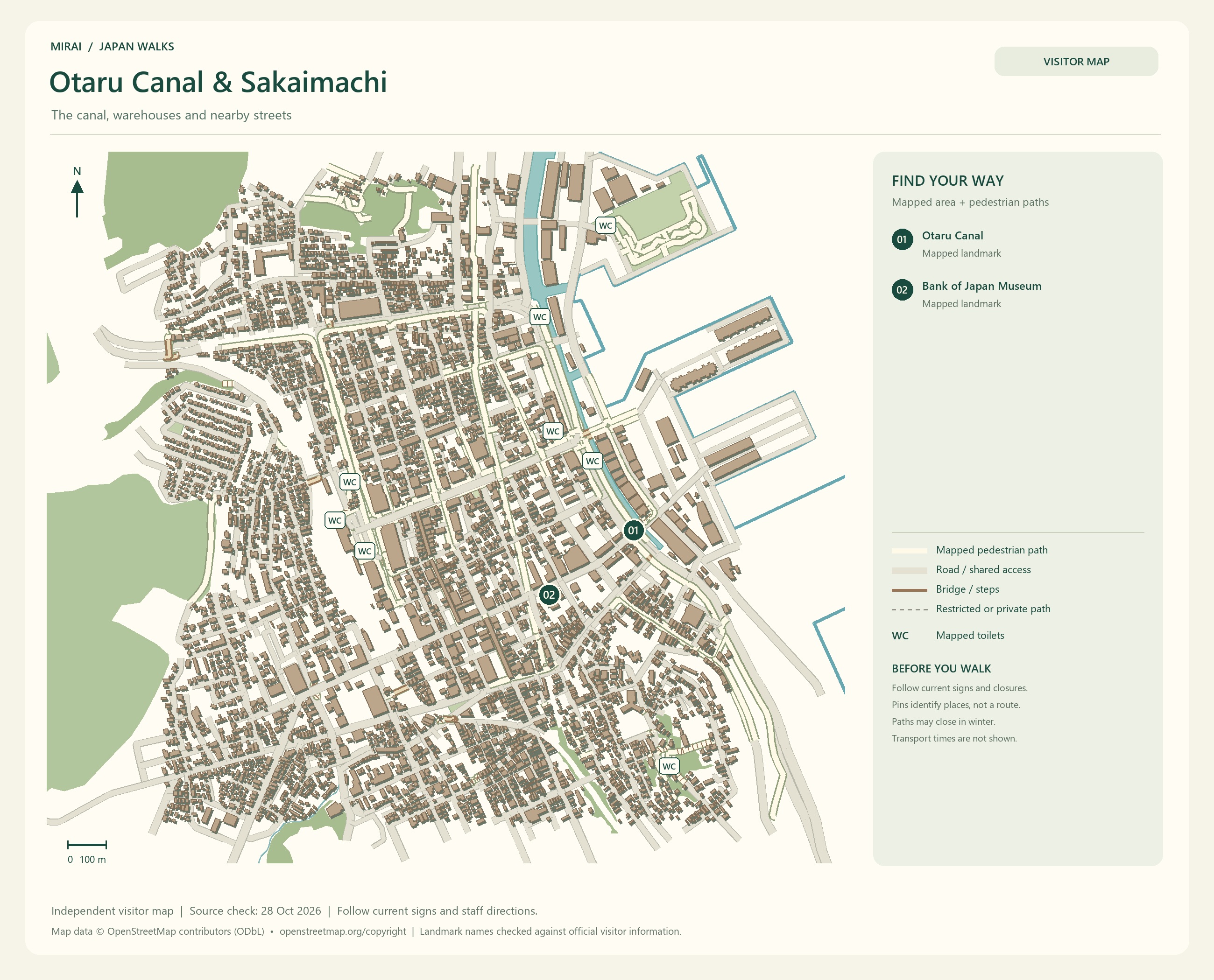
In Otaru, head for the canal and its stone warehouses. The canal was built to help move cargo from ships arriving in the port. Behind today’s peaceful waterfront is the working history that supported this harbour town.
After browsing glass shops and sweets along Sakaimachi Street, leave time to return to the canal at dusk. The warehouses in daylight and the streets as the lamps come on: wouldn’t it be lovely to see both?
If you are combining Sapporo and Otaru and would like to stay in Otaru for dinner, check your return train or bus first. Having the way back settled makes it easier to enjoy the walk without watching the clock.
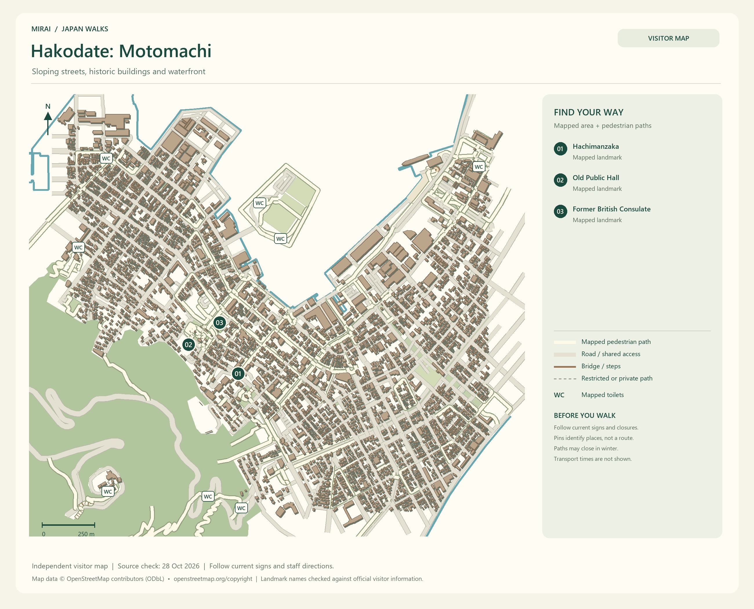
Maps follow the photos. They show the areas named in their titles, not a single route connecting every place in this gallery. Follow current signs and access conditions.
Photo and map credits
Sapporo Snow Festival Odori-Site At Night Panorama 1.jpg — ja:User:京浜にけ. https://commons.wikimedia.org/wiki/File:Sapporo_Snow_Festival_Odori-Site_At_Night_Panorama_1.jpg | CC BY-SA 3.0 https://creativecommons.org/licenses/by-sa/3.0. Resized/re-encoded for web display; no crop or retouch.
Odori Park Sapporo Snow Festival 2007.JPG — Eckhard Pecher. https://commons.wikimedia.org/wiki/File:Odori_Park_Sapporo_Snow_Festival_2007.JPG | CC BY 2.5 https://creativecommons.org/licenses/by/2.5. Resized/re-encoded for web display; no crop or retouch.
第64回さっぽろ雪まつり - ワット・ベンチャマポピット(SAPPORO SNOW FESTIVAL 64th - Wat Benchamabophit) - panoramio.jpg — t-konno. https://commons.wikimedia.org/wiki/File:%E7%AC%AC64%E5%9B%9E%E3%81%95%E3%81%A3%E3%81%BD%E3%82%8D%E9%9B%AA%E3%81%BE%E3%81%A4%E3%82%8A_-_%E3%83%AF%E3%83%83%E3%83%88%E3%83%BB%E3%83%99%E3%83%B3%E3%83%81%E3%83%A3%E3%83%9E%E3%83%9D%E3%83%94%E3%83%83%E3%83%88%EF%BC%88SAPPORO_SNOW_FESTIVAL_64th_-_Wat_Benchamabophit%EF%BC%89_-_panoramio.jpg | CC BY-SA 3.0 https://creativecommons.org/licenses/by-sa/3.0. Resized/re-encoded for web display; no crop or retouch.
Great Phoenix Ice Sculpture.JPG — Ominae. https://commons.wikimedia.org/wiki/File:Great_Phoenix_Ice_Sculpture.JPG | CC BY-SA 4.0 https://creativecommons.org/licenses/by-sa/4.0. Resized/re-encoded for web display; no crop or retouch.
2024-09-22 Odori Park.jpg — ノボホショコロトソ. https://commons.wikimedia.org/wiki/File:2024-09-22_Odori_Park.jpg | CC BY 4.0 https://creativecommons.org/licenses/by/4.0. Resized/re-encoded for web display; no crop or retouch.
Syringa vulgaris in Sapporo Odori Park 01.jpg — ノボホショコロトソ. https://commons.wikimedia.org/wiki/File:Syringa_vulgaris_in_Sapporo_Odori_Park_01.jpg | CC BY 4.0 https://creativecommons.org/licenses/by/4.0. Resized/re-encoded for web display; no crop or retouch.
Maps follow the photos. They show the areas named in their titles, not a single route connecting every place in this gallery. Follow current signs and access conditions.
Photo and map credits
Otaru - Otaru181.jpg — lumoplank. https://commons.wikimedia.org/wiki/File:Otaru_-_Otaru181.jpg | CC0 http://creativecommons.org/publicdomain/zero/1.0/deed.en. Resized/re-encoded for web display; no crop or retouch.
Hokkaido Otaru-unga.jpg — 爵士迷 at Chinese Wikipedia. https://commons.wikimedia.org/wiki/File:Hokkaido_Otaru-unga.jpg | Public domain . Resized/re-encoded for web display; no crop or retouch.
Otaru Canal Cruise (20240223).jpg — Fumikas Sagisavas. https://commons.wikimedia.org/wiki/File:Otaru_Canal_Cruise_(20240223).jpg | CC0 http://creativecommons.org/publicdomain/zero/1.0/deed.en. Resized/re-encoded for web display; no crop or retouch.
Otaru Canal Dusk.jpg — Komatta. https://commons.wikimedia.org/wiki/File:Otaru_Canal_Dusk.jpg | CC BY-SA 3.0 https://creativecommons.org/licenses/by-sa/3.0. Resized/re-encoded for web display; no crop or retouch.
Otaru Canal Dusk in summer.jpg — Sho Horiuchi. https://commons.wikimedia.org/wiki/File:Otaru_Canal_Dusk_in_summer.jpg | CC BY-SA 3.0 https://creativecommons.org/licenses/by-sa/3.0. Resized/re-encoded for web display; no crop or retouch.
Hakodate: hills, harbour views and a star-shaped fort
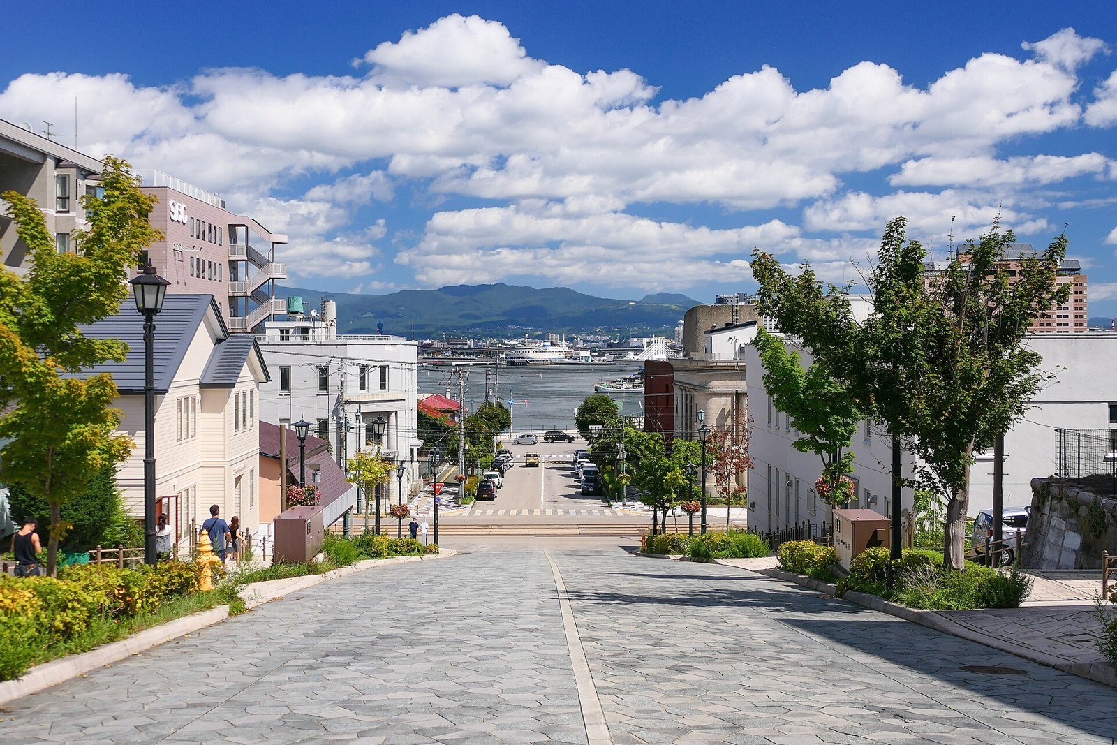
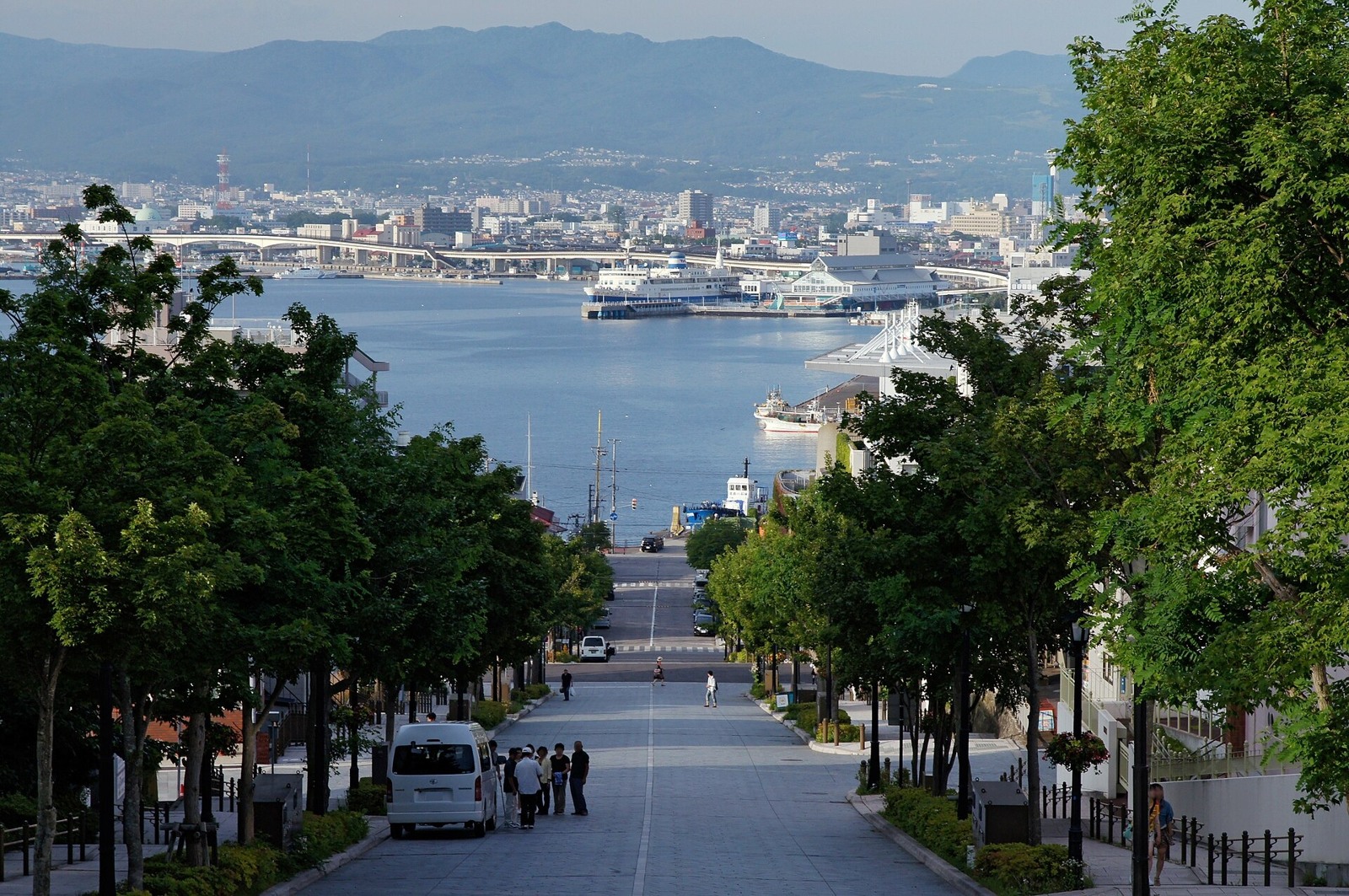
In Hakodate’s Motomachi district, look for a harbour view at the end of a sloping street. Hachimanzaka, the nearby churches and Western-style buildings reflect a city shaped by its connections across the sea.
Turn around partway up a hill, or step closer to a building that catches your eye. I can imagine wanting to stop for another photo at every turn. Take a tram part of the way, then combine a walk on the slopes with a café break.
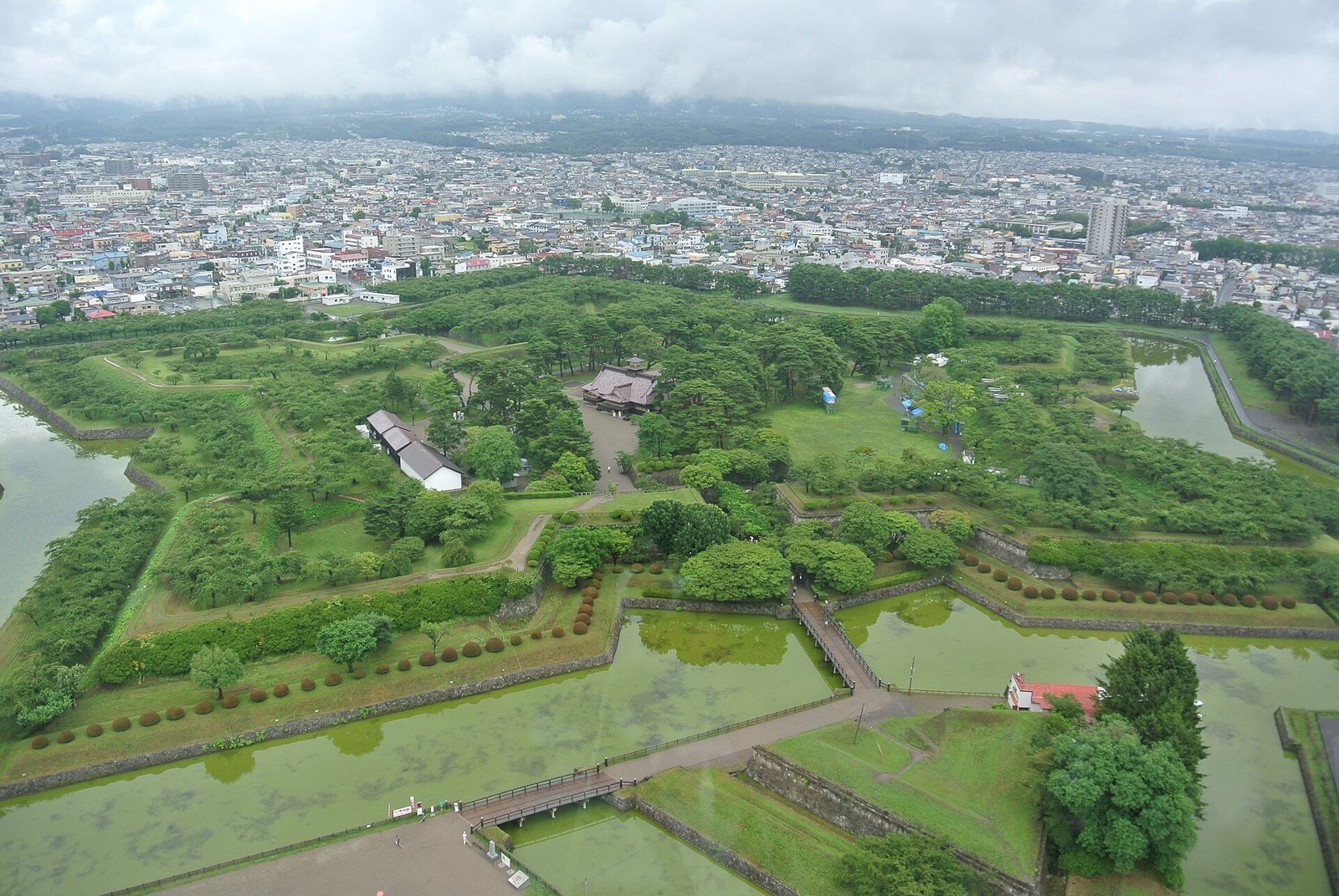
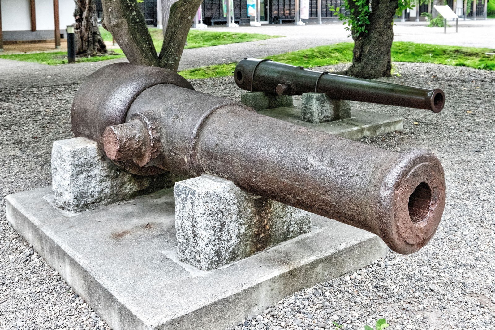
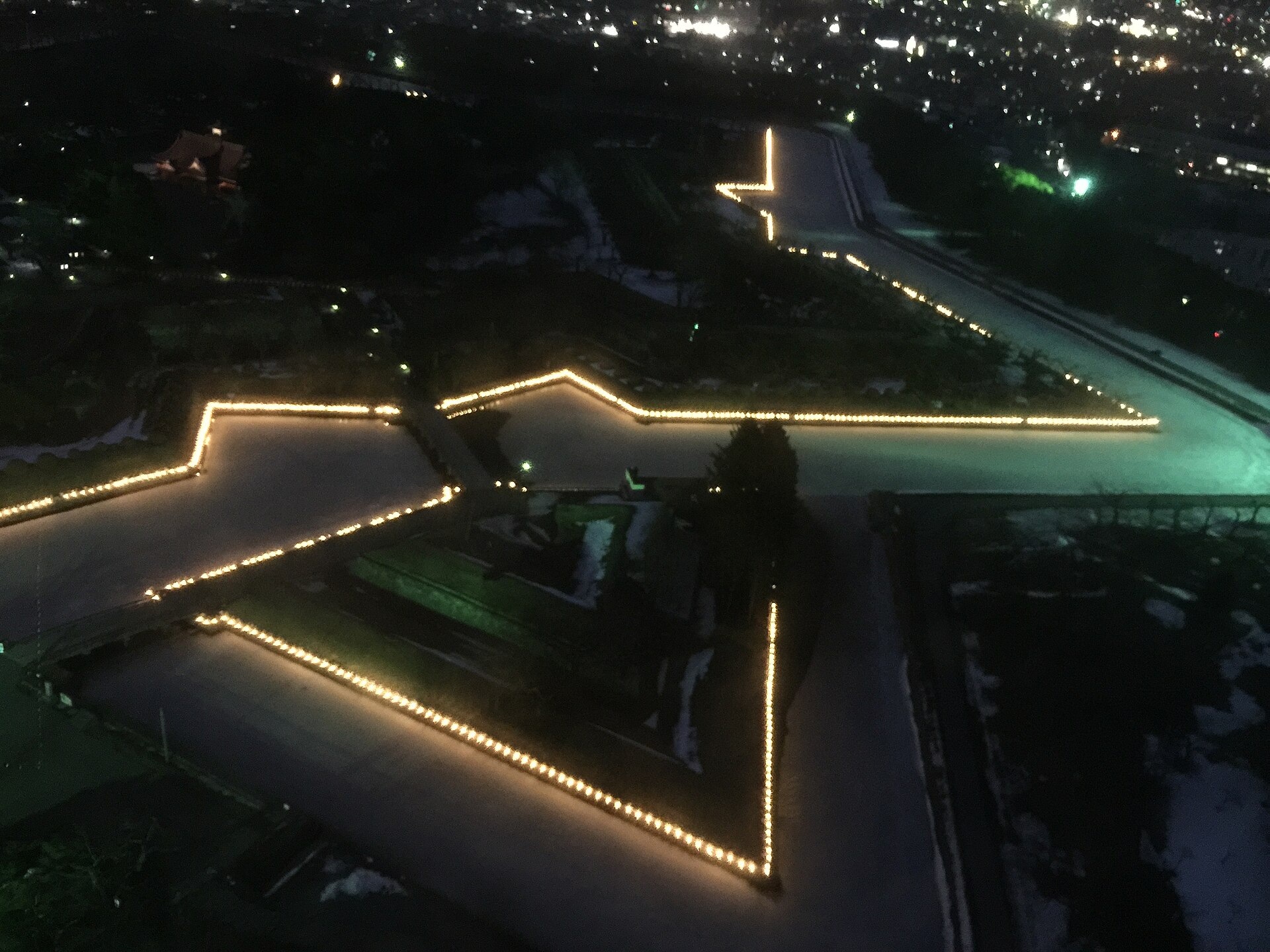
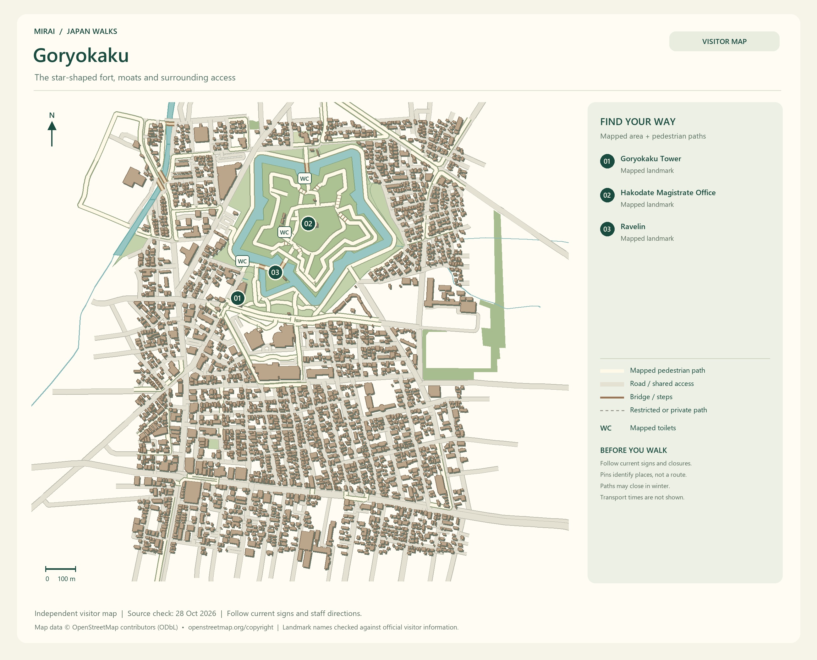
Goryokaku is another place I would love to see. Its star shape belongs to a Western-style fort built by the Tokugawa shogunate. Look down from Goryokaku Tower, then walk beside the moats and earthworks: the lines you saw from above begin to make sense beneath your feet.
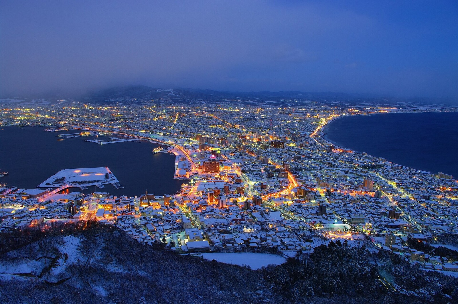
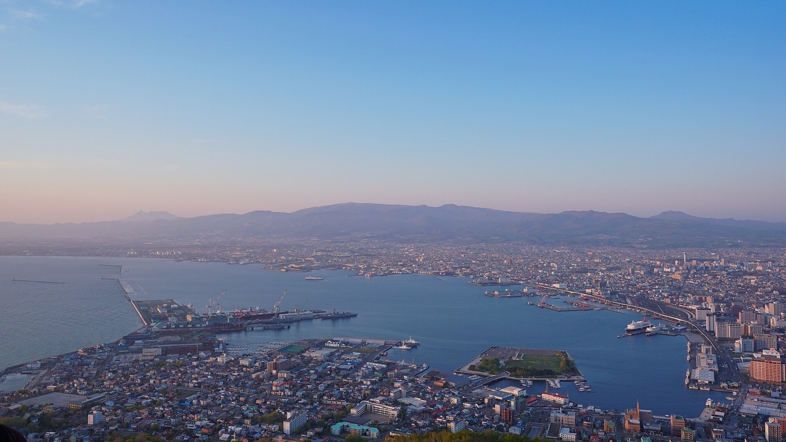
For a night view, consider Mount Hakodate. What shape will the streets you walked in daylight take after dark? Check the cloud, fog and wind before choosing a time to watch the lights.
Some sights still involve a walk from the tram stop. Around Motomachi, check the slopes as well as the distance on your map.
Maps follow the photos. They show the areas named in their titles, not a single route connecting every place in this gallery. Follow current signs and access conditions.
Photo and map credits
Hakodate Hachiman-zaka 2024.jpg — MaedaAkihiko. https://commons.wikimedia.org/wiki/File:Hakodate_Hachiman-zaka_2024.jpg | CC0 http://creativecommons.org/publicdomain/zero/1.0/deed.en. Resized/re-encoded for web display; no crop or retouch.
120726 Hachimanzaka Hakodate Hokkaido pref Japan01s3.jpg — 663highland. https://commons.wikimedia.org/wiki/File:120726_Hachimanzaka_Hakodate_Hokkaido_pref_Japan01s3.jpg | CC BY-SA 4.0 https://creativecommons.org/licenses/by-sa/4.0. Resized/re-encoded for web display; no crop or retouch.
Entire views of Goryokaku from Goryokaku Tower 20140807.jpg — Suicasmo. https://commons.wikimedia.org/wiki/File:Entire_views_of_Goryokaku_from_Goryokaku_Tower_20140807.jpg | CC BY-SA 4.0 https://creativecommons.org/licenses/by-sa/4.0. Resized/re-encoded for web display; no crop or retouch.
五稜郭公園20210723-IMG 4861.jpg — くろふね. https://commons.wikimedia.org/wiki/File:%E4%BA%94%E7%A8%9C%E9%83%AD%E5%85%AC%E5%9C%9220210723-IMG_4861.jpg | CC BY 4.0 https://creativecommons.org/licenses/by/4.0. Resized/re-encoded for web display; no crop or retouch.
Hokkaido Hakodate night view xl.jpg — 洞内定晴. https://commons.wikimedia.org/wiki/File:Hokkaido_Hakodate_night_view_xl.jpg | CC BY 4.0 https://creativecommons.org/licenses/by/4.0. Resized/re-encoded for web display; no crop or retouch.
Hakodate Bay seen from Mount Hakodate in sunset time.jpg — 掬茶. https://commons.wikimedia.org/wiki/File:Hakodate_Bay_seen_from_Mount_Hakodate_in_sunset_time.jpg | CC BY-SA 4.0 https://creativecommons.org/licenses/by-sa/4.0. Resized/re-encoded for web display; no crop or retouch.
Hakodate Goryokaku Tower, Goryokaku, Hakodate, Hokkaido, Japan, 五稜郭, 五稜郭公園, 函館, 北海道, 日本, 五稜郭タワ, はこだてし, ほっかいどう, にっぽん, にほん (16099844444).jpg — bryan.... https://commons.wikimedia.org/wiki/File:Hakodate_Goryokaku_Tower,_Goryokaku,_Hakodate,_Hokkaido,_Japan,_%E4%BA%94%E7%A8%9C%E9%83%AD,_%E4%BA%94%E7%A8%9C%E9%83%AD%E5%85%AC%E5%9C%92,_%E5%87%BD%E9%A4%A8,_%E5%8C%97%E6%B5%B7%E9%81%93,_%E6%97%A5%E6%9C%AC,_%E4%BA%94%E7%A8%9C%E9%83%AD%E3%82%BF%E3%83%AF,_%E3%81%AF%E3%81%93%E3%81%A0%E3%81%A6%E3%81%97,_%E3%81%BB%E3%81%A3%E3%81%8B%E3%81%84%E3%81%A9%E3%81%86,_%E3%81%AB%E3%81%A3%E3%81%BD%E3%82%93,_%E3%81%AB%E3%81%BB%E3%82%93_(16099844444).jpg | CC BY-SA 2.0 https://creativecommons.org/licenses/by-sa/2.0. Resized/re-encoded for web display; no crop or retouch.
Furano, Biei and Asahikawa: choose a view you would love to see
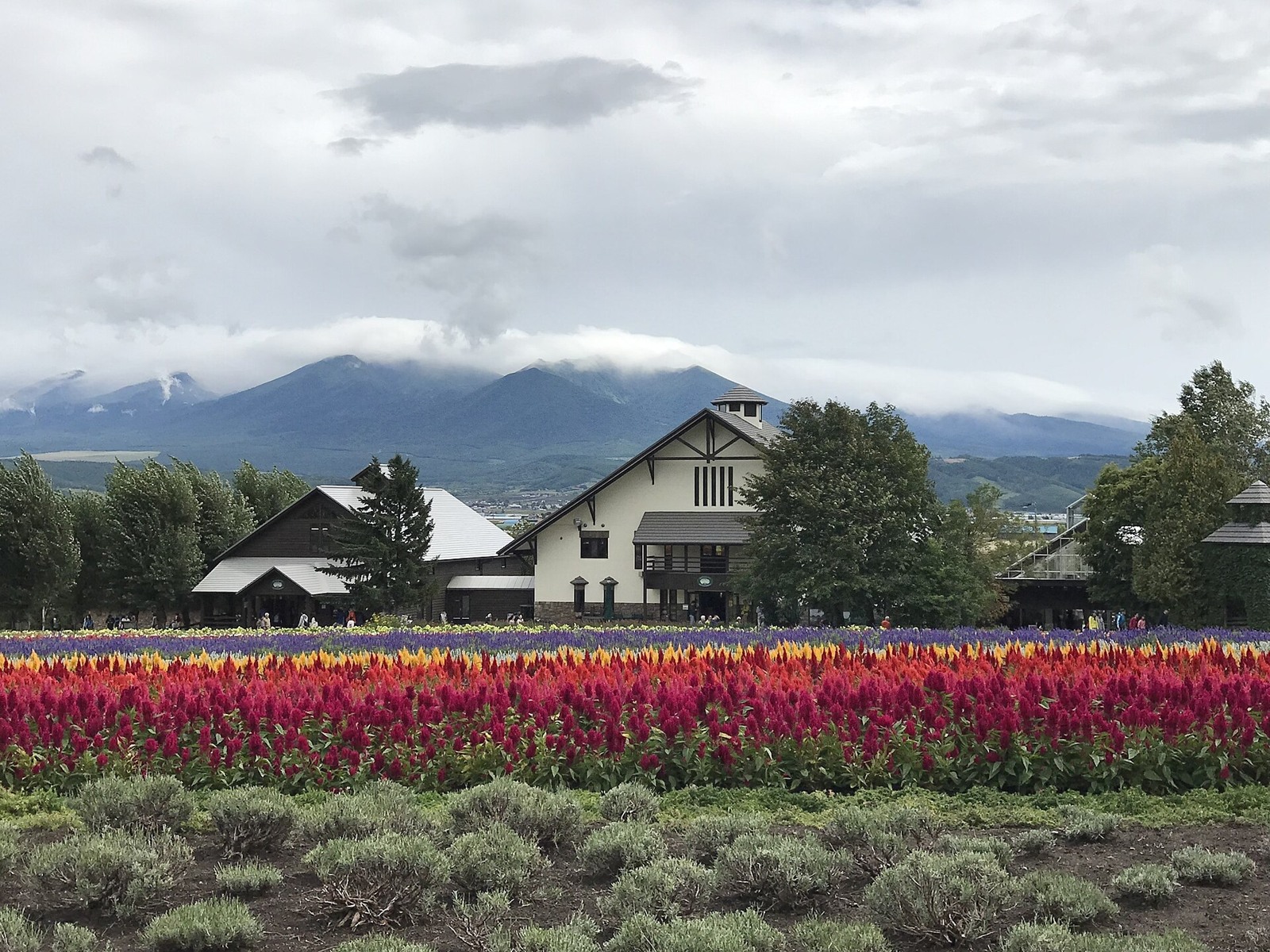
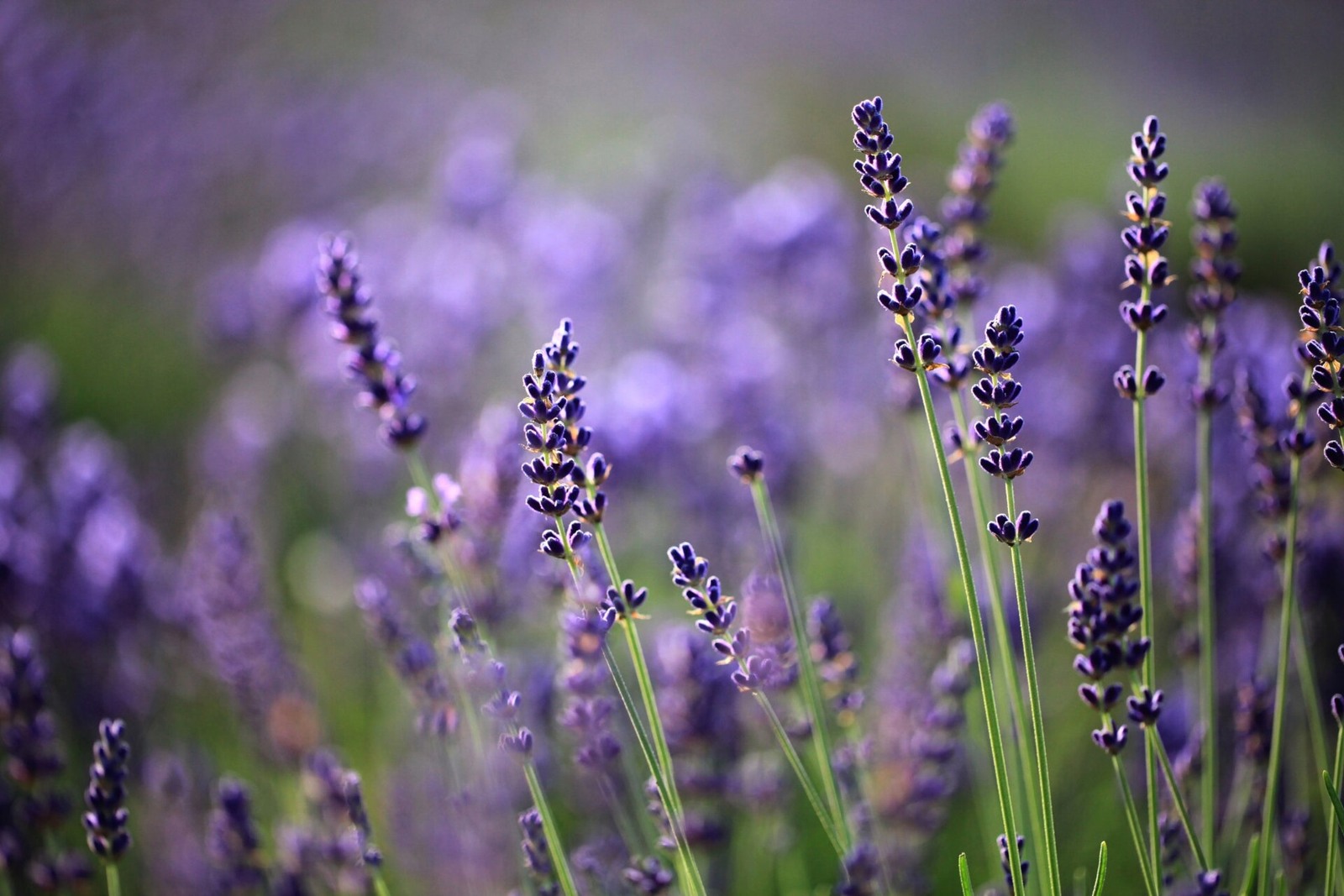
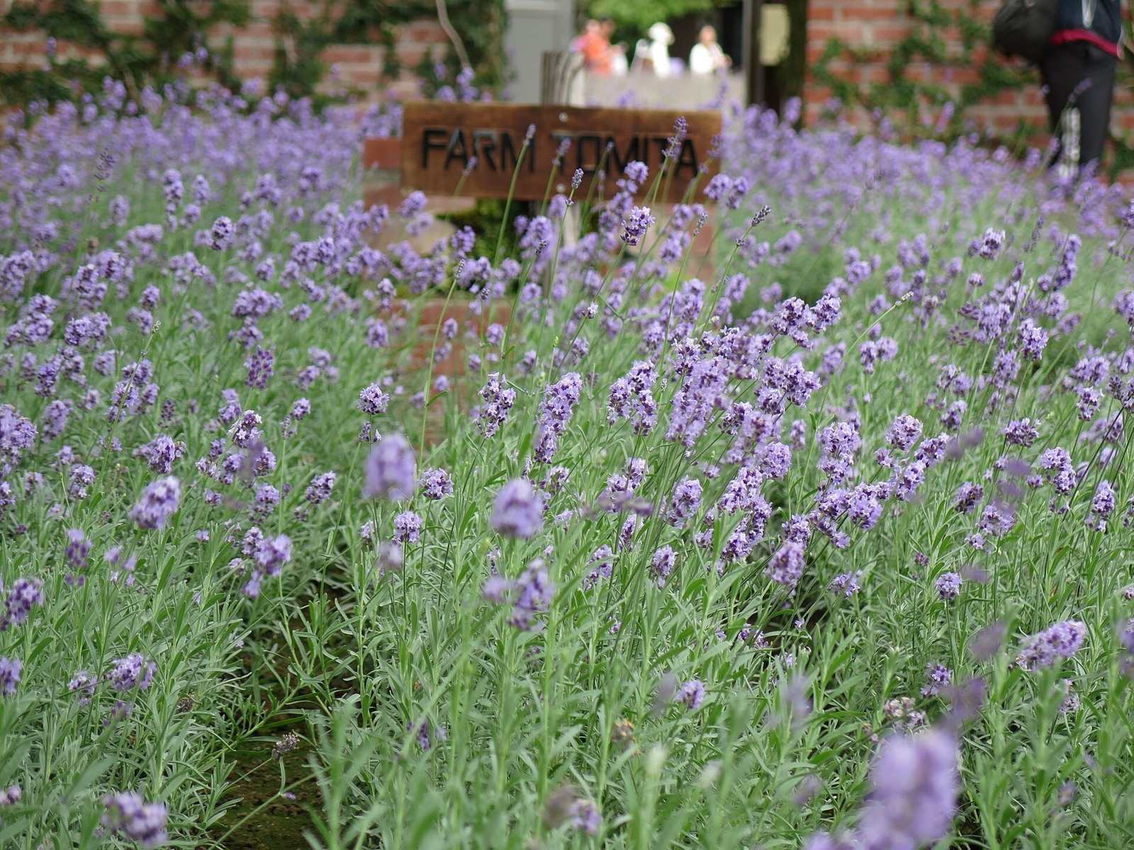
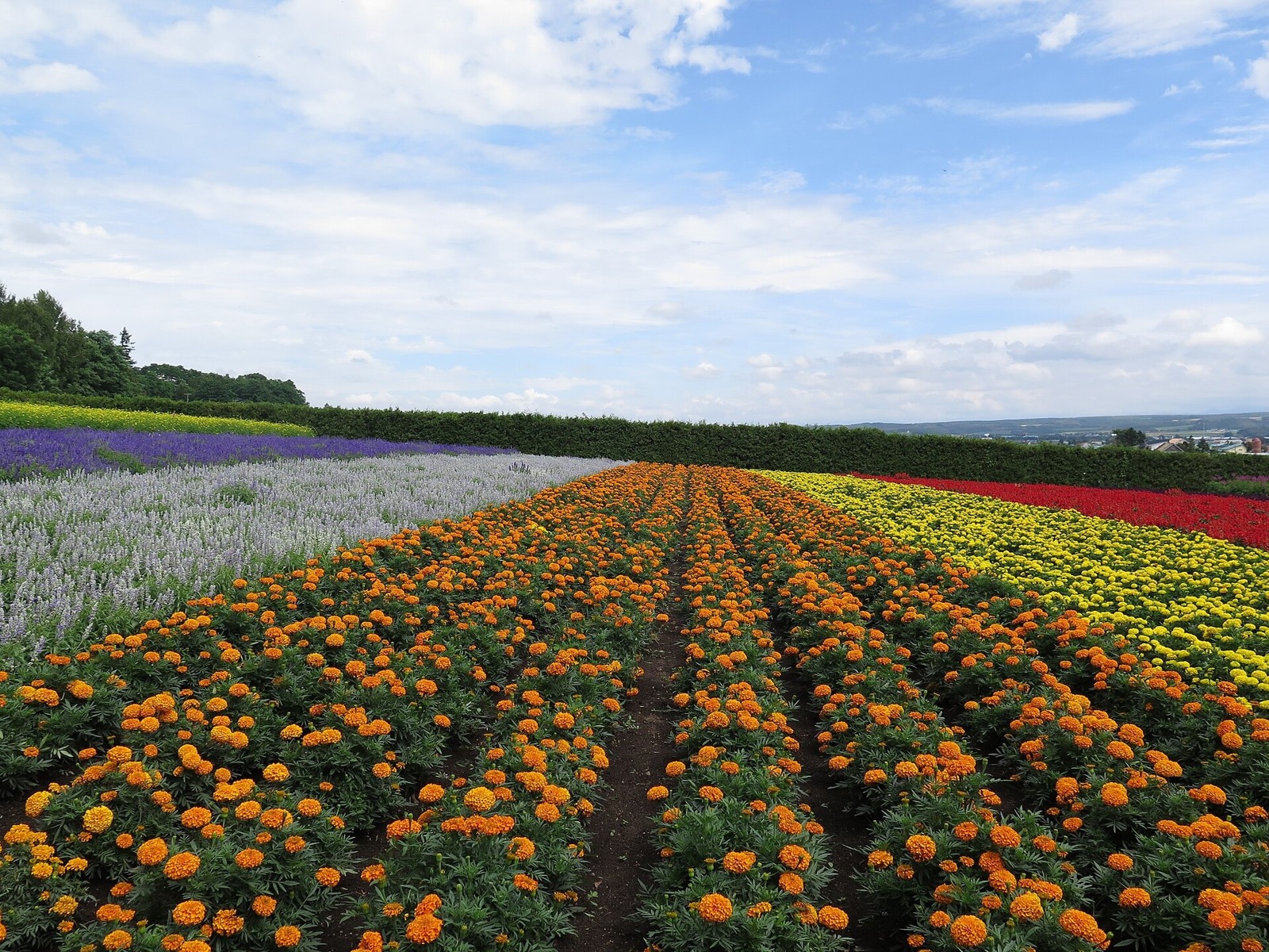
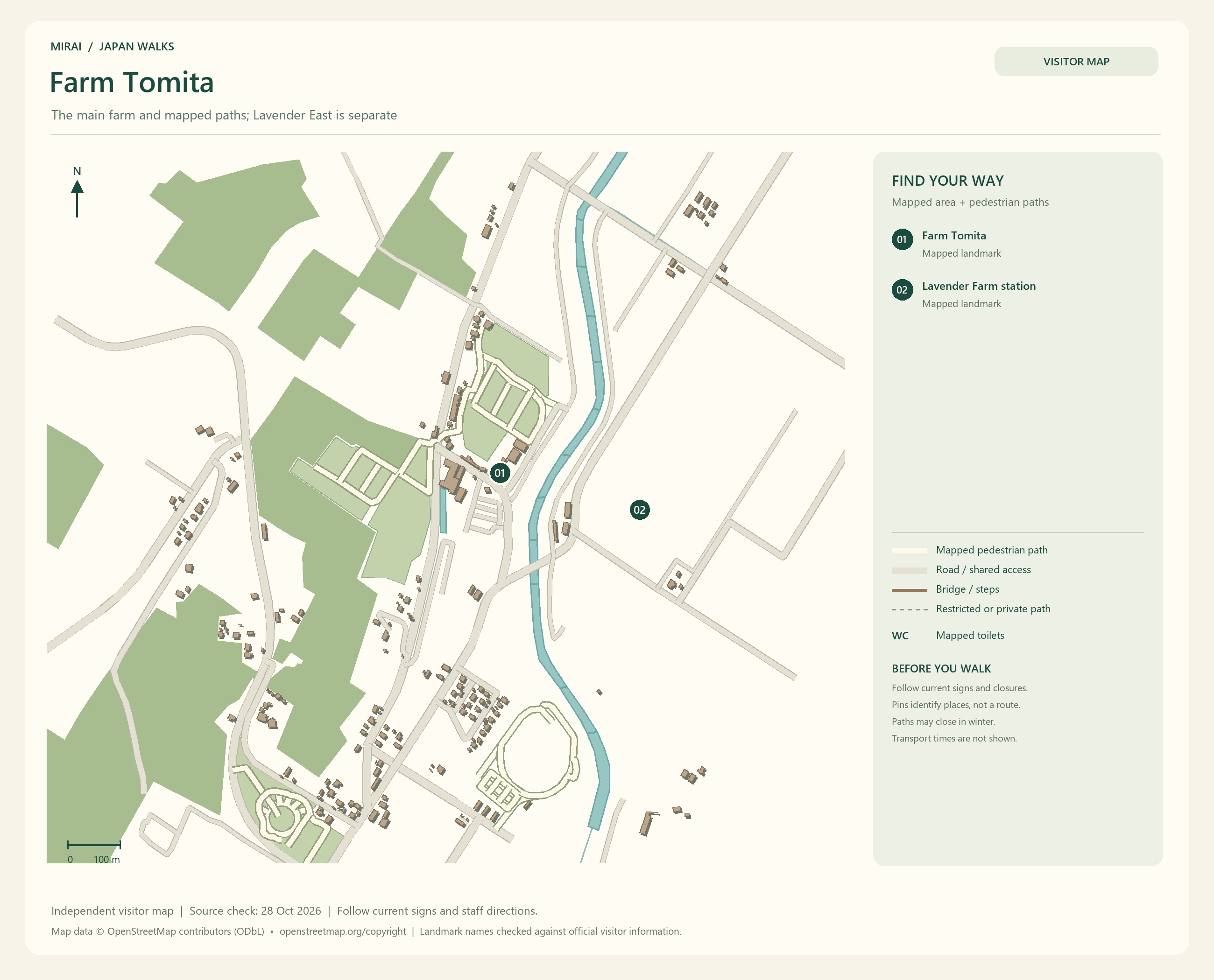
If flower fields are the reason for your trip, look towards the Furano area. At Farm Tomita in Nakafurano, lavender and other flowers change the scene with the seasons.
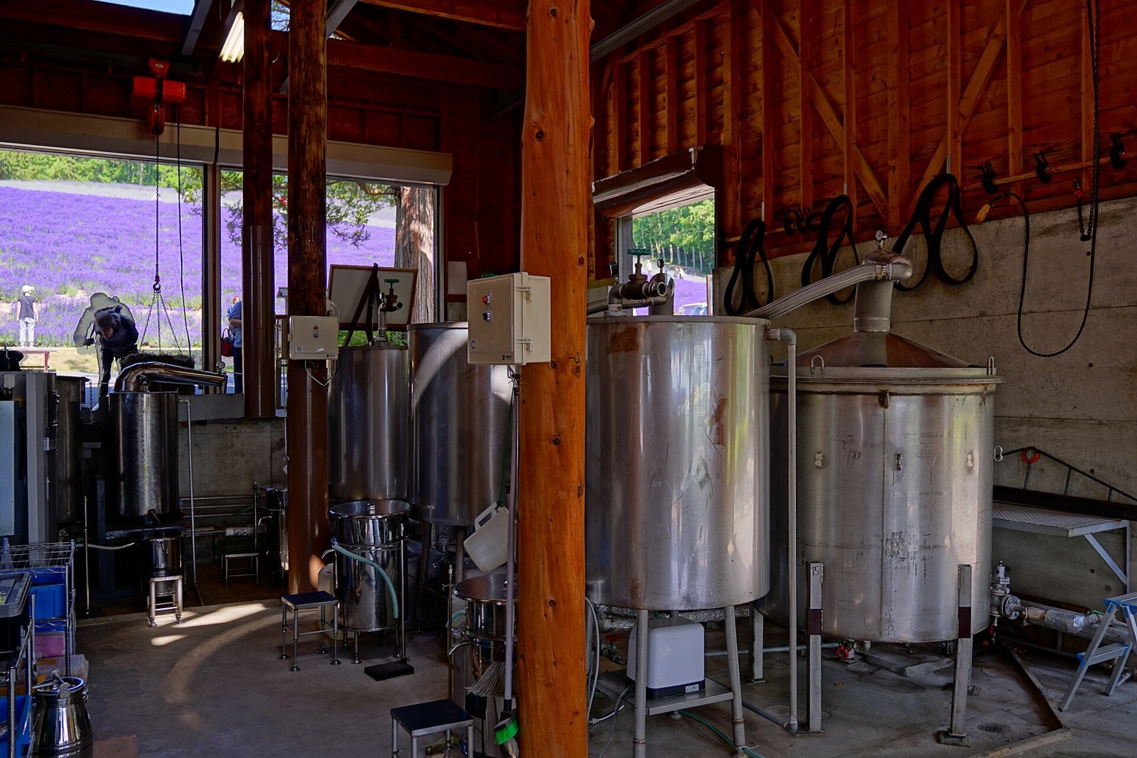
That lavender purple also has an agricultural history: the crop was grown to produce fragrance. These fields are scenery people have carefully cultivated. Check the flowering updates, then choose the time when the view you love is most likely to be waiting.
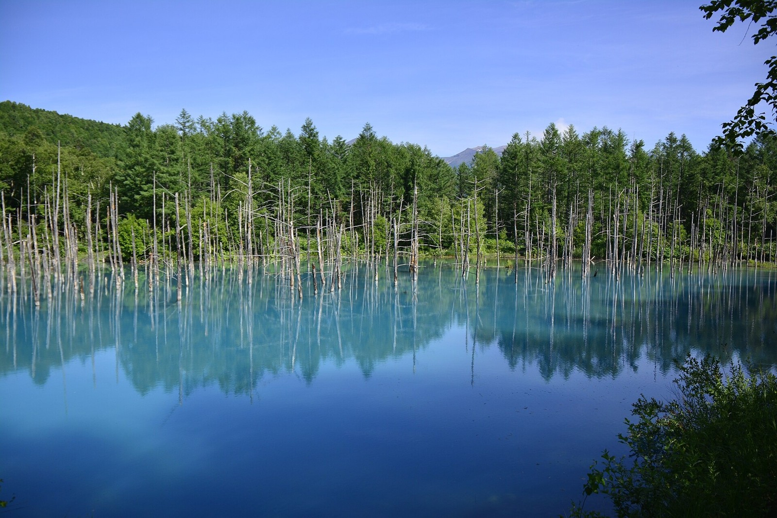
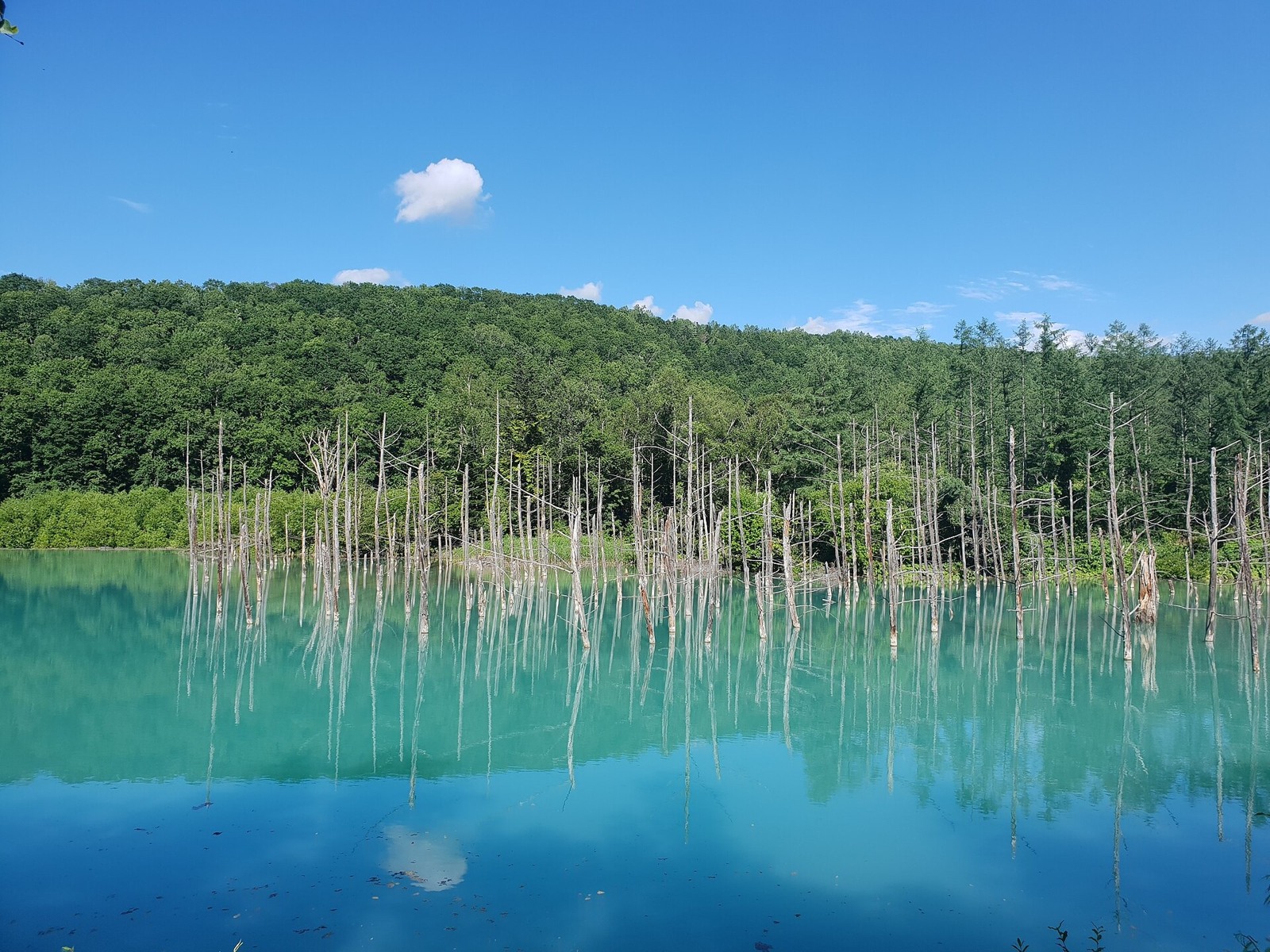
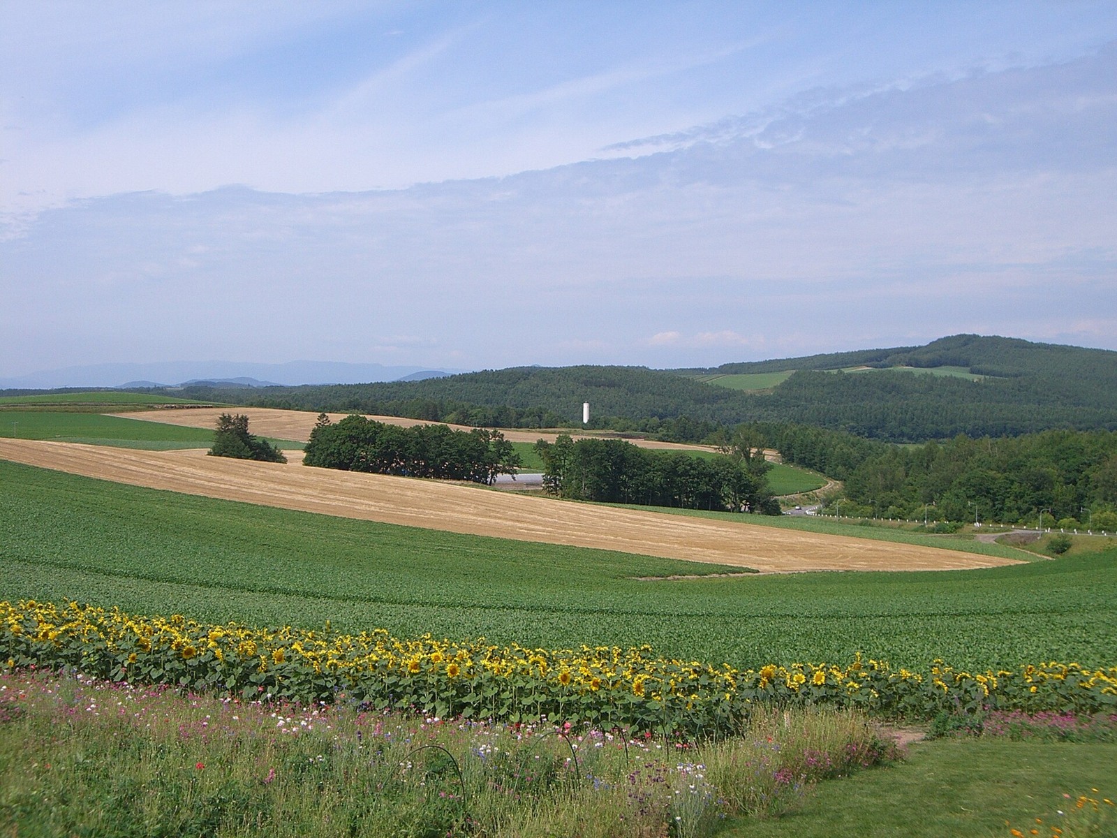
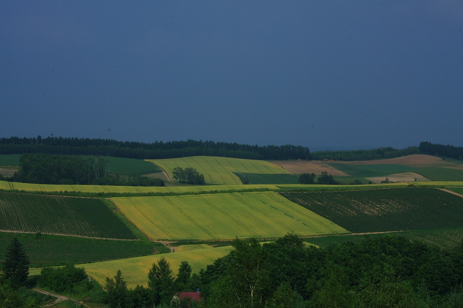
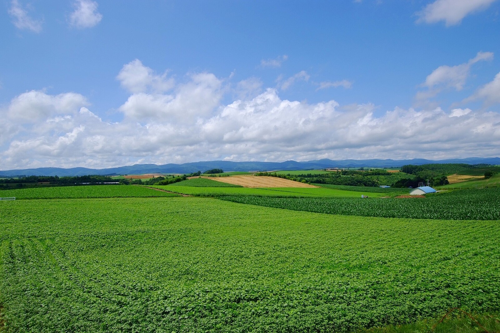
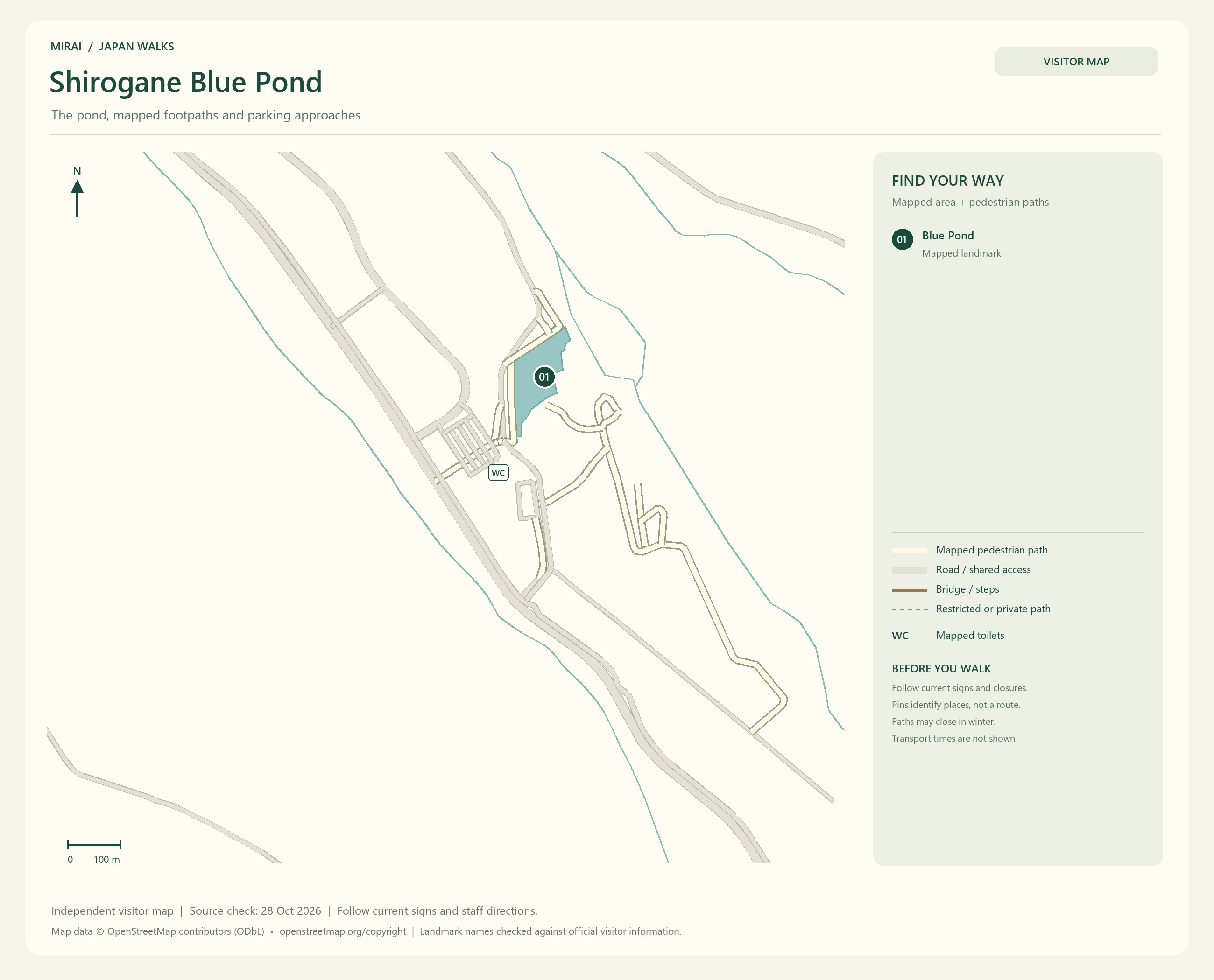
In Biei, explore the rolling farmland and Shirogane Blue Pond. The colours on the hills change with the crops and the season. Even if they differ from a photograph you remember, there is something to enjoy in the fields as they are that day.
Those fields are also someone’s workplace. Take photographs from permitted viewing areas without entering farmland or private property. Check where parking is allowed, too, so we can enjoy the view while respecting the work that creates it.
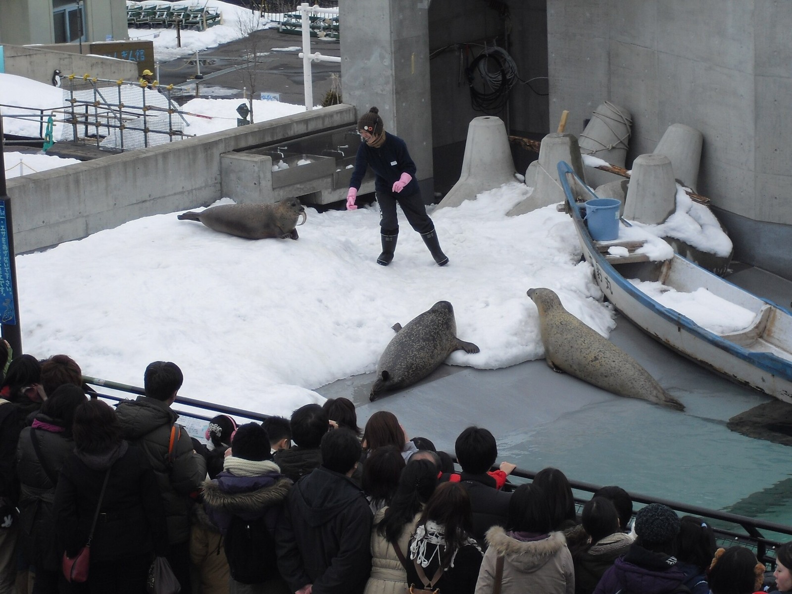
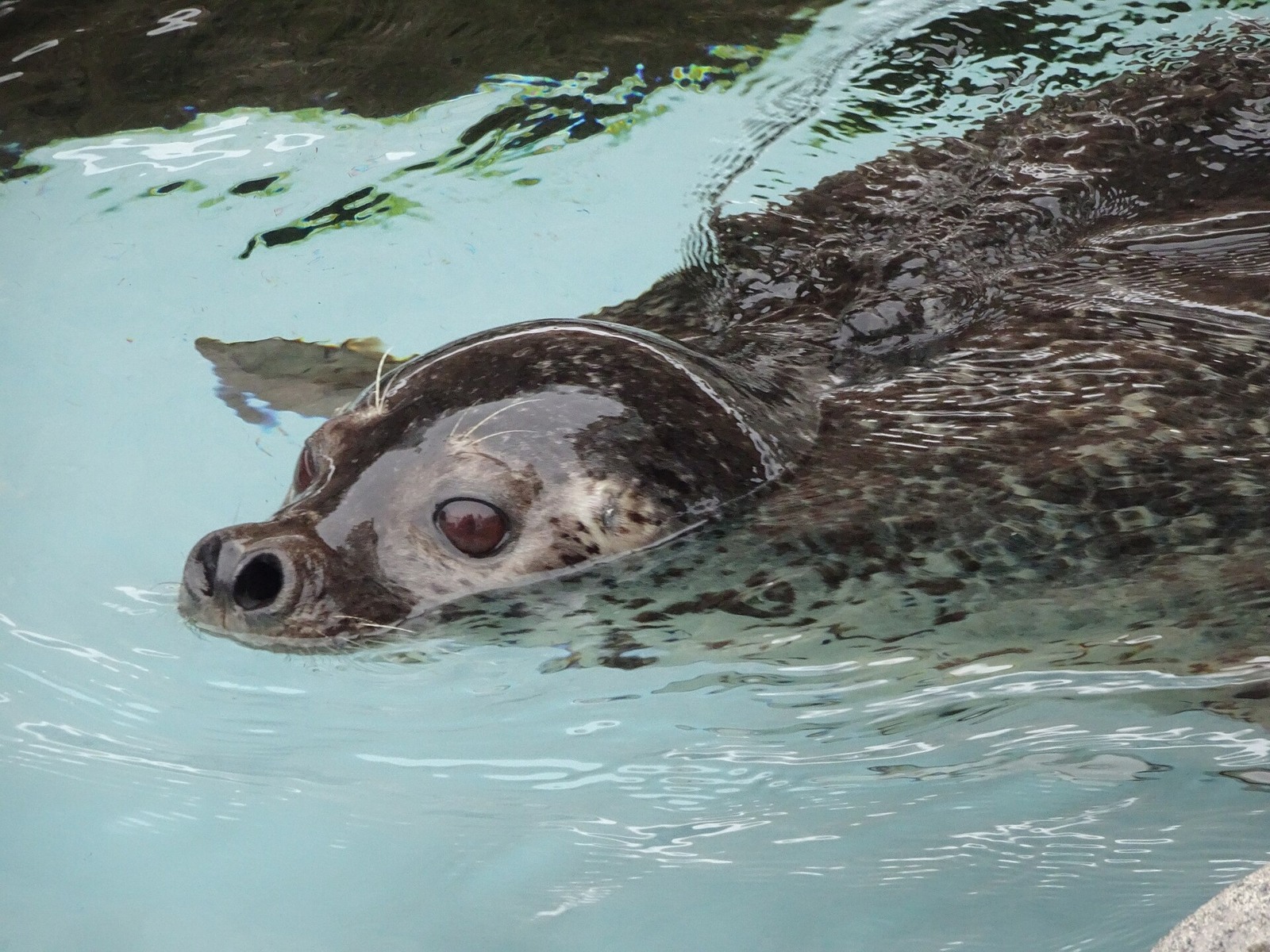
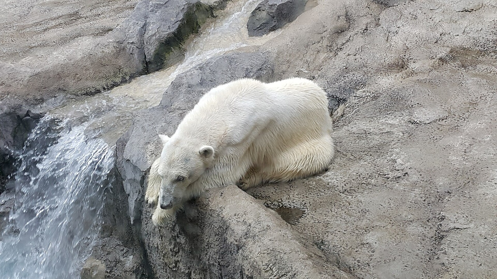
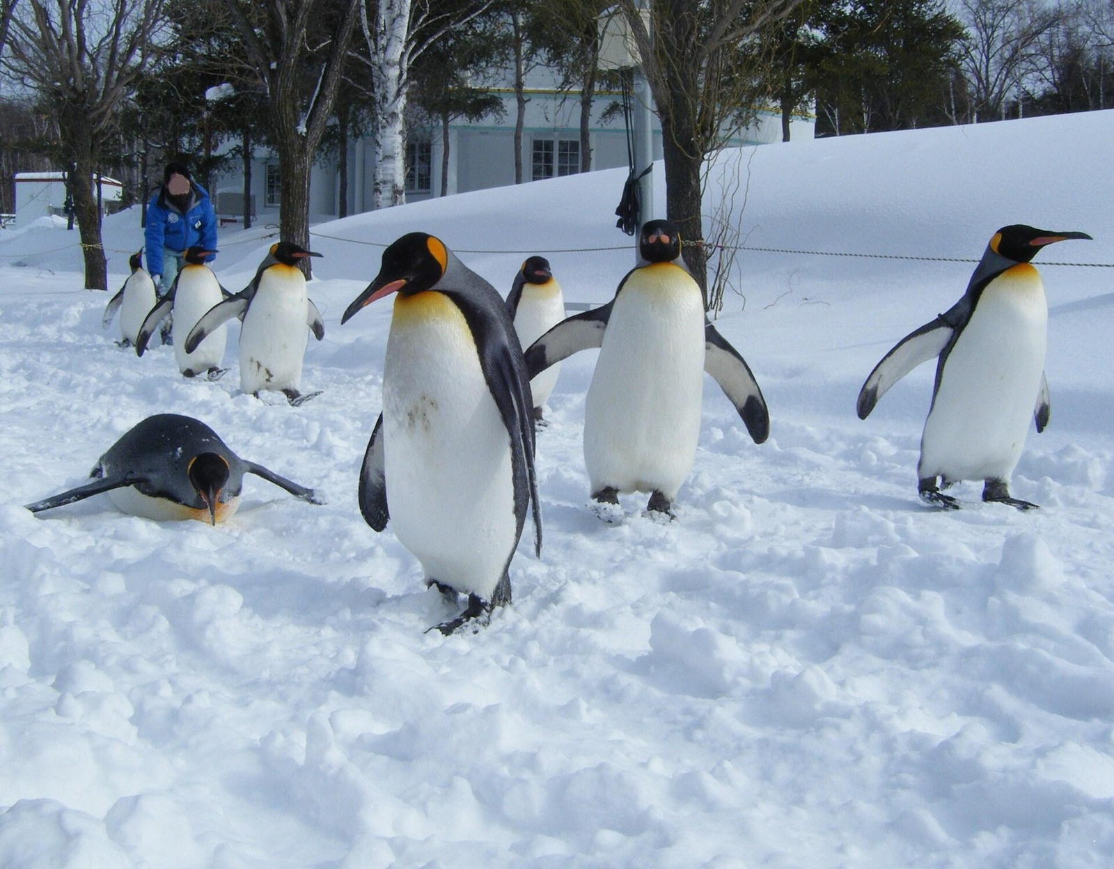
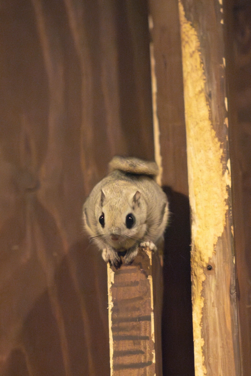
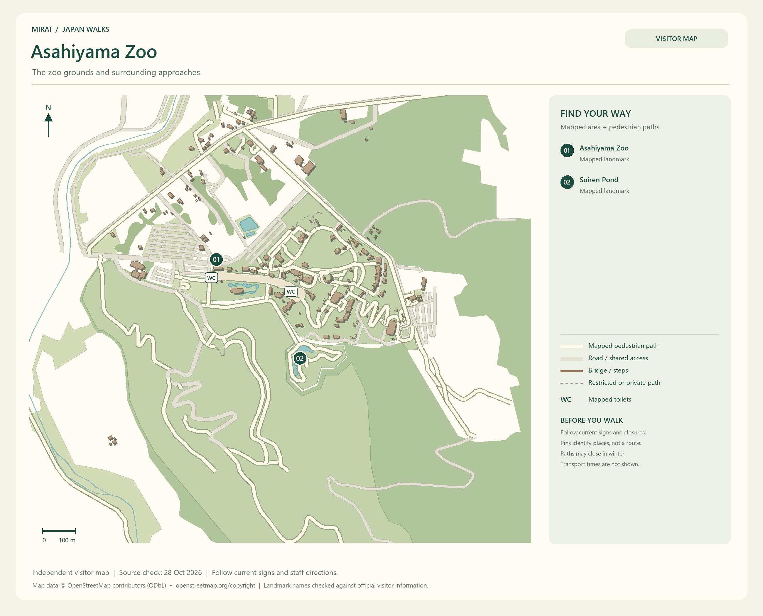
If you would like to meet the animals in Asahikawa, head to Asahiyama Zoo. It is known for exhibits designed to bring out animals’ natural abilities and behaviour. Watch how they swim, move and pause. A moment of ‘Oh, so that’s how they do it!’ might make you want to stay a little longer.
Flower fields, hills and the zoo all sound tempting, but there is travel between them. On a car-free trip, you can choose fewer stops or look for a tour visiting the places you want to see. Let’s leave enough time to enjoy the places we actually came for.
Maps follow the photos. They show the areas named in their titles, not a single route connecting every place in this gallery. Follow current signs and access conditions.
Photo and map credits
A photograph of Farm Tomita across the flower field.jpg — TheOneMattMan. https://commons.wikimedia.org/wiki/File:A_photograph_of_Farm_Tomita_across_the_flower_field.jpg | CC BY-SA 4.0 https://creativecommons.org/licenses/by-sa/4.0. Resized/re-encoded for web display; no crop or retouch.
A Field Of Lavender Farm Tomita (32578019).jpeg — Jolly Yau. https://commons.wikimedia.org/wiki/File:A_Field_Of_Lavender_Farm_Tomita_(32578019).jpeg | CC BY-SA 3.0 https://creativecommons.org/licenses/by-sa/3.0. Resized/re-encoded for web display; no crop or retouch.
Farm Tomita 1.jpg — Douglas Perkins. https://commons.wikimedia.org/wiki/File:Farm_Tomita_1.jpg | CC BY 4.0 https://creativecommons.org/licenses/by/4.0. Resized/re-encoded for web display; no crop or retouch.
Flowers at Farm Tomita 2.jpg — Douglas Perkins. https://commons.wikimedia.org/wiki/File:Flowers_at_Farm_Tomita_2.jpg | CC BY 4.0 https://creativecommons.org/licenses/by/4.0. Resized/re-encoded for web display; no crop or retouch.
Lavender distilleries in Farm Tomita.jpg — 掬茶. https://commons.wikimedia.org/wiki/File:Lavender_distilleries_in_Farm_Tomita.jpg | CC BY-SA 4.0 https://creativecommons.org/licenses/by-sa/4.0. Resized/re-encoded for web display; no crop or retouch.
Maps follow the photos. They show the areas named in their titles, not a single route connecting every place in this gallery. Follow current signs and access conditions.
Photo and map credits
Shirogane Blue Pond, Biei, Hokkaido Japan.jpg — AndyLeungHK. https://commons.wikimedia.org/wiki/File:Shirogane_Blue_Pond,_Biei,_Hokkaido_Japan.jpg | CC0 http://creativecommons.org/publicdomain/zero/1.0/deed.en. Resized/re-encoded for web display; no crop or retouch.
Aoi-ike(Blue Pond), Biei on July 18th, 2018.jpg — Choi2451. https://commons.wikimedia.org/wiki/File:Aoi-ike(Blue_Pond),_Biei_on_July_18th,_2018.jpg | CC BY-SA 3.0 https://creativecommons.org/licenses/by-sa/3.0. Resized/re-encoded for web display; no crop or retouch.
Patchwork hills - biei - panoramio.jpg — taku-k. https://commons.wikimedia.org/wiki/File:Patchwork_hills_-_biei_-_panoramio.jpg | CC BY 3.0 https://creativecommons.org/licenses/by/3.0. Resized/re-encoded for web display; no crop or retouch.
Hills like patch work - panoramio.jpg — 柴田拓. https://commons.wikimedia.org/wiki/File:Hills_like_patch_work_-_panoramio.jpg | CC BY-SA 3.0 https://creativecommons.org/licenses/by-sa/3.0. Resized/re-encoded for web display; no crop or retouch.
新栄の丘展望公園(The Hill of Shinei Outlook park) - panoramio.jpg — t-konno. https://commons.wikimedia.org/wiki/File:%E6%96%B0%E6%A0%84%E3%81%AE%E4%B8%98%E5%B1%95%E6%9C%9B%E5%85%AC%E5%9C%92%EF%BC%88The_Hill_of_Shinei_Outlook_park%EF%BC%89_-_panoramio.jpg | CC BY-SA 3.0 https://creativecommons.org/licenses/by-sa/3.0. Resized/re-encoded for web display; no crop or retouch.
Maps follow the photos. They show the areas named in their titles, not a single route connecting every place in this gallery. Follow current signs and access conditions.
Photo and map credits
Asahiyama-zoo-Phoca.jpg — As6022014. https://commons.wikimedia.org/wiki/File:Asahiyama-zoo-Phoca.jpg | Public domain . Resized/re-encoded for web display; no crop or retouch.
Swimming Seal at Asahiyama Zoo.jpg — ParrotPoint. https://commons.wikimedia.org/wiki/File:Swimming_Seal_at_Asahiyama_Zoo.jpg | CC BY 4.0 https://creativecommons.org/licenses/by/4.0. Resized/re-encoded for web display; no crop or retouch.
Asahiyama polar bear.jpg — Douglas Perkins. https://commons.wikimedia.org/wiki/File:Asahiyama_polar_bear.jpg | CC BY 4.0 https://creativecommons.org/licenses/by/4.0. Resized/re-encoded for web display; no crop or retouch.
Asahiyama zoo Penguin.jpg — 欅 (Keyaki). https://commons.wikimedia.org/wiki/File:Asahiyama_zoo_Penguin.jpg | CC BY-SA 3.0 https://creativecommons.org/licenses/by-sa/3.0. Resized/re-encoded for web display; no crop or retouch.
Pteromys volans orii, Asahiyama Zoo.jpg — Kingfiser. https://commons.wikimedia.org/wiki/File:Pteromys_volans_orii,_Asahiyama_Zoo.jpg | CC BY-SA 4.0 https://creativecommons.org/licenses/by-sa/4.0. Resized/re-encoded for web display; no crop or retouch.
Noboribetsu, Lake Toya and Lake Shikotsu: time to slow down
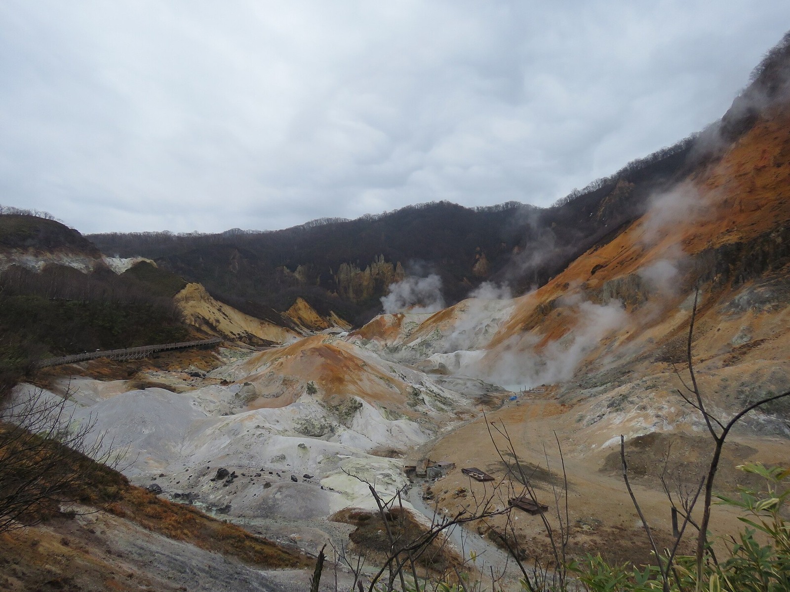
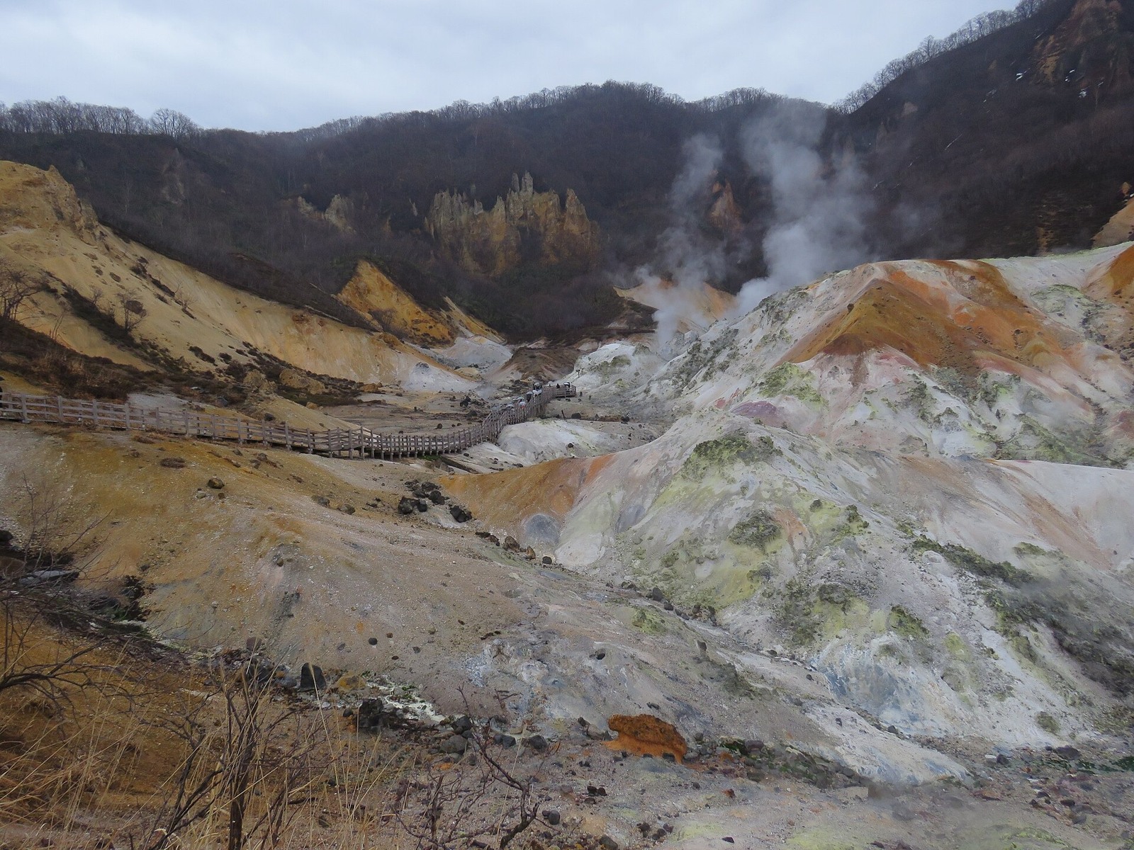
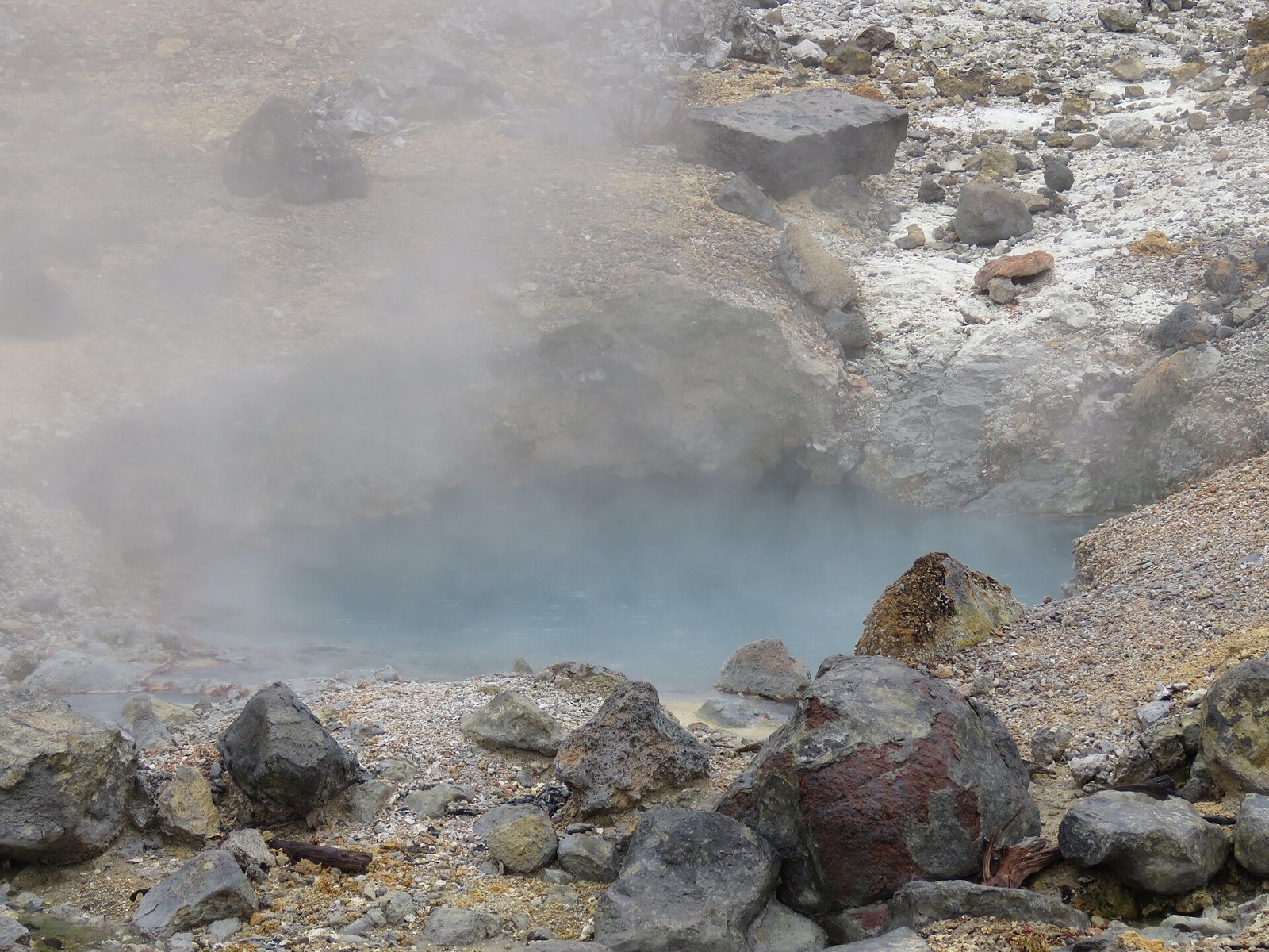
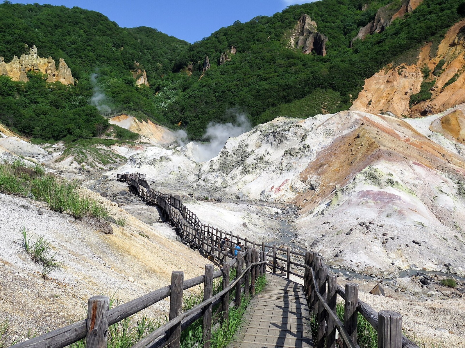
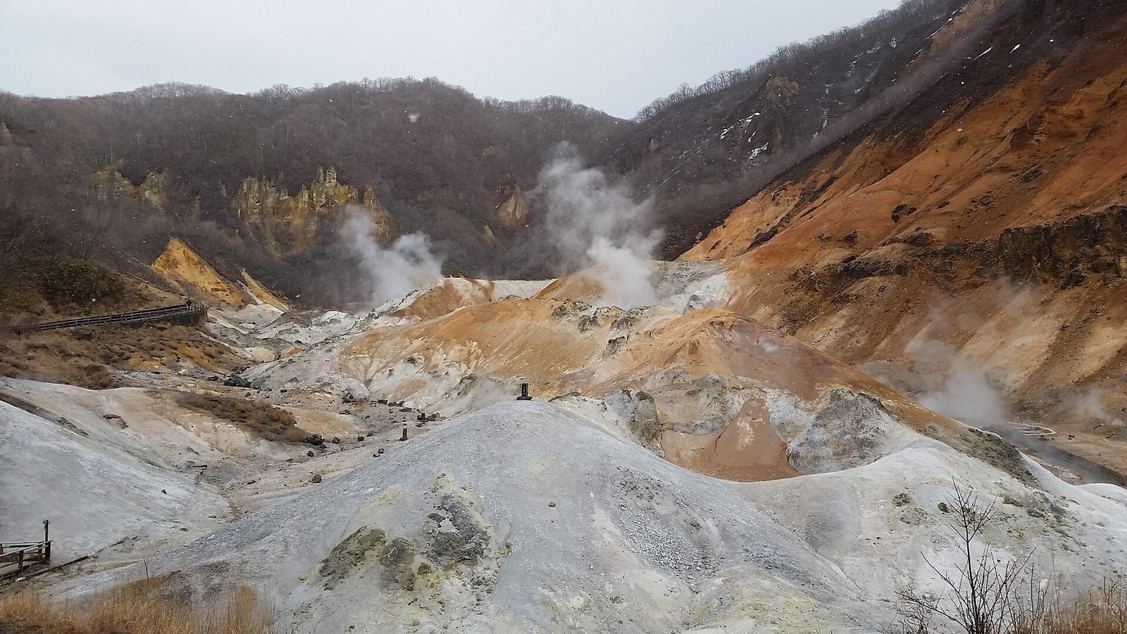
For a trip built around hot springs, consider Noboribetsu. At Jigokudani, or Hell Valley, steam rises above the bare rock, bringing the connection between volcanoes and hot springs into view.
After exploring the paths that are open, settle into your accommodation and take it easy. After several busy walking days, a day for hot springs and a good meal would be rather lovely.
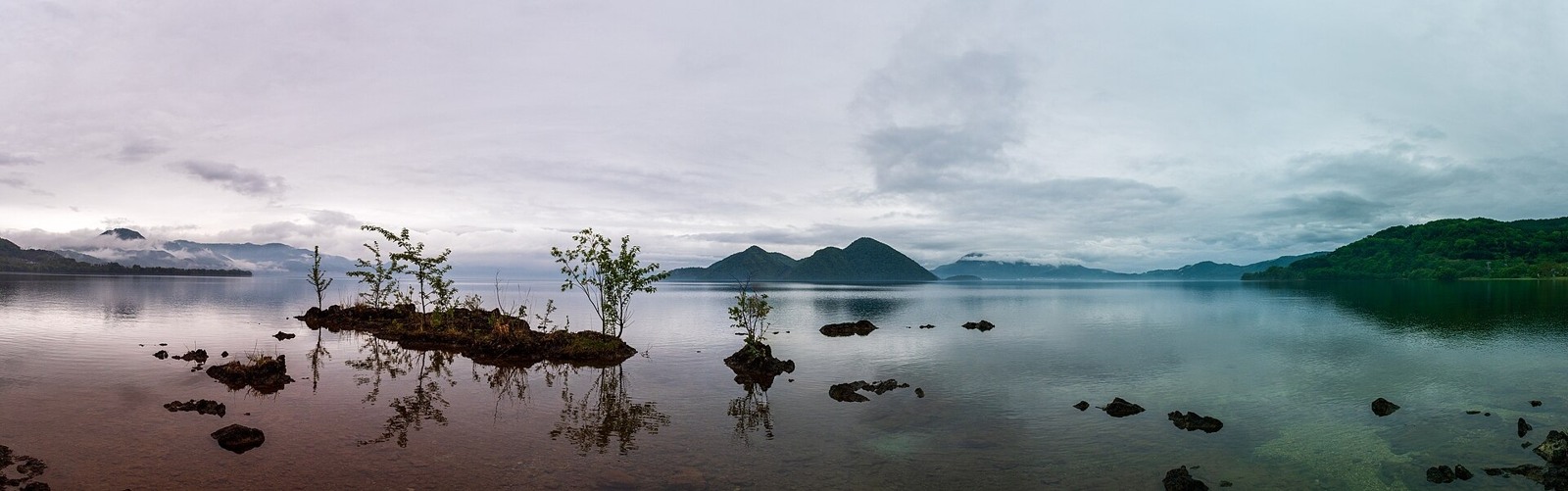
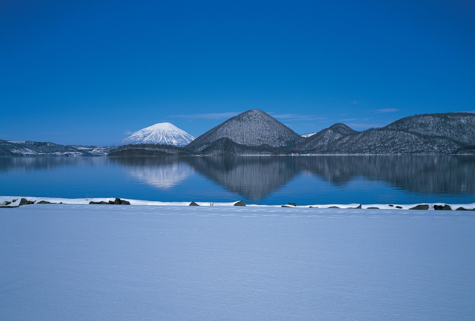
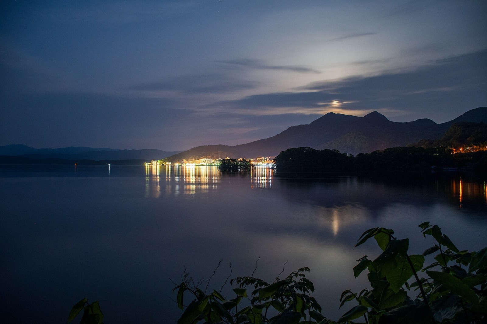
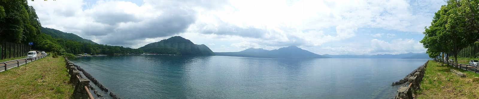
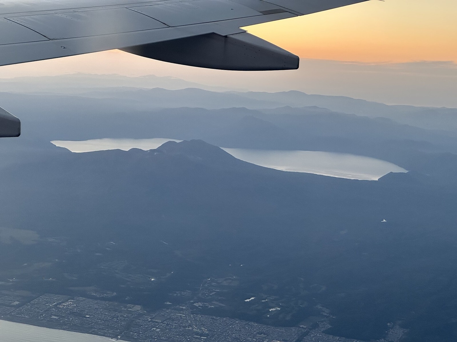
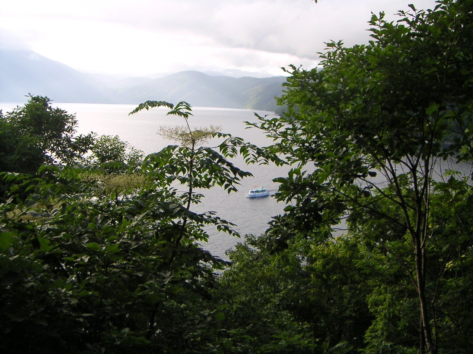
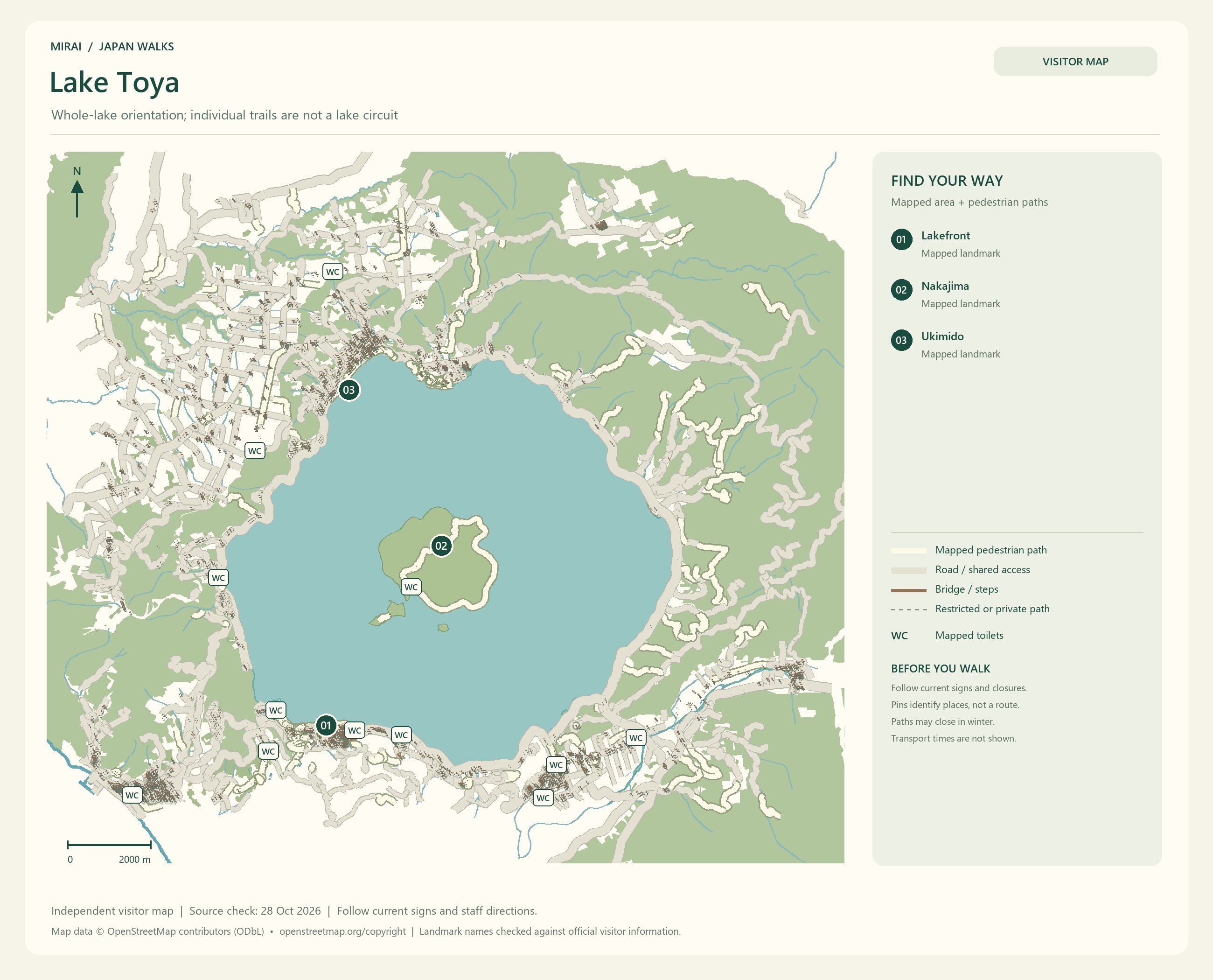
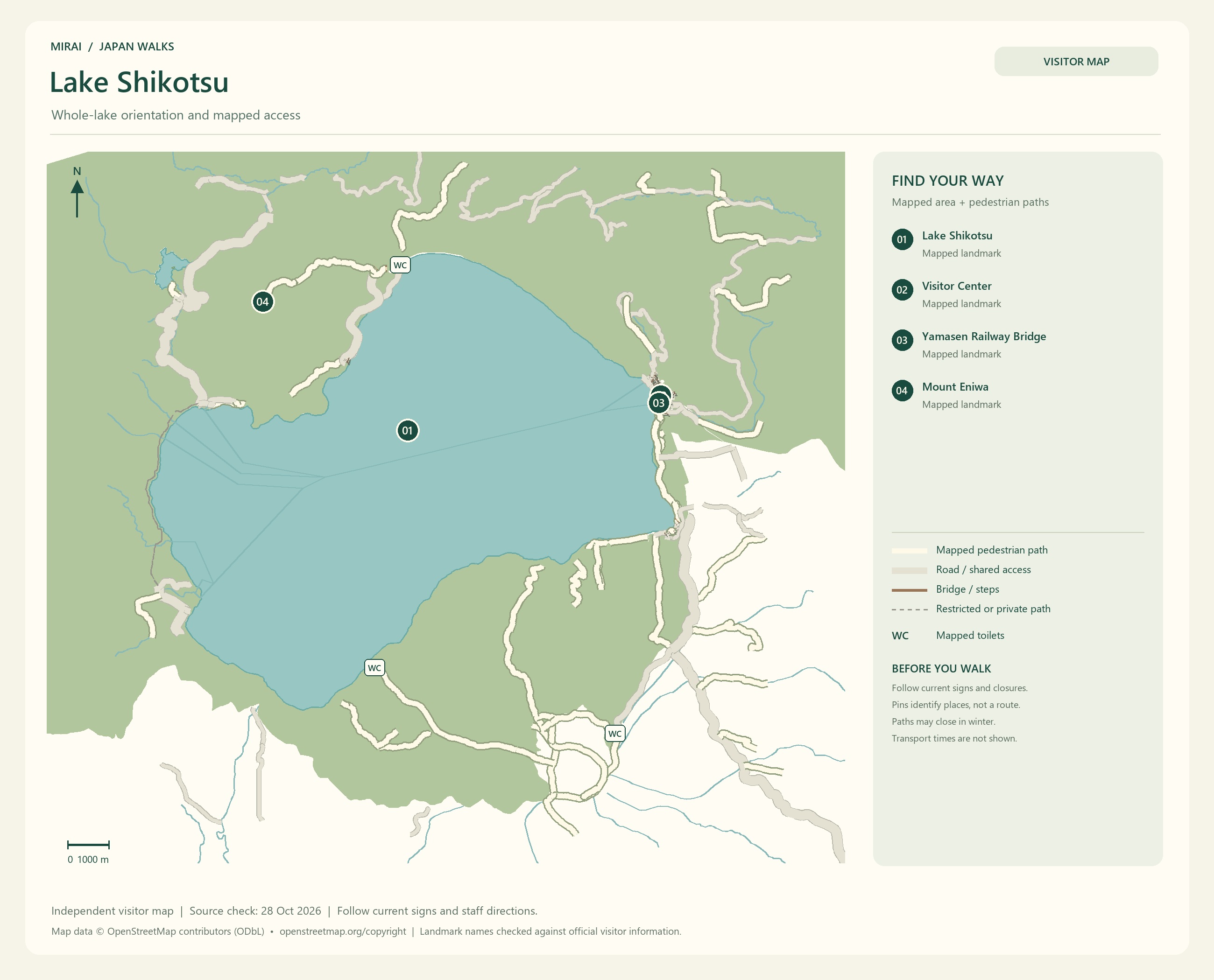
At Lake Toya, walk beside the water with the Nakajima islands in view. At Lake Shikotsu, look towards the mountains surrounding the lake. You could even leave a little time without a plan and simply stay by the water.
Noboribetsu, Lake Toya and Lake Shikotsu are separate destinations. Instead of rushing through all three, shall we choose a hot-spring stay this time, or a night beside a lake? The time spent at your accommodation can be part of the attraction, too.
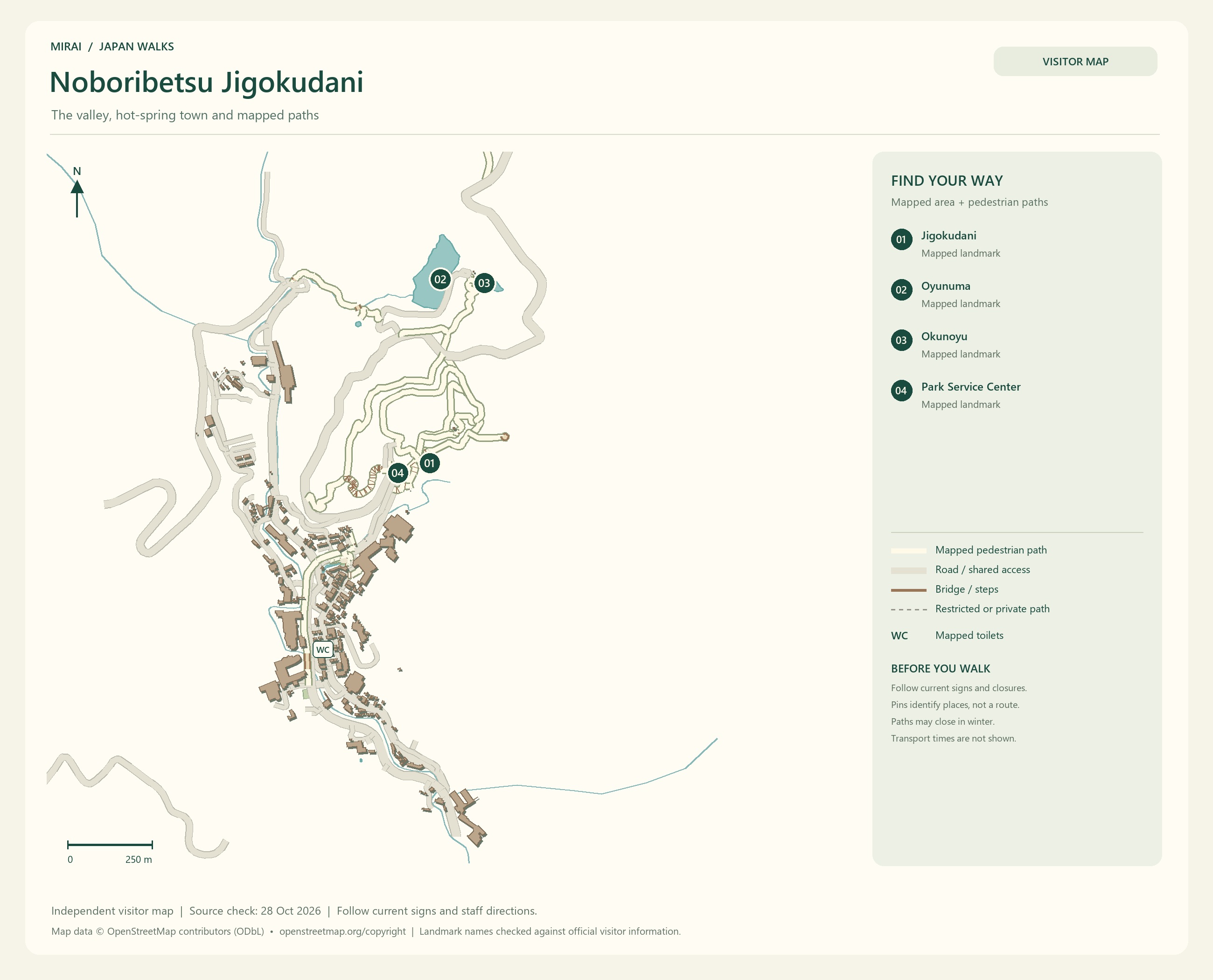
Maps follow the photos. They show the areas named in their titles, not a single route connecting every place in this gallery. Follow current signs and access conditions.
Photo and map credits
Jigokudani (Hell Valley), Noboribetsu Onsen, Hokkaido, April 2023 01.jpg — Calistemon. https://commons.wikimedia.org/wiki/File:Jigokudani_(Hell_Valley),_Noboribetsu_Onsen,_Hokkaido,_April_2023_01.jpg | CC BY-SA 4.0 https://creativecommons.org/licenses/by-sa/4.0. Resized/re-encoded for web display; no crop or retouch.
Jigokudani (Hell Valley), Noboribetsu Onsen, Hokkaido, April 2023 07.jpg — Calistemon. https://commons.wikimedia.org/wiki/File:Jigokudani_(Hell_Valley),_Noboribetsu_Onsen,_Hokkaido,_April_2023_07.jpg | CC BY-SA 4.0 https://creativecommons.org/licenses/by-sa/4.0. Resized/re-encoded for web display; no crop or retouch.
Jigokudani (Hell Valley), Noboribetsu Onsen, Hokkaido, April 2023 19.jpg — Calistemon. https://commons.wikimedia.org/wiki/File:Jigokudani_(Hell_Valley),_Noboribetsu_Onsen,_Hokkaido,_April_2023_19.jpg | CC BY-SA 4.0 https://creativecommons.org/licenses/by-sa/4.0. Resized/re-encoded for web display; no crop or retouch.
Noboribetsu Jigokudani (Hell valley) Tessen Pond 201406.jpg — Wpcpey. https://commons.wikimedia.org/wiki/File:Noboribetsu_Jigokudani_(Hell_valley)_Tessen_Pond_201406.jpg | CC BY-SA 4.0 https://creativecommons.org/licenses/by-sa/4.0. Resized/re-encoded for web display; no crop or retouch.
Noboribetsu Onsen hot spring.jpg — Lawsonstu. https://commons.wikimedia.org/wiki/File:Noboribetsu_Onsen_hot_spring.jpg | CC0 http://creativecommons.org/publicdomain/zero/1.0/deed.en. Resized/re-encoded for web display; no crop or retouch.
Maps follow the photos. They show the areas named in their titles, not a single route connecting every place in this gallery. Follow current signs and access conditions.
Photo and map credits
Lake Tōya panorama from Ukimido.jpg — Photos of Japan. https://commons.wikimedia.org/wiki/File:Lake_T%C5%8Dya_panorama_from_Ukimido.jpg | CC0 http://creativecommons.org/publicdomain/zero/1.0/deed.en. Resized/re-encoded for web display; no crop or retouch.
Hokkaido-Toya Lake-xl.jpg — 洞爺湖町. https://commons.wikimedia.org/wiki/File:Hokkaido-Toya_Lake-xl.jpg | CC BY 4.0 https://creativecommons.org/licenses/by/4.0. Resized/re-encoded for web display; no crop or retouch.
Lake Tōya at night.jpg — Photos of Japan. https://commons.wikimedia.org/wiki/File:Lake_T%C5%8Dya_at_night.jpg | CC0 http://creativecommons.org/publicdomain/zero/1.0/deed.en. Resized/re-encoded for web display; no crop or retouch.
Lake Shikotsu - Panorama 1 - 2016 8 14.jpg — Nesnad. https://commons.wikimedia.org/wiki/File:Lake_Shikotsu_-_Panorama_1_-_2016_8_14.jpg | CC BY 4.0 https://creativecommons.org/licenses/by/4.0. Resized/re-encoded for web display; no crop or retouch.
Lake Shikotsu 01.jpg — ノボホショコロトソ. https://commons.wikimedia.org/wiki/File:Lake_Shikotsu_01.jpg | CC BY 4.0 https://creativecommons.org/licenses/by/4.0. Resized/re-encoded for web display; no crop or retouch.
Shikotsu Lake and tour boat.JPG — Hotsuregua. https://commons.wikimedia.org/wiki/File:Shikotsu_Lake_and_tour_boat.JPG | CC BY-SA 3.0 https://creativecommons.org/licenses/by-sa/3.0. Resized/re-encoded for web display; no crop or retouch.
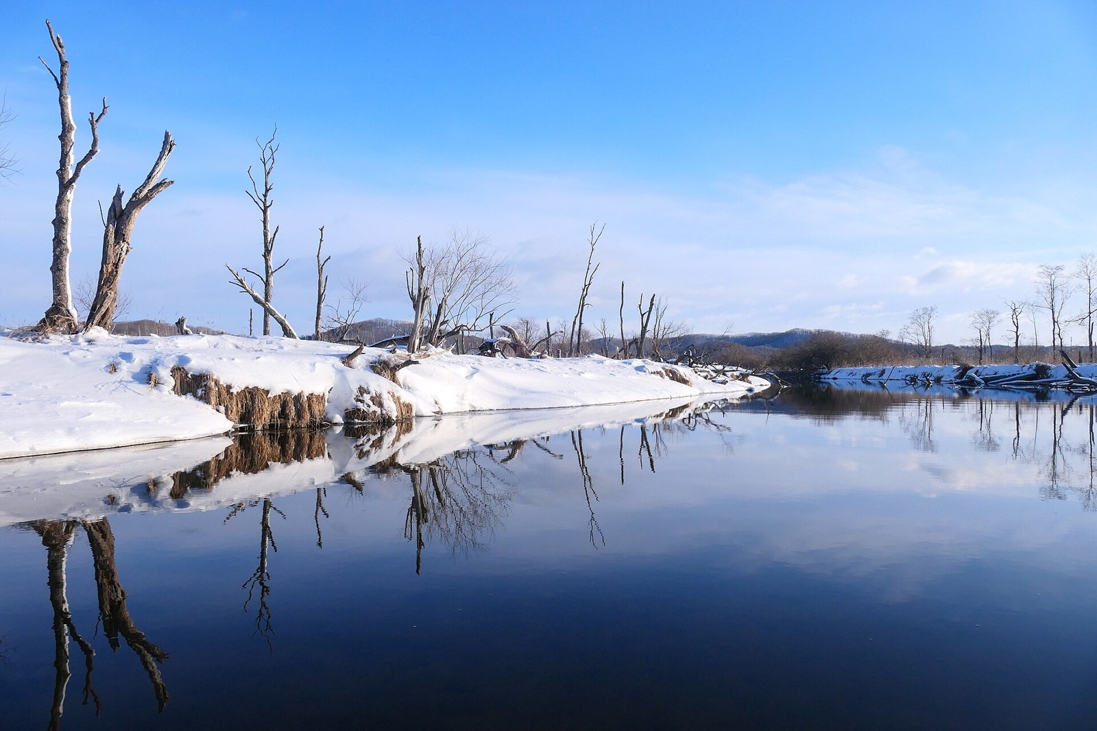
Wetlands, lakes, forests, sea and farming country all belong to eastern Hokkaido. They are spread across a large area, so let’s look at them a little at a time.
Kushiro Wetland, Lake Akan and Lake Mashu
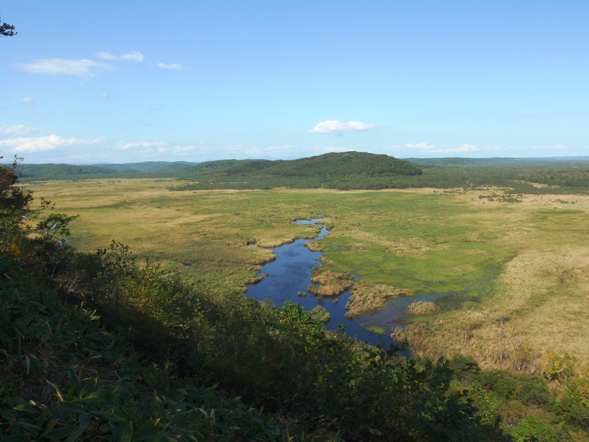
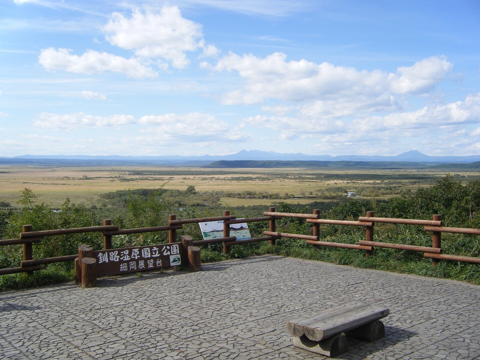
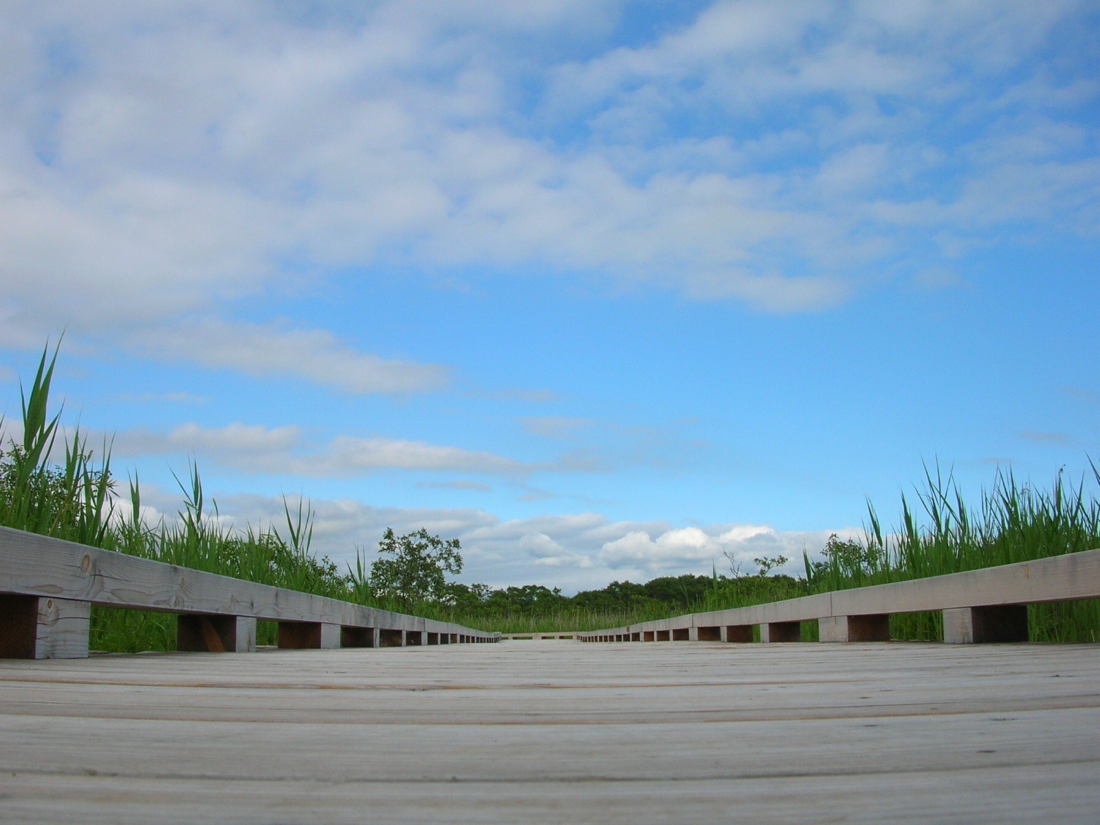
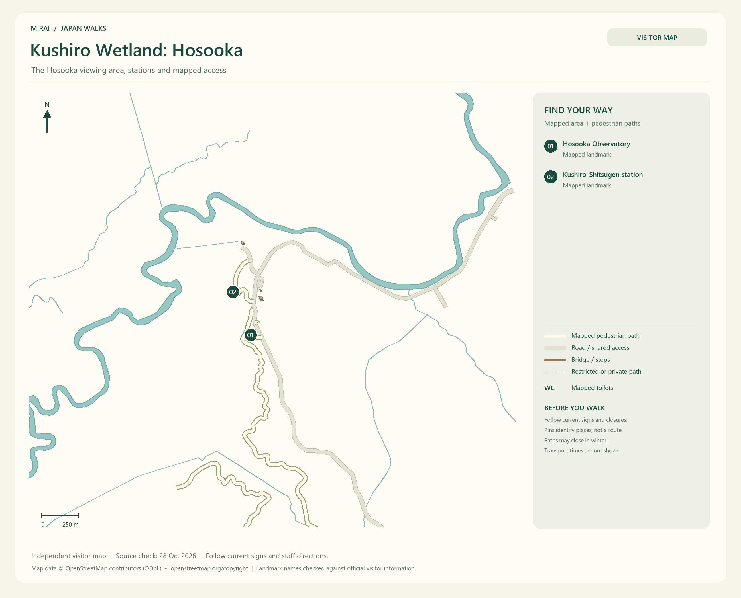
At Kushiro Wetland, take in the wide view from an observation point or walk along an established boardwalk. Looking across the whole wetland and seeing the grasses and water close by draw your attention to different things.
Observation points and trail entrances are scattered around the wetland. Go one step beyond ‘visiting Kushiro Wetland’ and choose where you would like to look from. The useful station or bus stop, and the walk afterwards, depend on that choice.
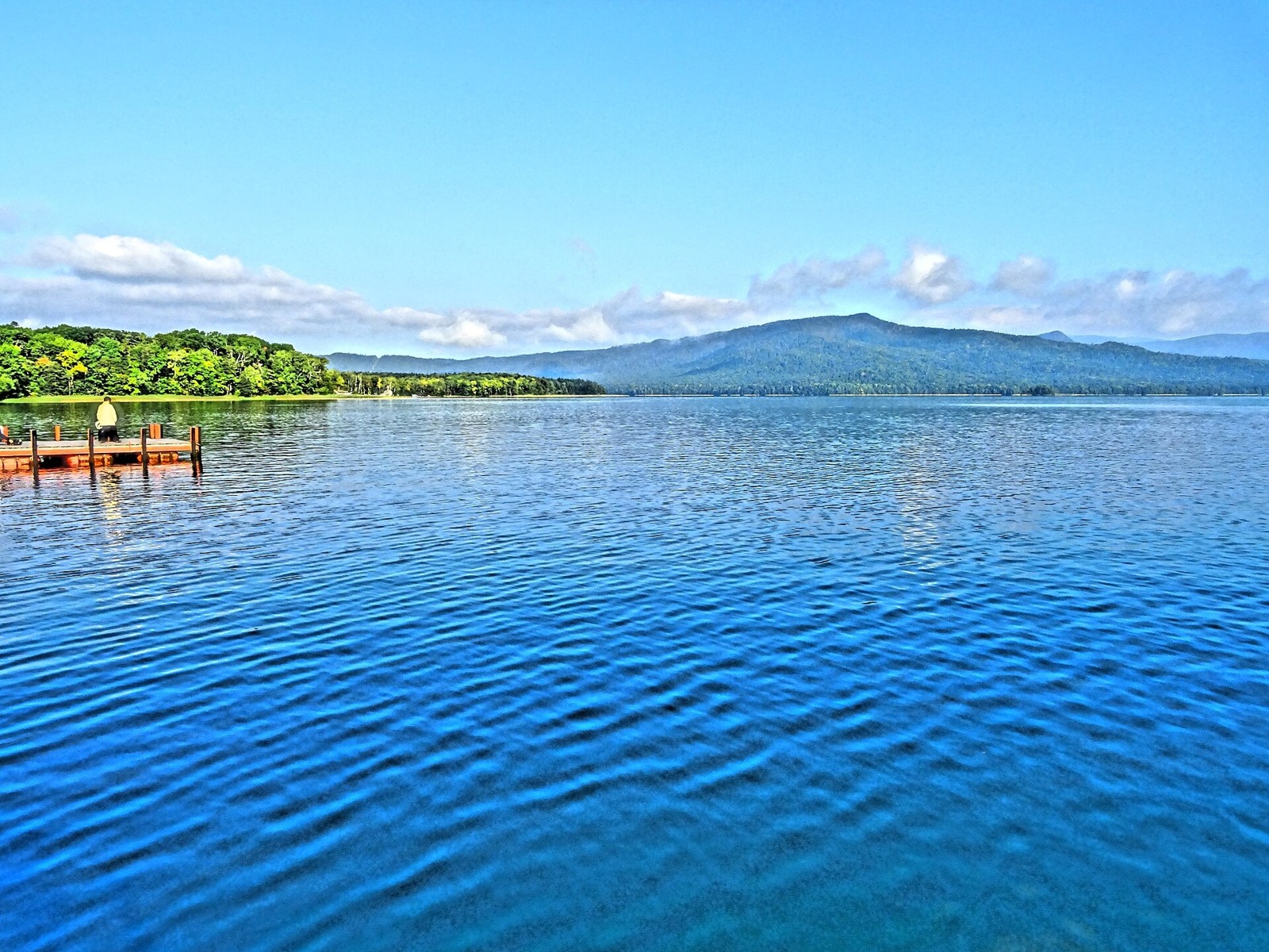
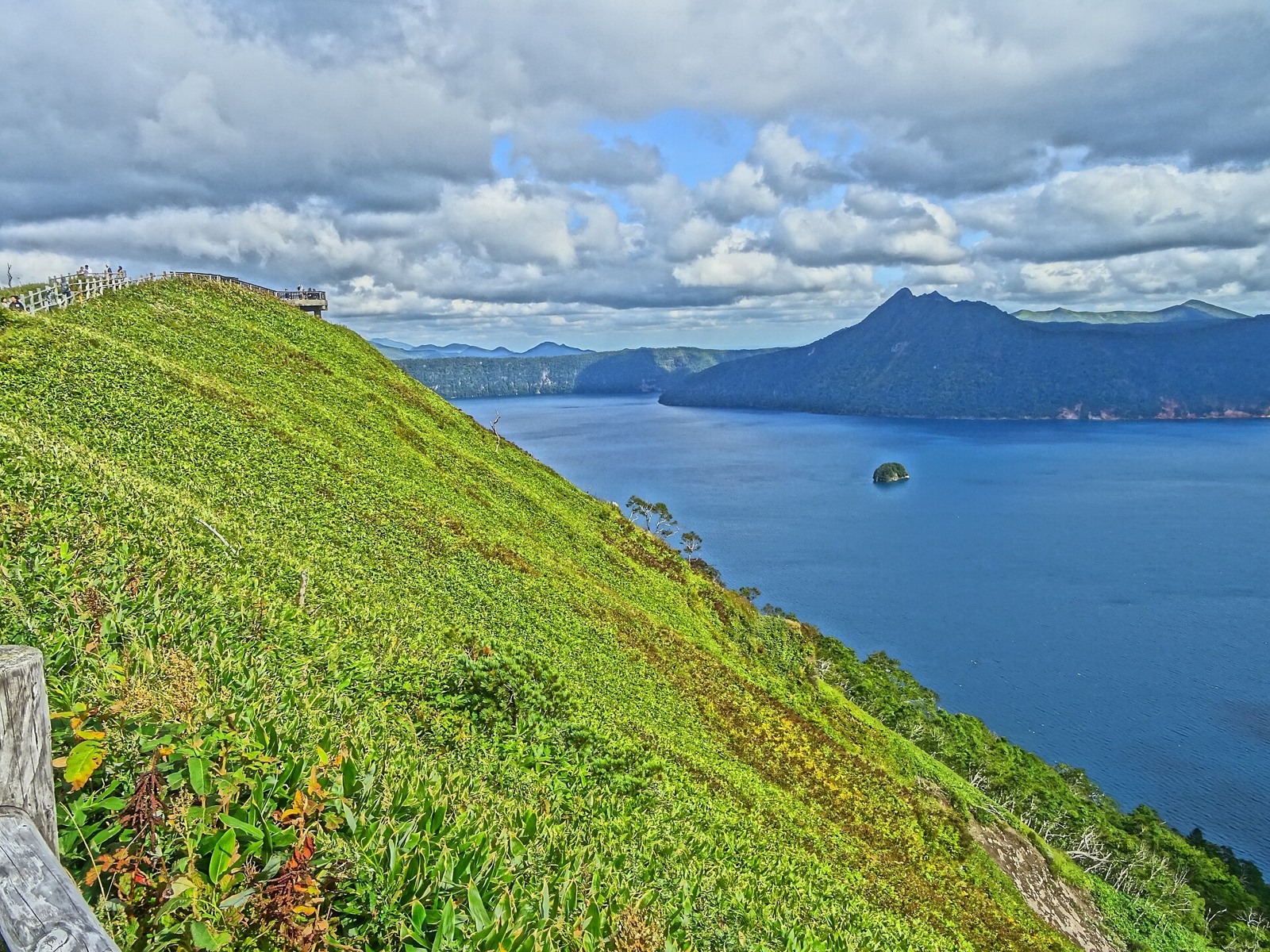
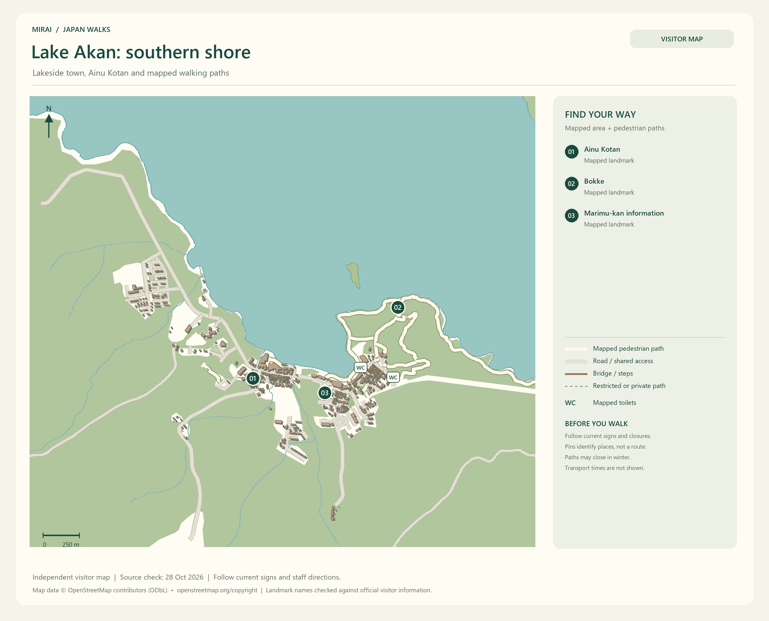
For hot springs and a little lakeside town life, consider Lake Akan. For a lake seen from an observation point, Lake Mashu is another possibility. Fog can hide its surface, so whether you meet the view in your favourite photograph depends on the weather that day.
Choosing one lake and spending more time around it could make a lovely trip, too.
Maps follow the photos. They show the areas named in their titles, not a single route connecting every place in this gallery. Follow current signs and access conditions.
Photo and map credits
Kushiro-Shitsugen Kushiro-river.jpg — MaedaAkihiko. https://commons.wikimedia.org/wiki/File:Kushiro-Shitsugen_Kushiro-river.jpg | CC BY-SA 4.0 https://creativecommons.org/licenses/by-sa/4.0. Resized/re-encoded for web display; no crop or retouch.
Kottaro situgen 2009.jpg — Soica2001 ( talk ). https://commons.wikimedia.org/wiki/File:Kottaro_situgen_2009.jpg | Public domain . Resized/re-encoded for web display; no crop or retouch.
Kushirositsugen Hosooka Tenboudai.jpg — User:欅. https://commons.wikimedia.org/wiki/File:Kushirositsugen_Hosooka_Tenboudai.jpg | CC BY-SA 3.0 https://creativecommons.org/licenses/by-sa/3.0. Resized/re-encoded for web display; no crop or retouch.
木道(Tree way on the wetlands ) - panoramio.jpg — pakku. https://commons.wikimedia.org/wiki/File:%E6%9C%A8%E9%81%93%EF%BC%88Tree_way_on_the_wetlands_%EF%BC%89_-_panoramio.jpg | CC BY 3.0 https://creativecommons.org/licenses/by/3.0. Resized/re-encoded for web display; no crop or retouch.
Lake-akan and Mt-ahoro.jpg — melvil. https://commons.wikimedia.org/wiki/File:Lake-akan_and_Mt-ahoro.jpg | CC BY-SA 4.0 https://creativecommons.org/licenses/by-sa/4.0. Resized/re-encoded for web display; no crop or retouch.
2017-Japan Lake Masshu.jpg — melvil. https://commons.wikimedia.org/wiki/File:2017-Japan_Lake_Masshu.jpg | CC BY-SA 4.0 https://creativecommons.org/licenses/by-sa/4.0. Resized/re-encoded for web display; no crop or retouch.
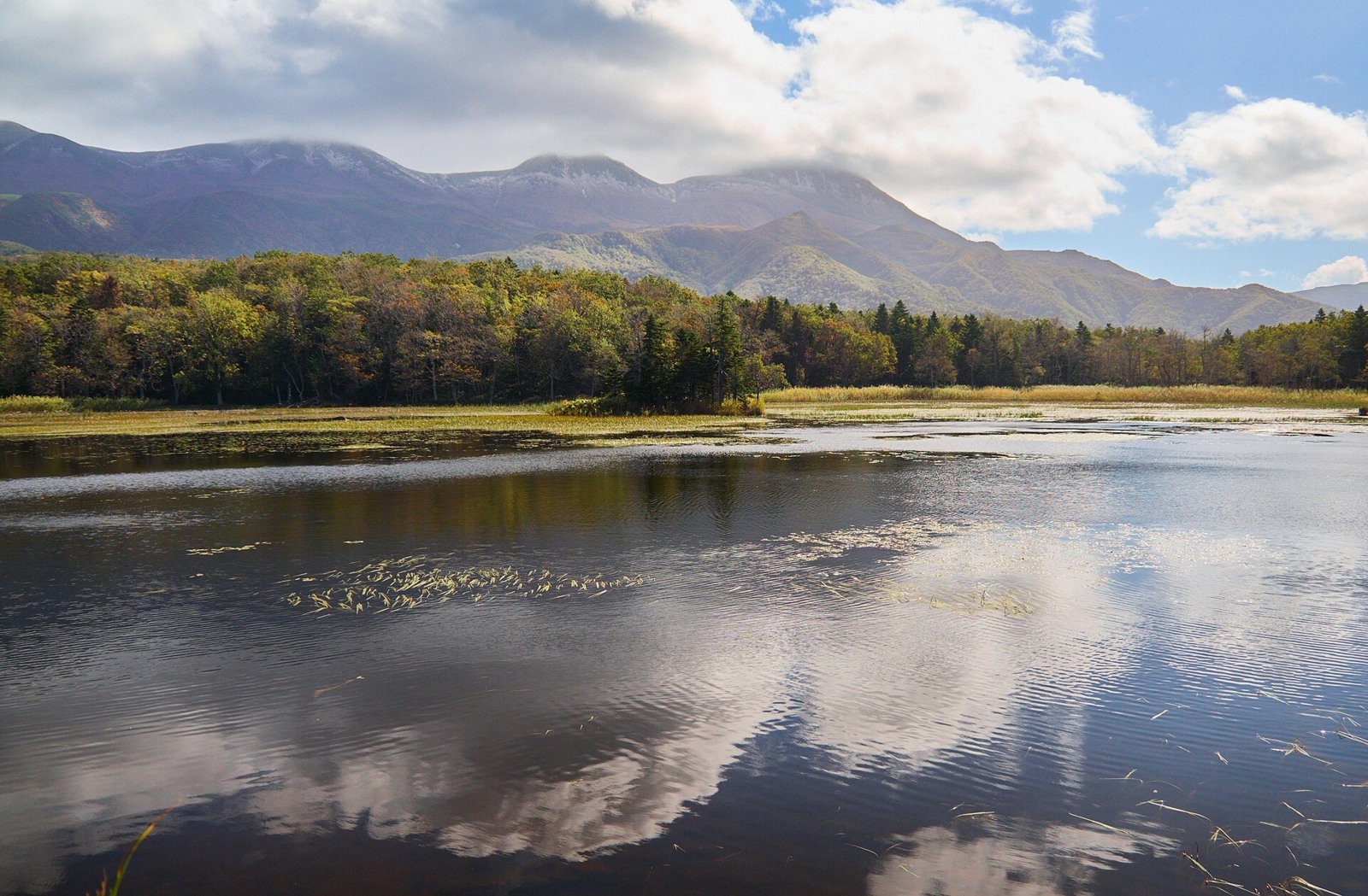
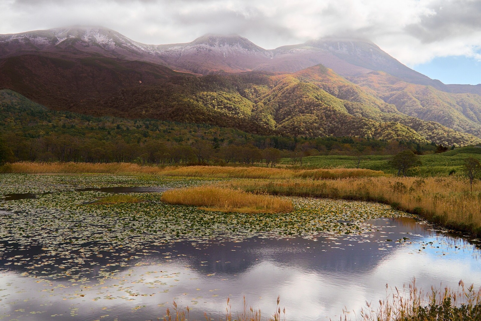
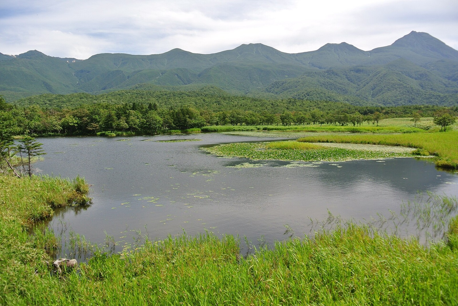
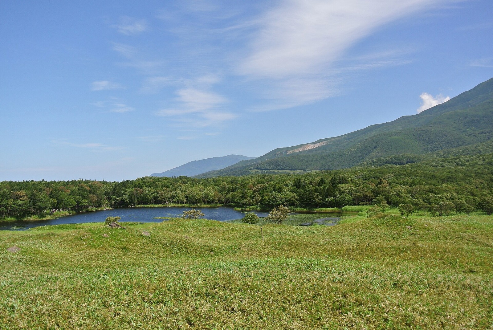
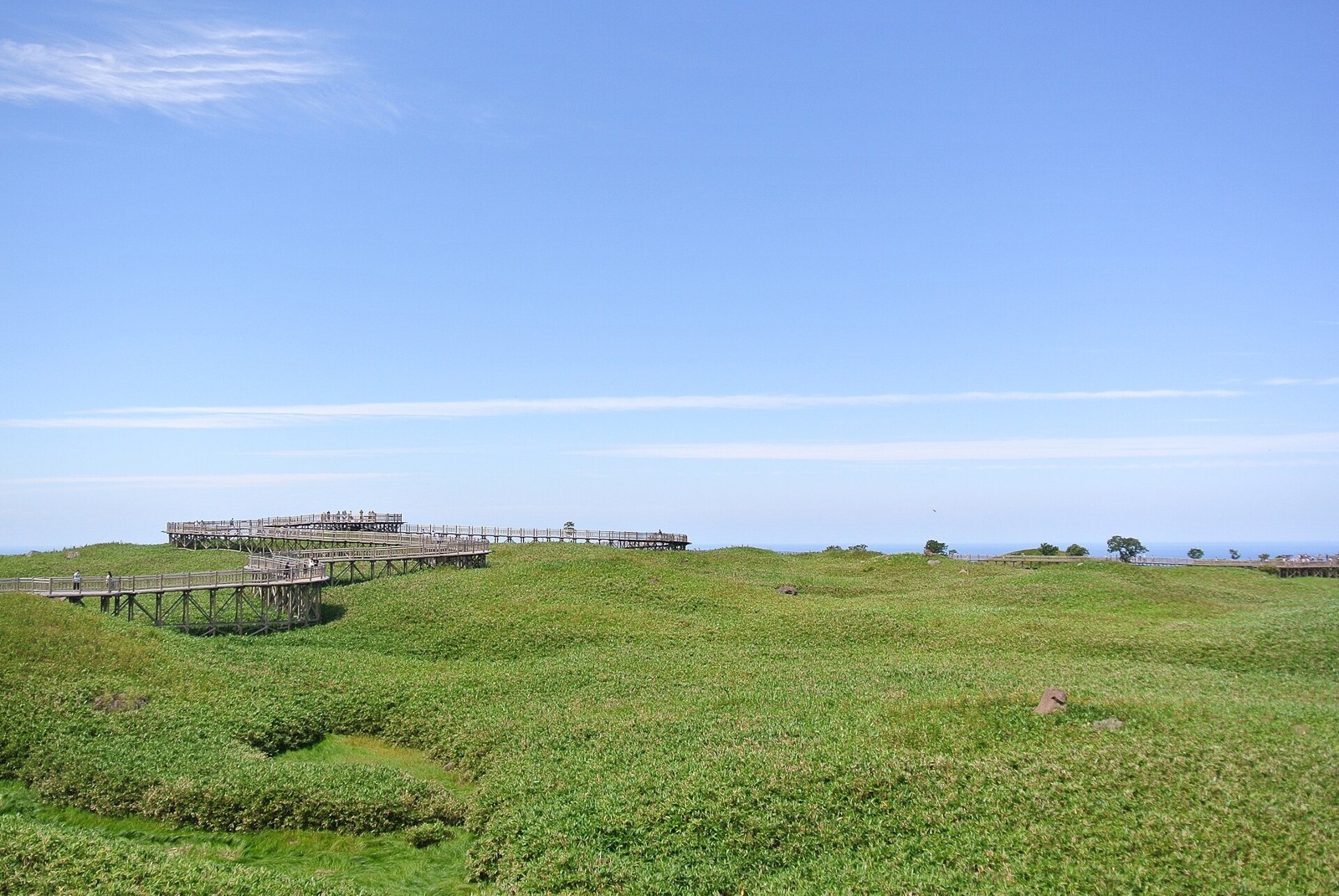
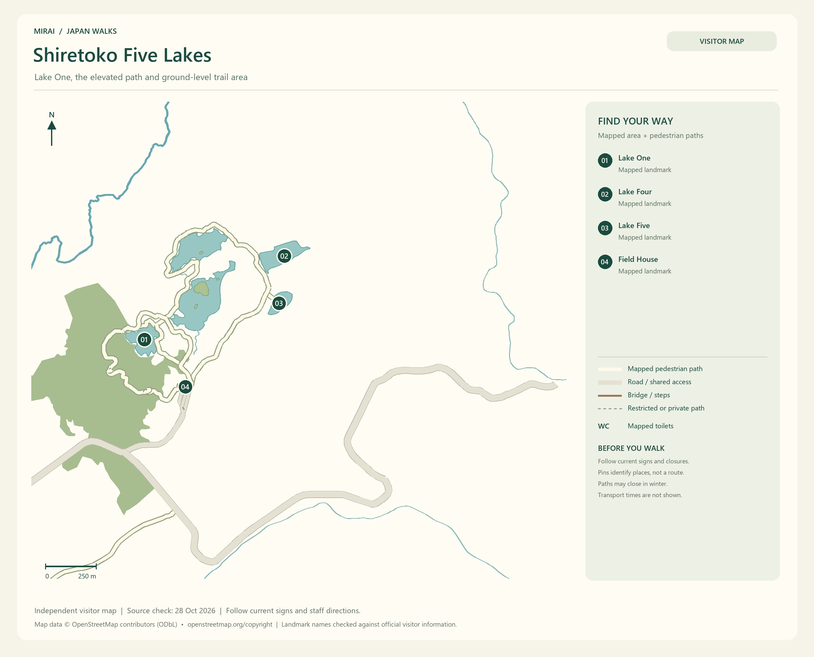
In Shiretoko, make time for the water and forests of the Shiretoko Five Lakes. The elevated wooden path leading to Lake One and the ground-level trails take you to different places and have different access conditions.
Depending on the season, the ground-level trails require a registered guide or a briefing. They may also close because of brown bear activity or other conditions. Once you choose a route, check how to use it at that time of year. Preparing to enter nature is part of the journey.
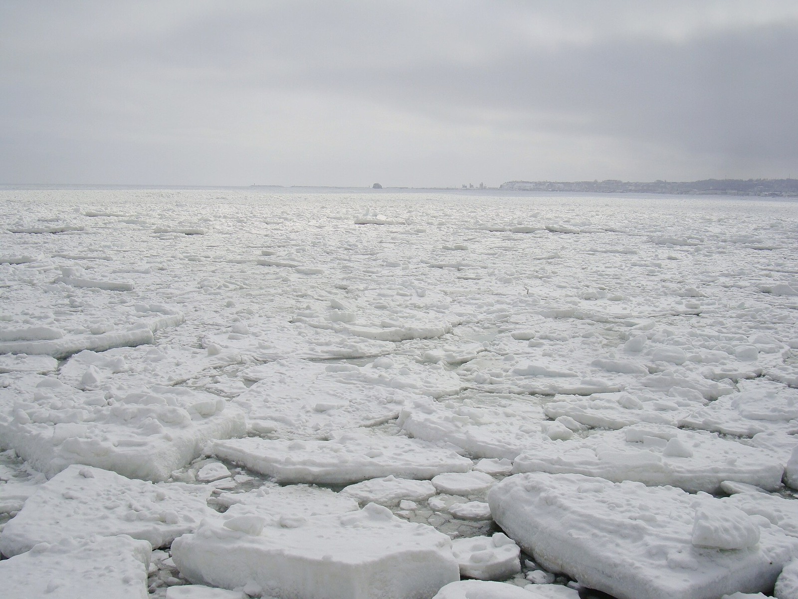
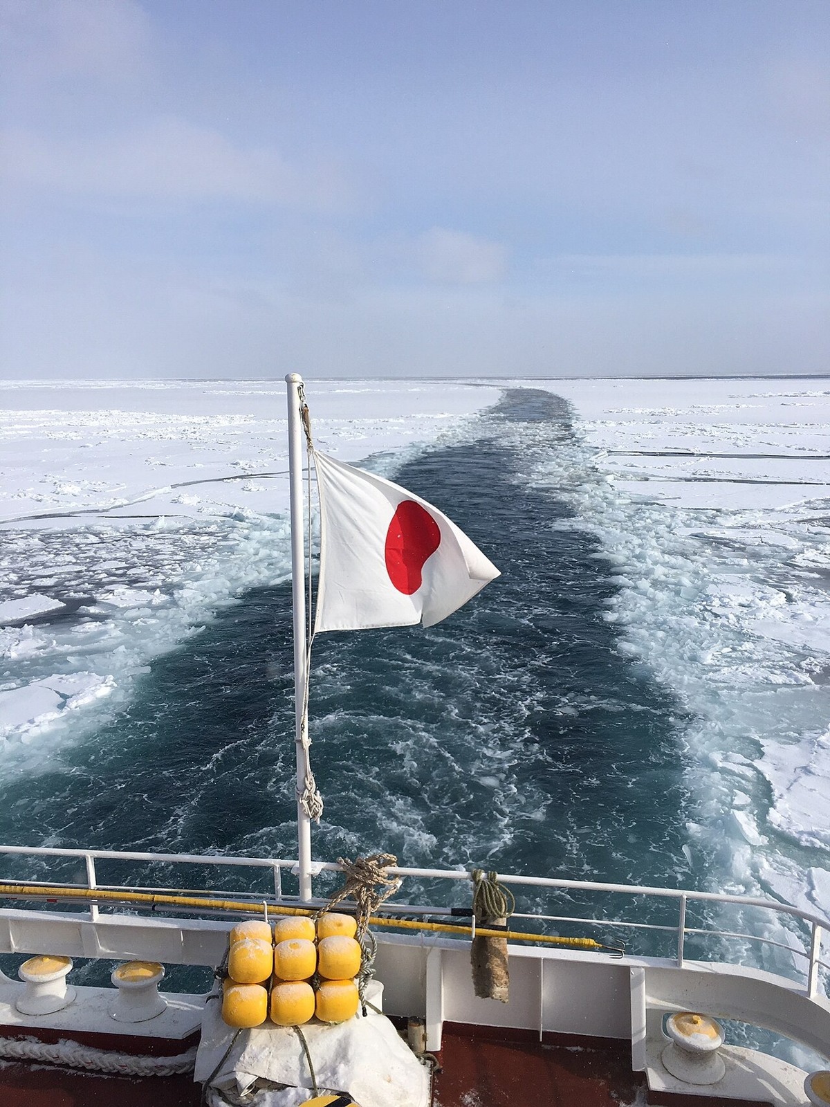
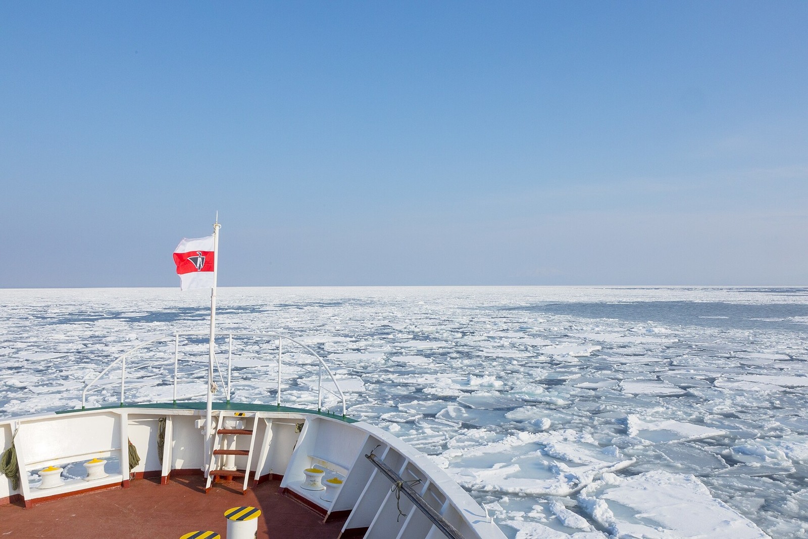
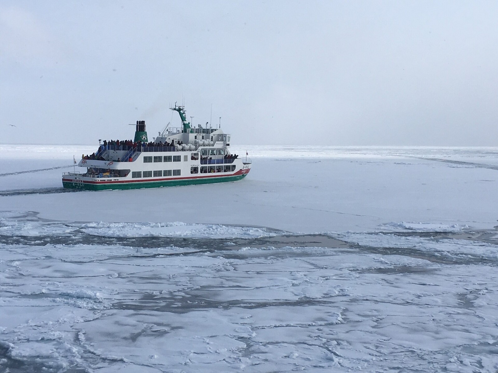
Along the Sea of Okhotsk coast, including Abashiri, winter drift ice is another view that captures the imagination. I would love to see the sea turn white. Ice conditions and sightseeing-boat operations vary with the year and the day’s weather, though.
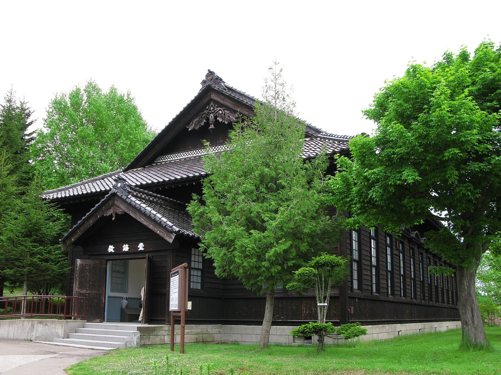
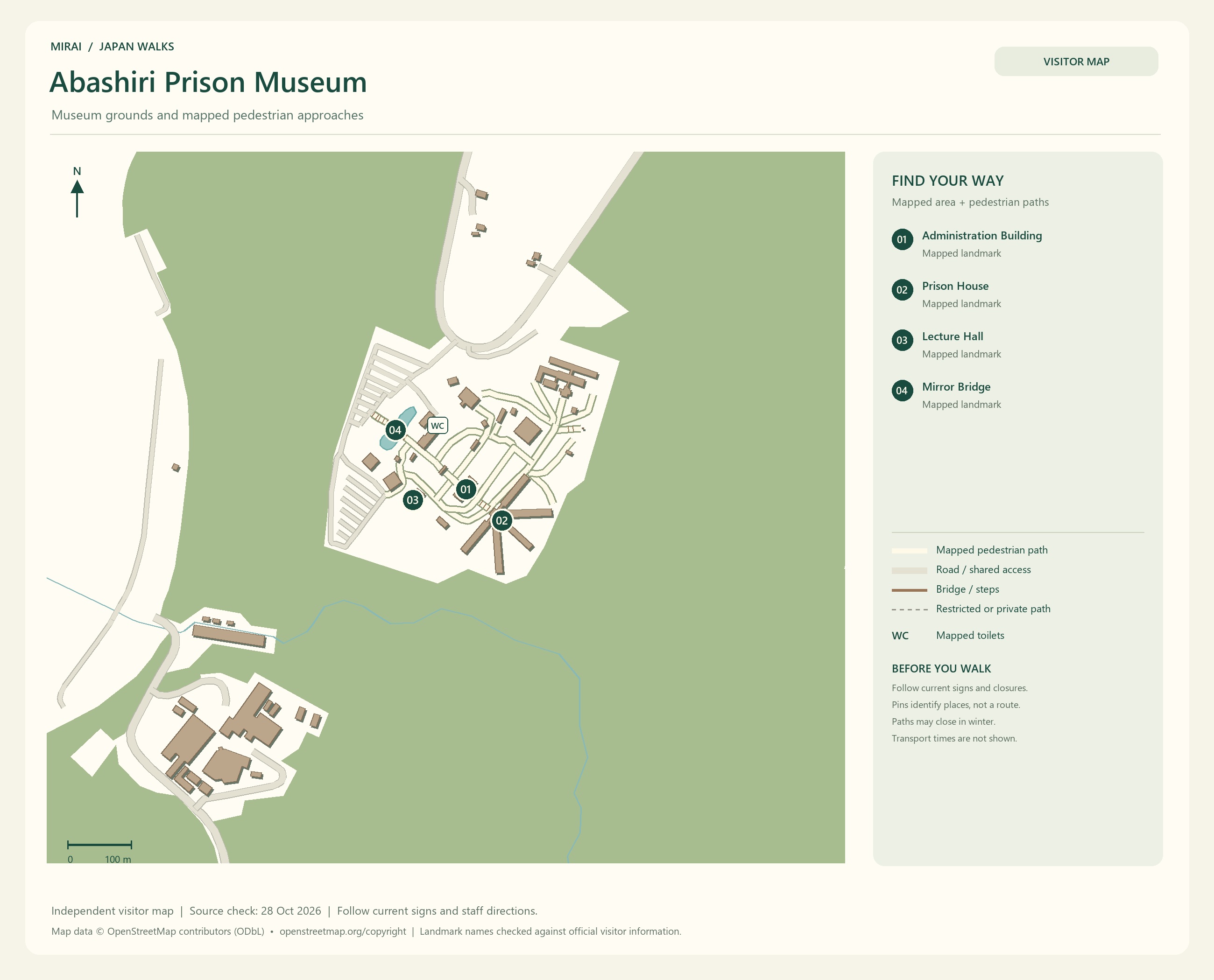
For a little history in Abashiri, visit Abashiri Prison Museum. Its relocated and reconstructed buildings belonged to the old prison; it is a separate attraction from the prison operating today. The buildings and exhibits offer a way to learn about the connection between prisons and the development of Hokkaido.
Maps follow the photos. They show the areas named in their titles, not a single route connecting every place in this gallery. Follow current signs and access conditions.
Photo and map credits
Shiretoko Five Lakes - ShiretokoFiveLakes7962.jpg — lumoplank. https://commons.wikimedia.org/wiki/File:Shiretoko_Five_Lakes_-_ShiretokoFiveLakes7962.jpg | CC0 http://creativecommons.org/publicdomain/zero/1.0/deed.en. Resized/re-encoded for web display; no crop or retouch.
Shiretoko Five Lakes - ShiretokoFiveLakes7982.jpg — lumoplank. https://commons.wikimedia.org/wiki/File:Shiretoko_Five_Lakes_-_ShiretokoFiveLakes7982.jpg | CC0 http://creativecommons.org/publicdomain/zero/1.0/deed.en. Resized/re-encoded for web display; no crop or retouch.
Shiretoko Five Lakes 20140811-1.jpg — Suicasmo. https://commons.wikimedia.org/wiki/File:Shiretoko_Five_Lakes_20140811-1.jpg | CC BY-SA 4.0 https://creativecommons.org/licenses/by-sa/4.0. Resized/re-encoded for web display; no crop or retouch.
Shiretoko Five Lakes 20140811-2.jpg — Suicasmo. https://commons.wikimedia.org/wiki/File:Shiretoko_Five_Lakes_20140811-2.jpg | CC BY-SA 4.0 https://creativecommons.org/licenses/by-sa/4.0. Resized/re-encoded for web display; no crop or retouch.
Shiretoko Five Lakes 20140811-3.jpg — Suicasmo. https://commons.wikimedia.org/wiki/File:Shiretoko_Five_Lakes_20140811-3.jpg | CC BY-SA 4.0 https://creativecommons.org/licenses/by-sa/4.0. Resized/re-encoded for web display; no crop or retouch.
Maps follow the photos. They show the areas named in their titles, not a single route connecting every place in this gallery. Follow current signs and access conditions.
Photo and map credits
Abashiri Drift ice01.JPG — 221.20 ( talk ). https://commons.wikimedia.org/wiki/File:Abashiri_Drift_ice01.JPG | Public domain . Resized/re-encoded for web display; no crop or retouch.
Aboard Aurora Icebreaker at Sea of Okhost.jpg — Lkj12344321. https://commons.wikimedia.org/wiki/File:Aboard_Aurora_Icebreaker_at_Sea_of_Okhost.jpg | CC BY-SA 4.0 https://creativecommons.org/licenses/by-sa/4.0. Resized/re-encoded for web display; no crop or retouch.
Hokkaido-Abashiri Drift Icebreaker Ship Aurora-xl.jpg — kkawamura. https://commons.wikimedia.org/wiki/File:Hokkaido-Abashiri_Drift_Icebreaker_Ship_Aurora-xl.jpg | CC BY 4.0 https://creativecommons.org/licenses/by/4.0. Resized/re-encoded for web display; no crop or retouch.
Icebreaker Aurora on drift ice at Sea of Okhost.jpg — Lkj12344321. https://commons.wikimedia.org/wiki/File:Icebreaker_Aurora_on_drift_ice_at_Sea_of_Okhost.jpg | CC BY-SA 4.0 https://creativecommons.org/licenses/by-sa/4.0. Resized/re-encoded for web display; no crop or retouch.
Abashiri Abashiri Prison Museum Kyokaido 1.JPG — 京浜にけ. https://commons.wikimedia.org/wiki/File:Abashiri_Abashiri_Prison_Museum_Kyokaido_1.JPG | CC BY-SA 3.0 https://creativecommons.org/licenses/by-sa/3.0. Resized/re-encoded for web display; no crop or retouch.
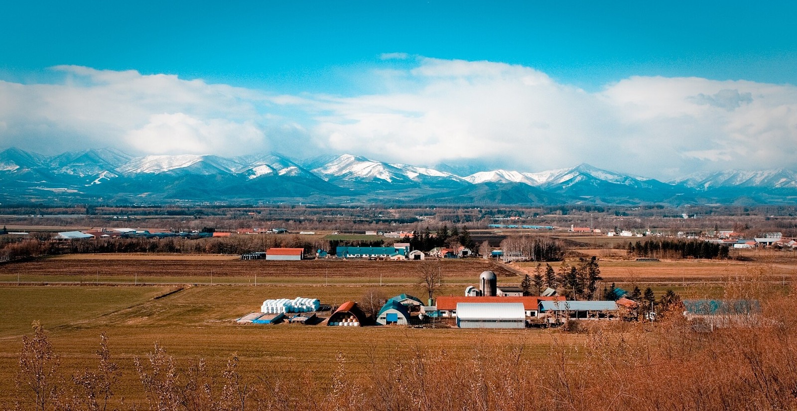
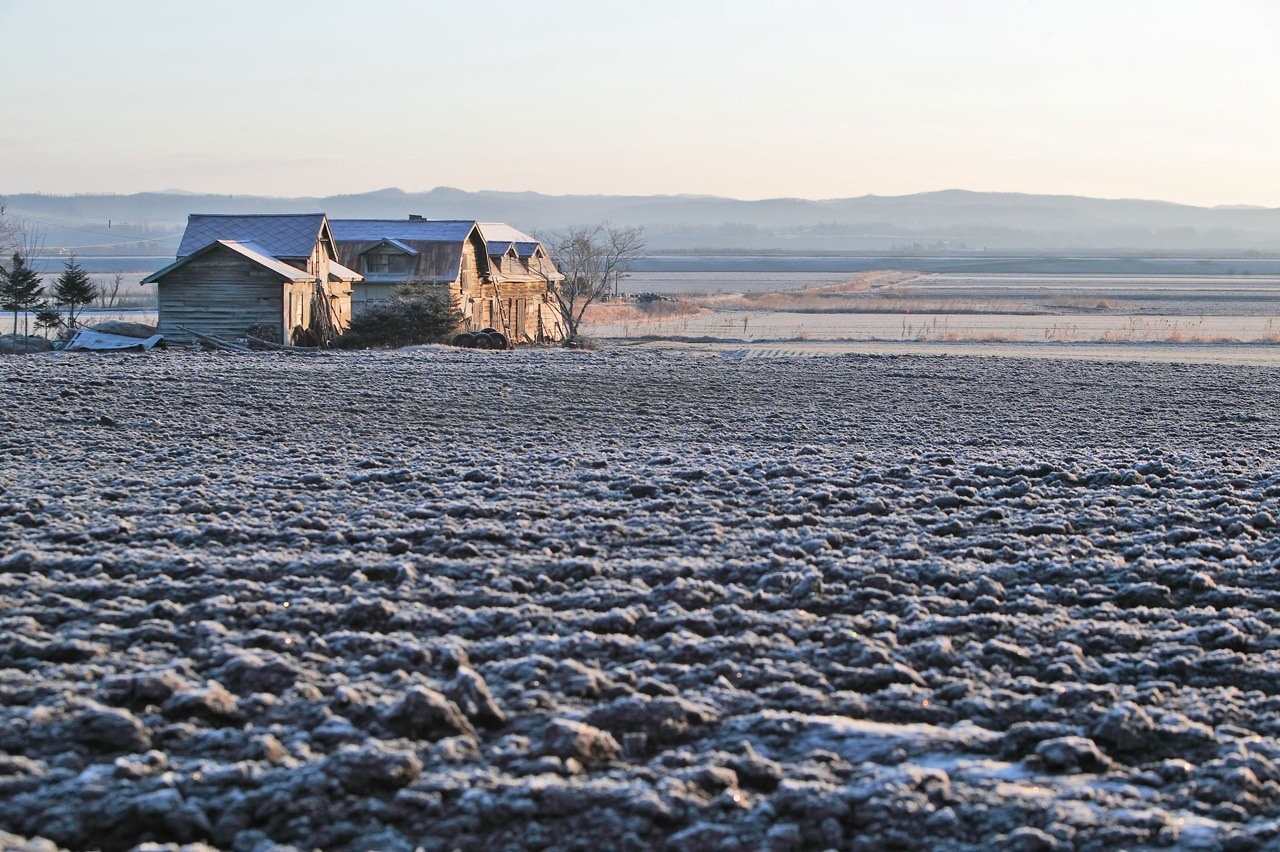
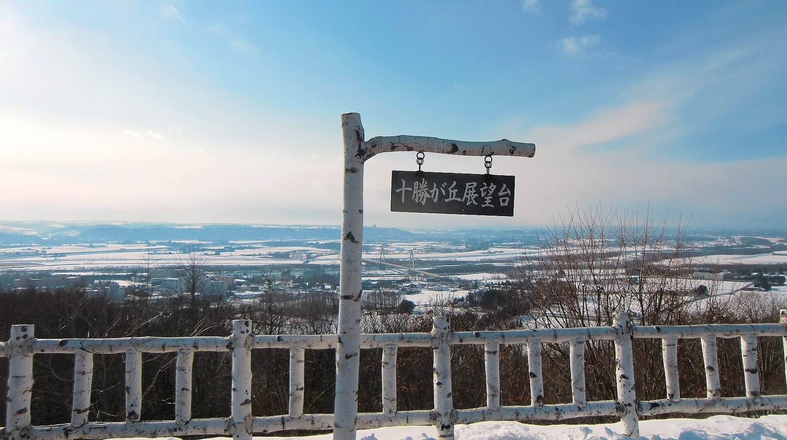
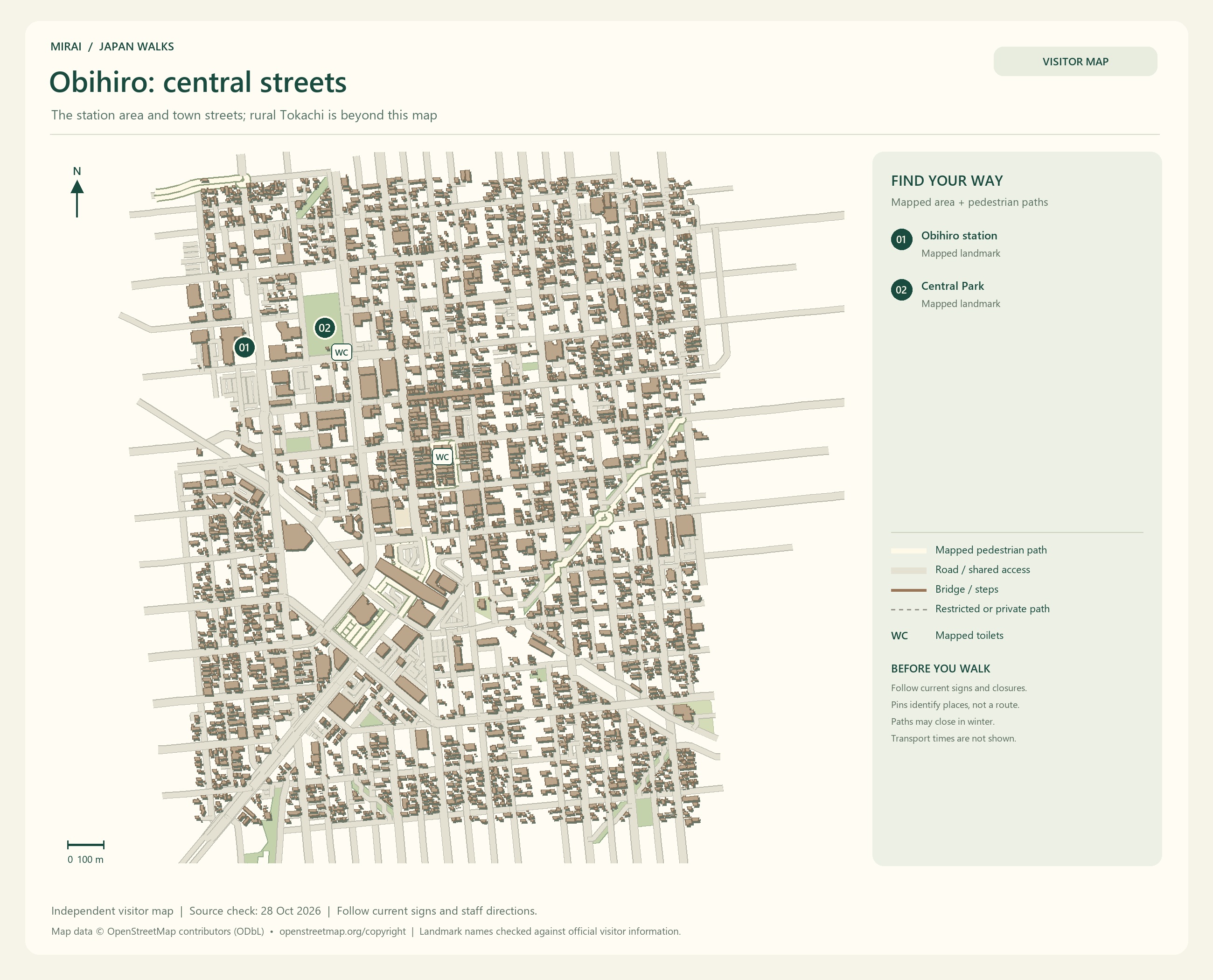
In Tokachi, look forward to broad fields and farming landscapes. Find a view where the sky seems to carry on beyond the fields, and you might want to stop for a while.
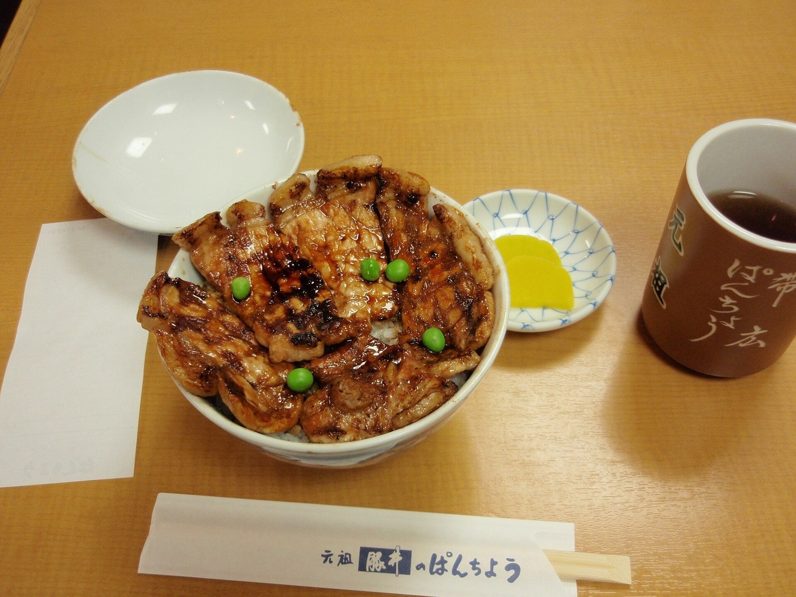
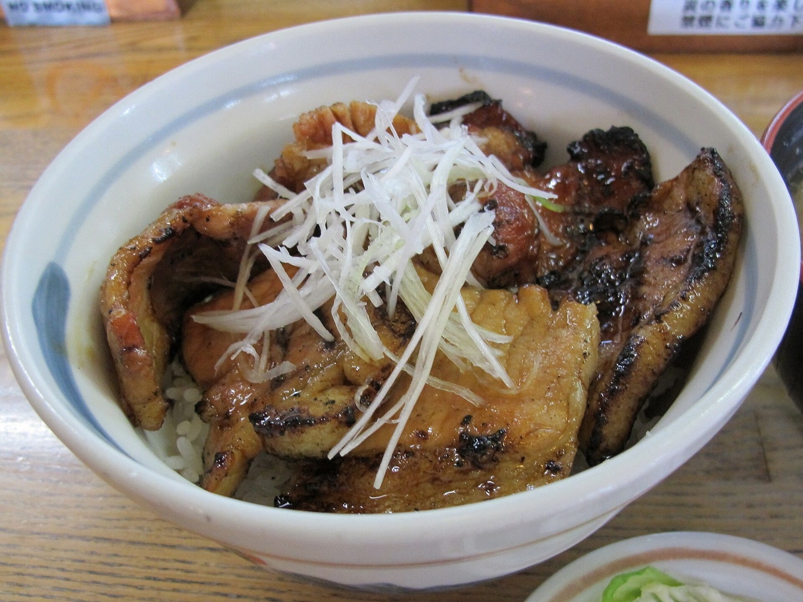
A pork rice bowl in Obihiro, followed by dairy treats or sweets, connects the landscape with what is on your plate. The views are tempting, and so are the snacks… I suspect we might need a few extra breaks here.
Tokachi, Kushiro, Abashiri and Shiretoko are spread across a large part of eastern Hokkaido. Rather than treating them as neighbouring stops, choose where you would most like to spend your time on this trip.
Maps follow the photos. They show the areas named in their titles, not a single route connecting every place in this gallery. Follow current signs and access conditions.
Photo and map credits
Panoramic Shimizu.jpeg — Hokkaido-man. https://commons.wikimedia.org/wiki/File:Panoramic_Shimizu.jpeg | CC BY-SA 3.0 https://creativecommons.org/licenses/by-sa/3.0. Resized/re-encoded for web display; no crop or retouch.
Makubetsu Tokachi 001.JPG — Tennen-Gas. https://commons.wikimedia.org/wiki/File:Makubetsu_Tokachi_001.JPG | CC BY-SA 3.0 http://creativecommons.org/licenses/by-sa/3.0/. Resized/re-encoded for web display; no crop or retouch.
View from Tokachi-gaoka.JPG — On-chan. https://commons.wikimedia.org/wiki/File:View_from_Tokachi-gaoka.JPG | CC BY-SA 3.0 https://creativecommons.org/licenses/by-sa/3.0. Resized/re-encoded for web display; no crop or retouch.
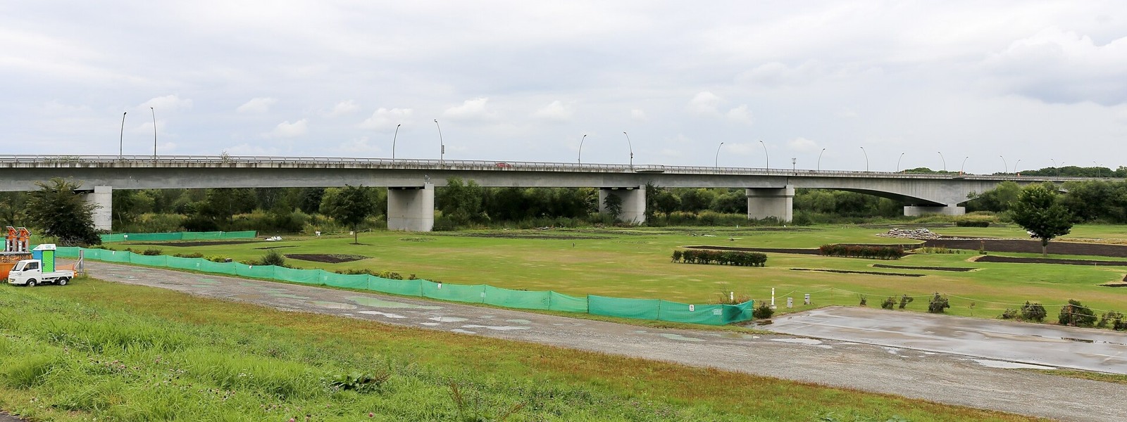
Suzuran Bridge over the Tokachi River.jpg — Yasu ( talk ). https://commons.wikimedia.org/wiki/File:Suzuran_Bridge_over_the_Tokachi_River.jpg | CC BY-SA 3.0 https://creativecommons.org/licenses/by-sa/3.0. Resized/re-encoded for web display; no crop or retouch.
Butadon of Pancho.jpg — OskNe ( talk ). https://commons.wikimedia.org/wiki/File:Butadon_of_Pancho.jpg | Public domain . Resized/re-encoded for web display; no crop or retouch.
Wakkanai, Rishiri and Rebun: a little farther north
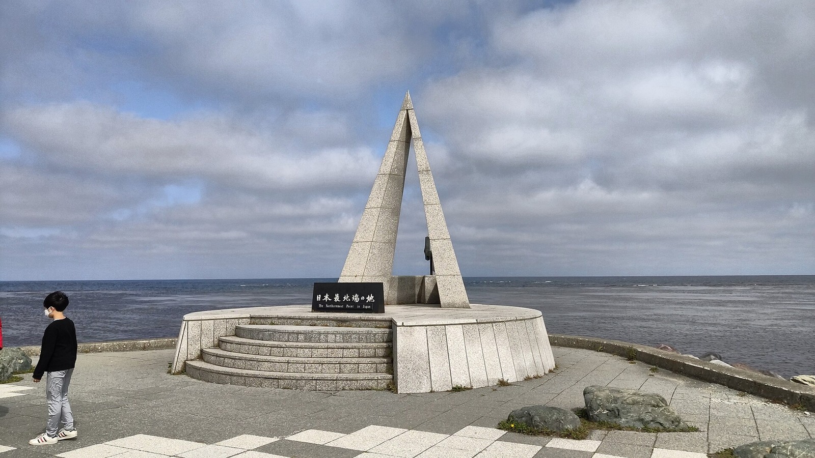
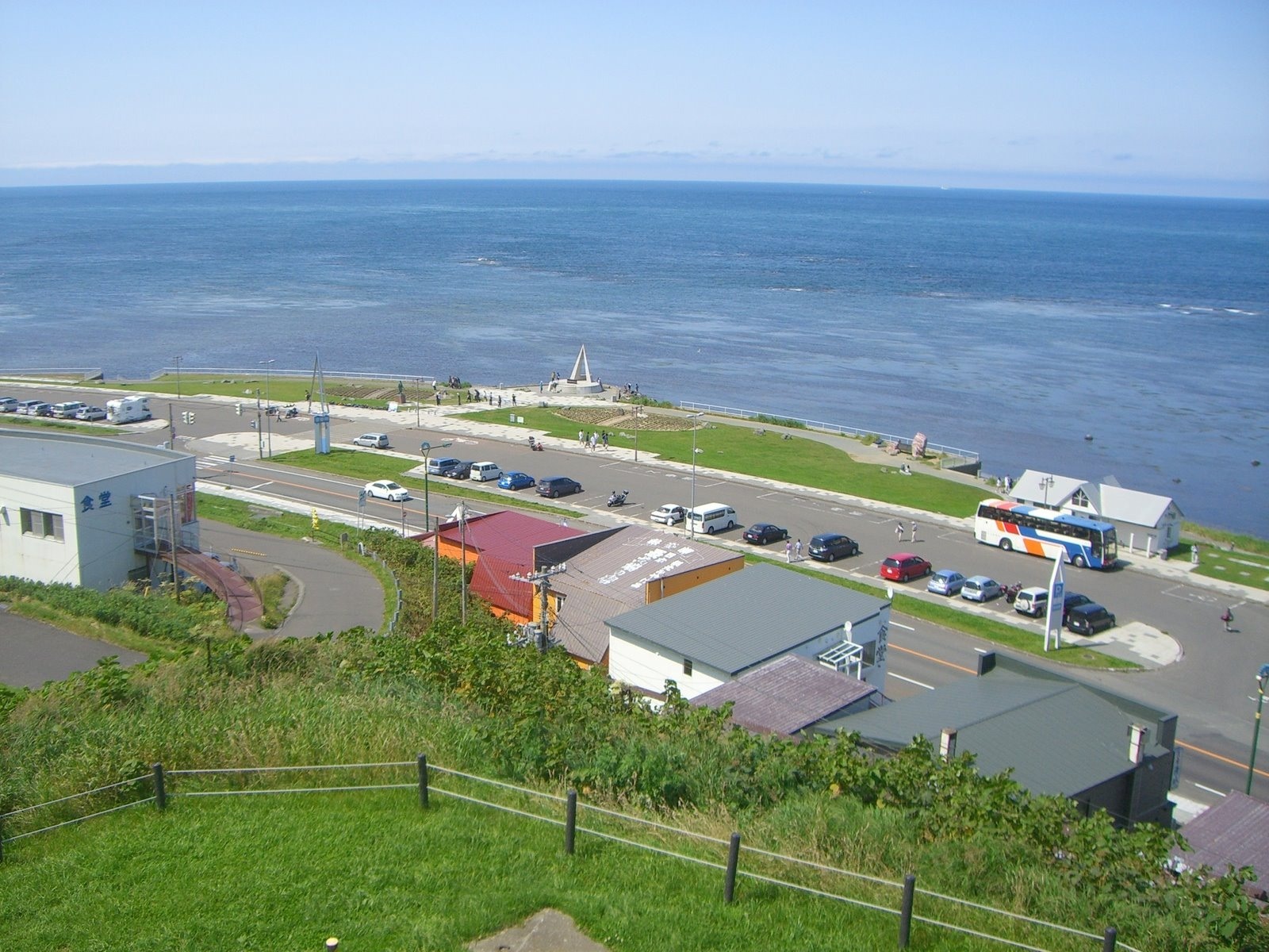
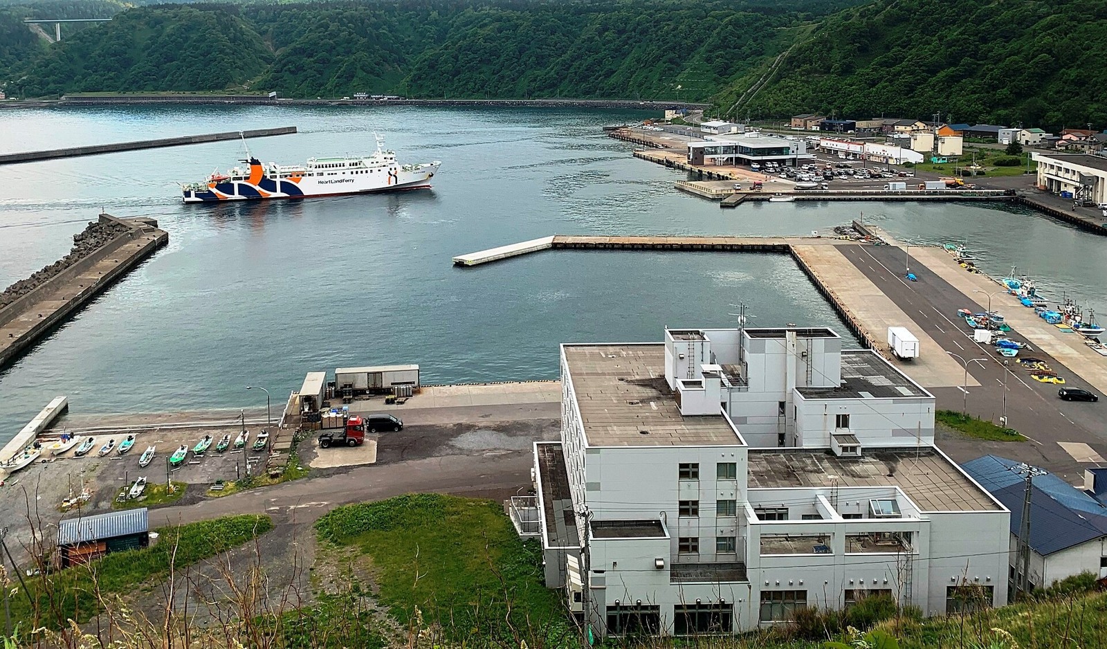
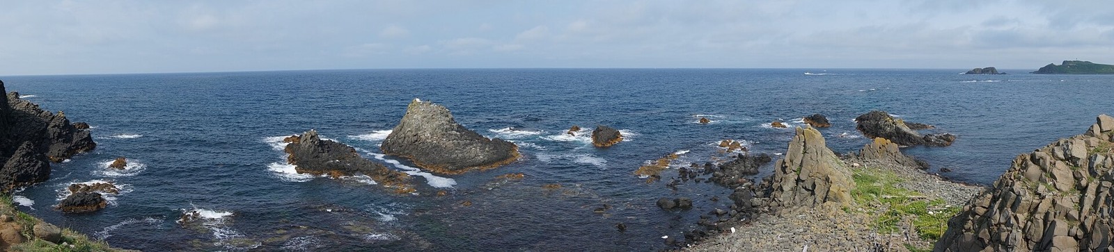
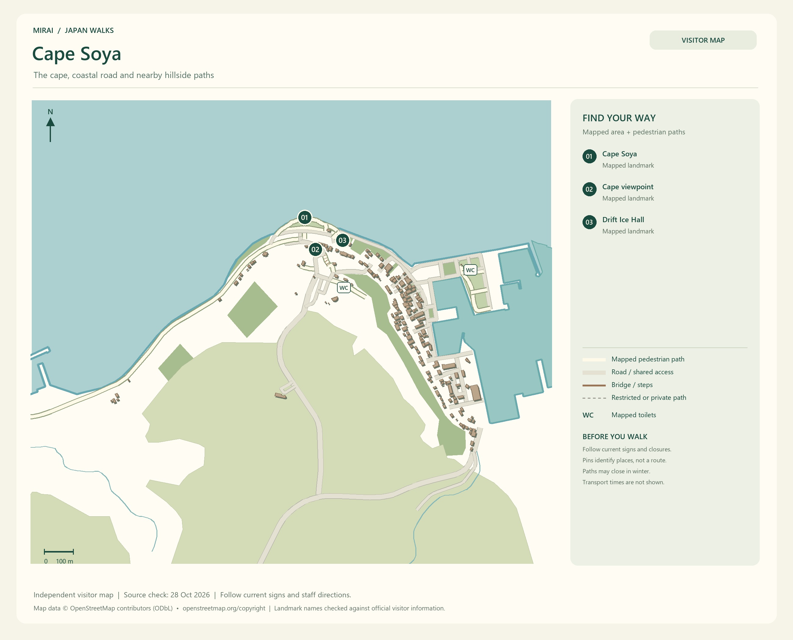
For a journey north, head towards Cape Soya in Wakkanai. Looking across the sea and thinking back over the journey that brought you here could become a memory of its own.
Cape Soya and Cape Noshappu are different places. Check the view you want and how to reach it on a map, rather than choosing by name alone. If you are taking a bus, settle the return journey along with the outward one.
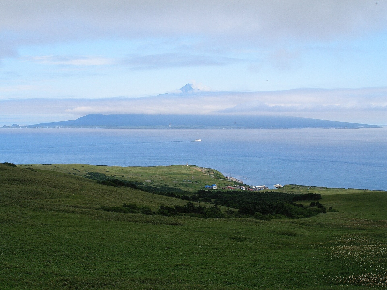
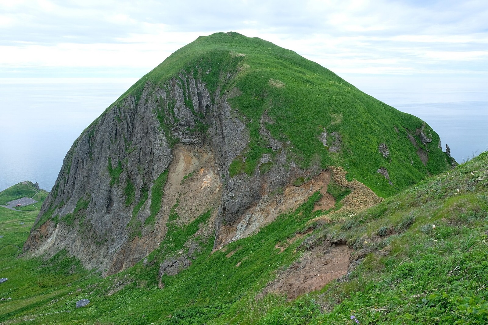
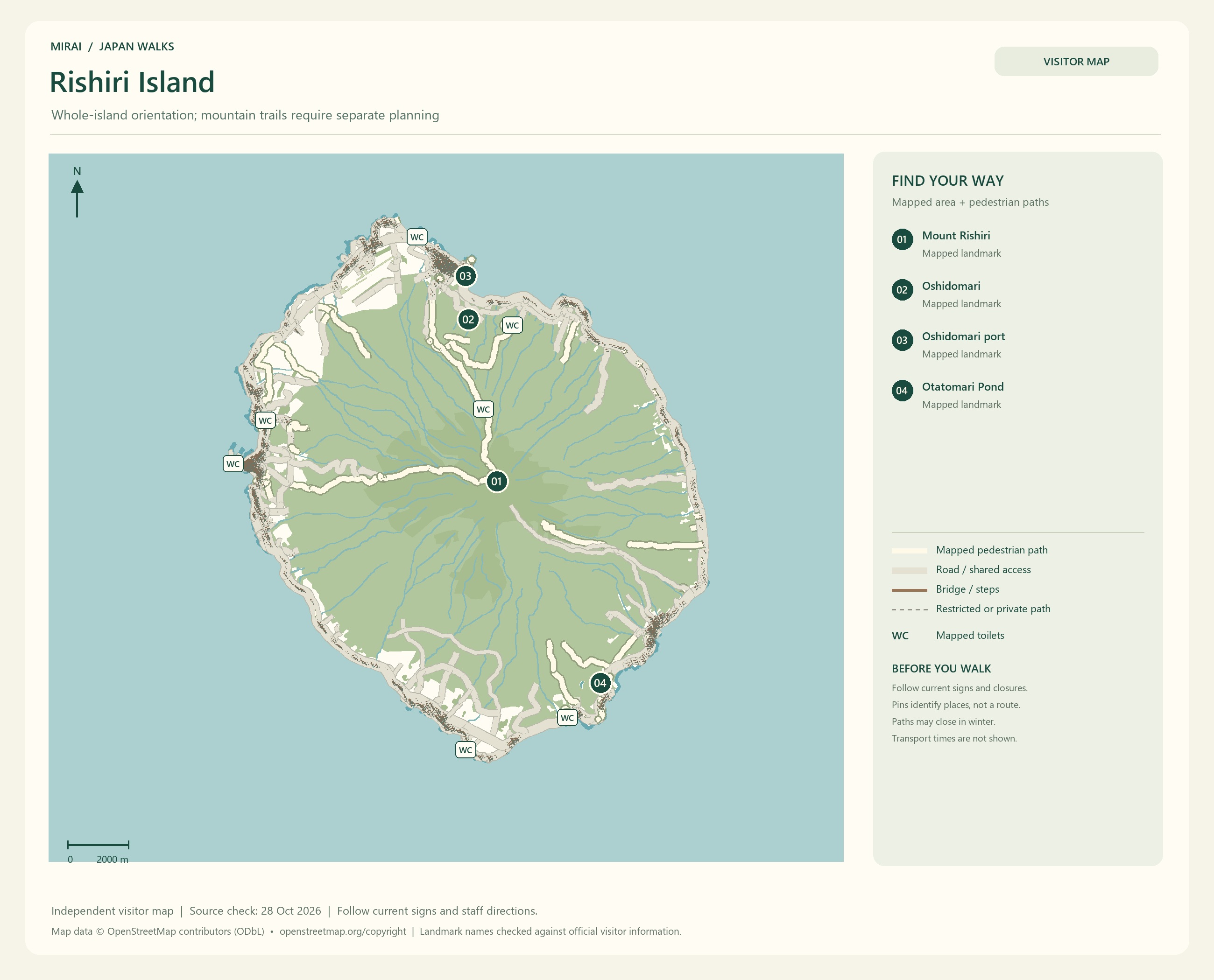
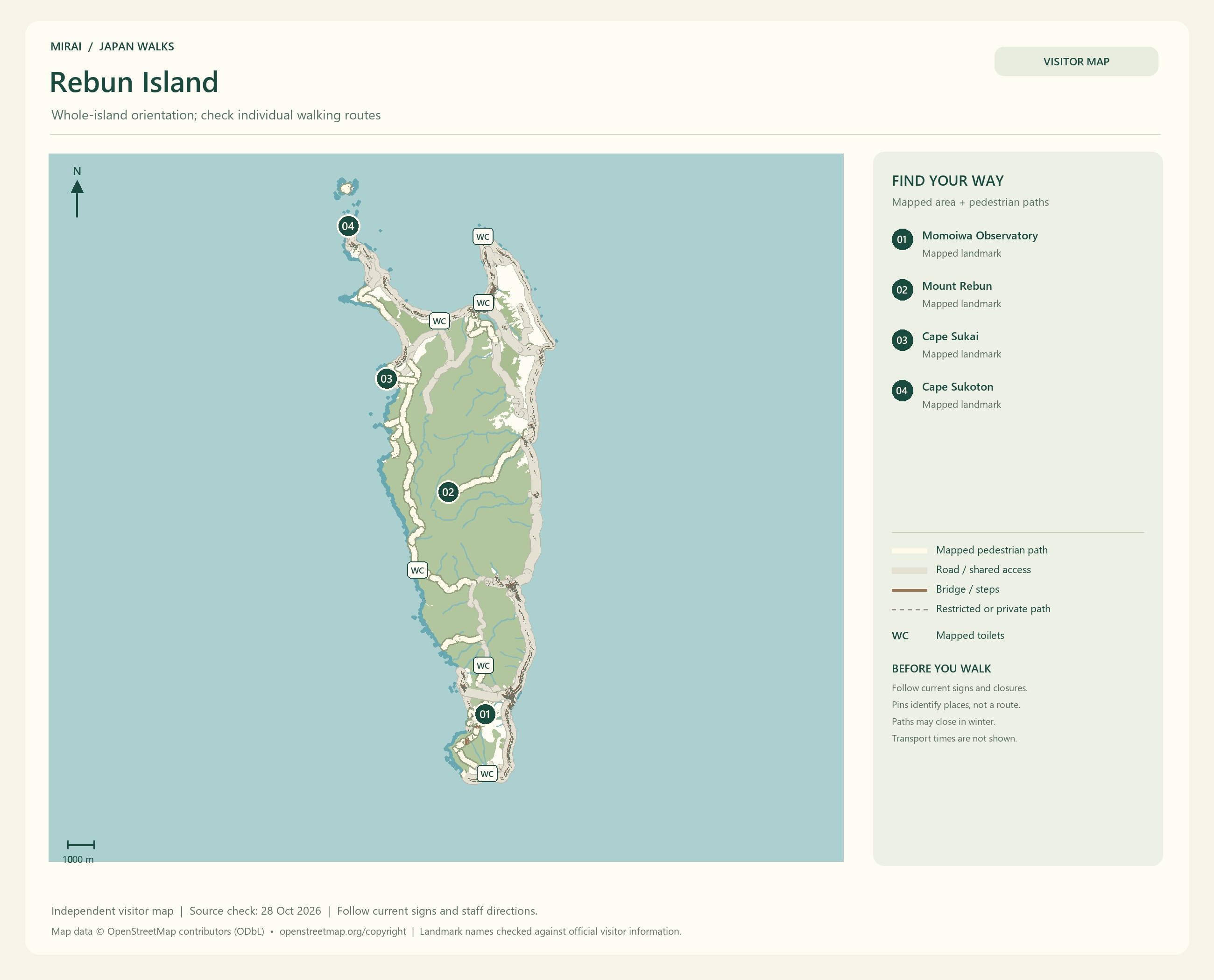
For an island trip, consider Rishiri and Rebun. Would you like to look towards Mount Rishiri, or walk in search of seasonal flowers on Rebun? The thing you most want to do helps you choose both the season and how to spend your stay.
Ferry timetables and the ports served change with the season. Plan accommodation and transport on the islands together, and leave some room in case a sailing is cancelled. A day when you do not have to hurry on to the next place sounds like a lovely way to enjoy an island view.
Maps follow the photos. They show the areas named in their titles, not a single route connecting every place in this gallery. Follow current signs and access conditions.
Photo and map credits
Souya Cape.jpg — Drivephotographer. https://commons.wikimedia.org/wiki/File:Souya_Cape.jpg | CC0 http://creativecommons.org/publicdomain/zero/1.0/deed.en. Resized/re-encoded for web display; no crop or retouch.
Cape Soya 20090805.jpg — Shift. https://commons.wikimedia.org/wiki/File:Cape_Soya_20090805.jpg | CC BY-SA 3.0 https://creativecommons.org/licenses/by-sa/3.0. Resized/re-encoded for web display; no crop or retouch.
Rishiri Island from Rebun.JPG — Vickerman625. https://commons.wikimedia.org/wiki/File:Rishiri_Island_from_Rebun.JPG | Public domain . Resized/re-encoded for web display; no crop or retouch.
Oshidomari Port, Rishirifuji, Rishiri Island, Hokkaido Prefecture, Japan.jpg — OKJaguar. https://commons.wikimedia.org/wiki/File:Oshidomari_Port,_Rishirifuji,_Rishiri_Island,_Hokkaido_Prefecture,_Japan.jpg | CC BY-SA 4.0 https://creativecommons.org/licenses/by-sa/4.0. Resized/re-encoded for web display; no crop or retouch.
Momoiwa (Peach Rock), Rebun Island, Japan.jpg — OKJaguar. https://commons.wikimedia.org/wiki/File:Momoiwa_(Peach_Rock),_Rebun_Island,_Japan.jpg | CC BY-SA 4.0 https://creativecommons.org/licenses/by-sa/4.0. Resized/re-encoded for web display; no crop or retouch.
SukotonCape RebunIsland Hokkaido Japan JUL2014.jpg — Ka23 13. https://commons.wikimedia.org/wiki/File:SukotonCape_RebunIsland_Hokkaido_Japan_JUL2014.jpg | CC BY-SA 4.0 https://creativecommons.org/licenses/by-sa/4.0. Resized/re-encoded for web display; no crop or retouch.
Would you like to add time to learn about Ainu history and culture to your journey?
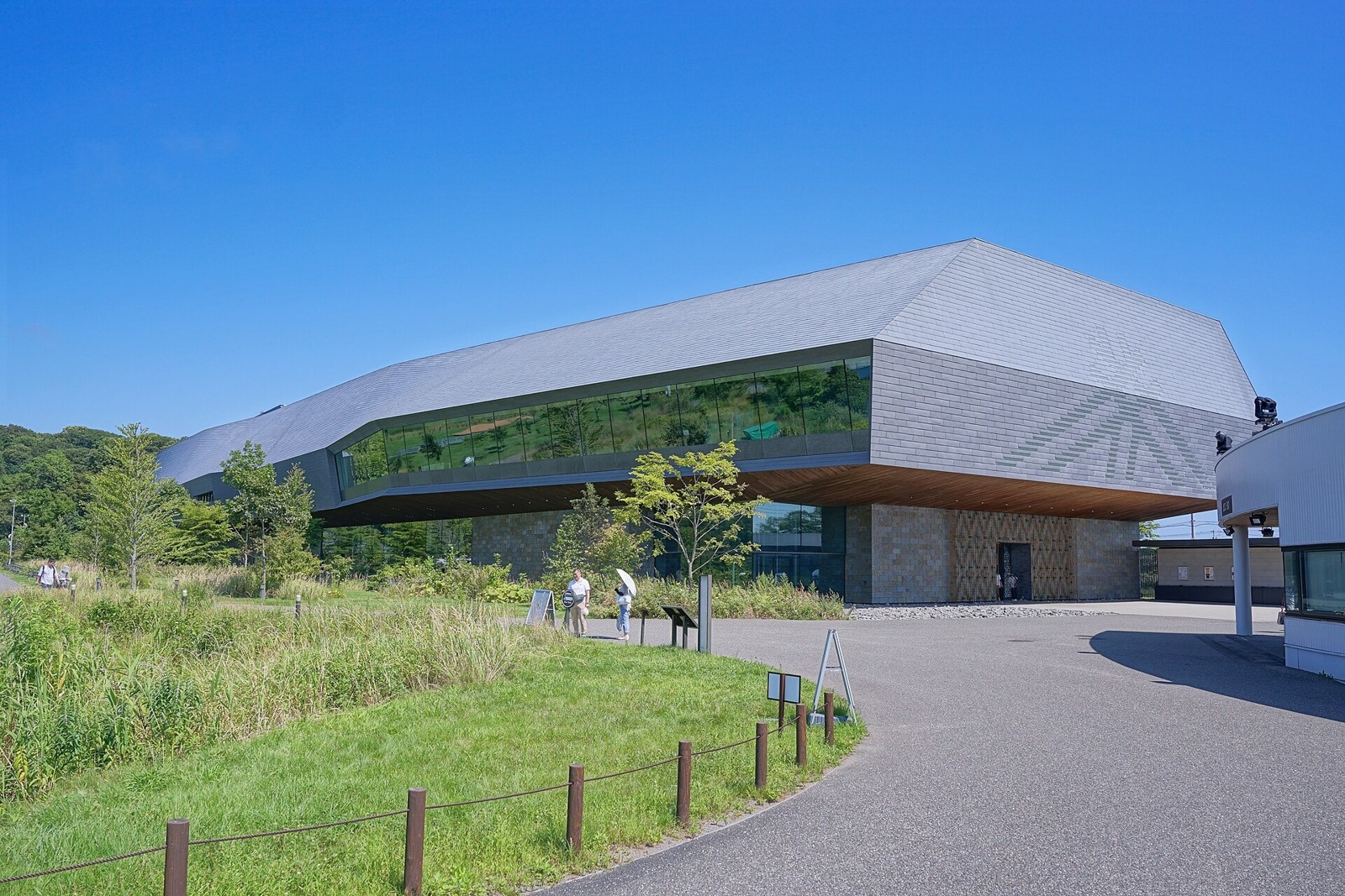
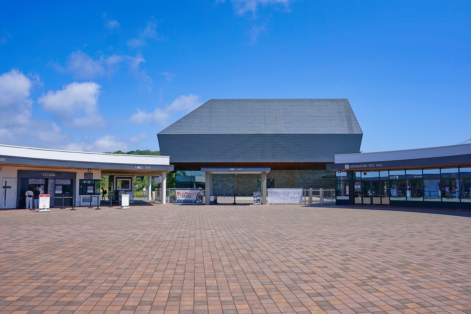
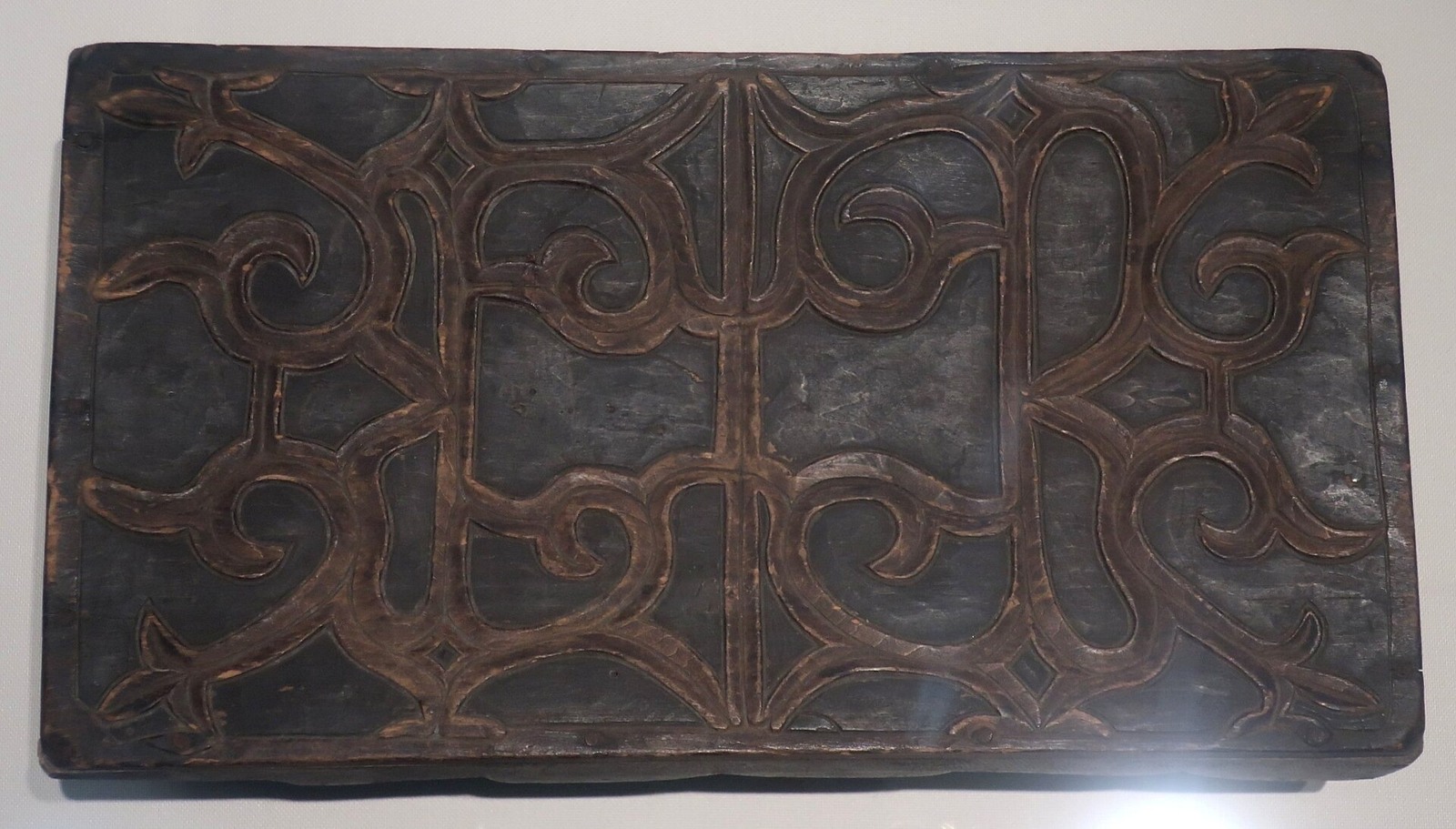
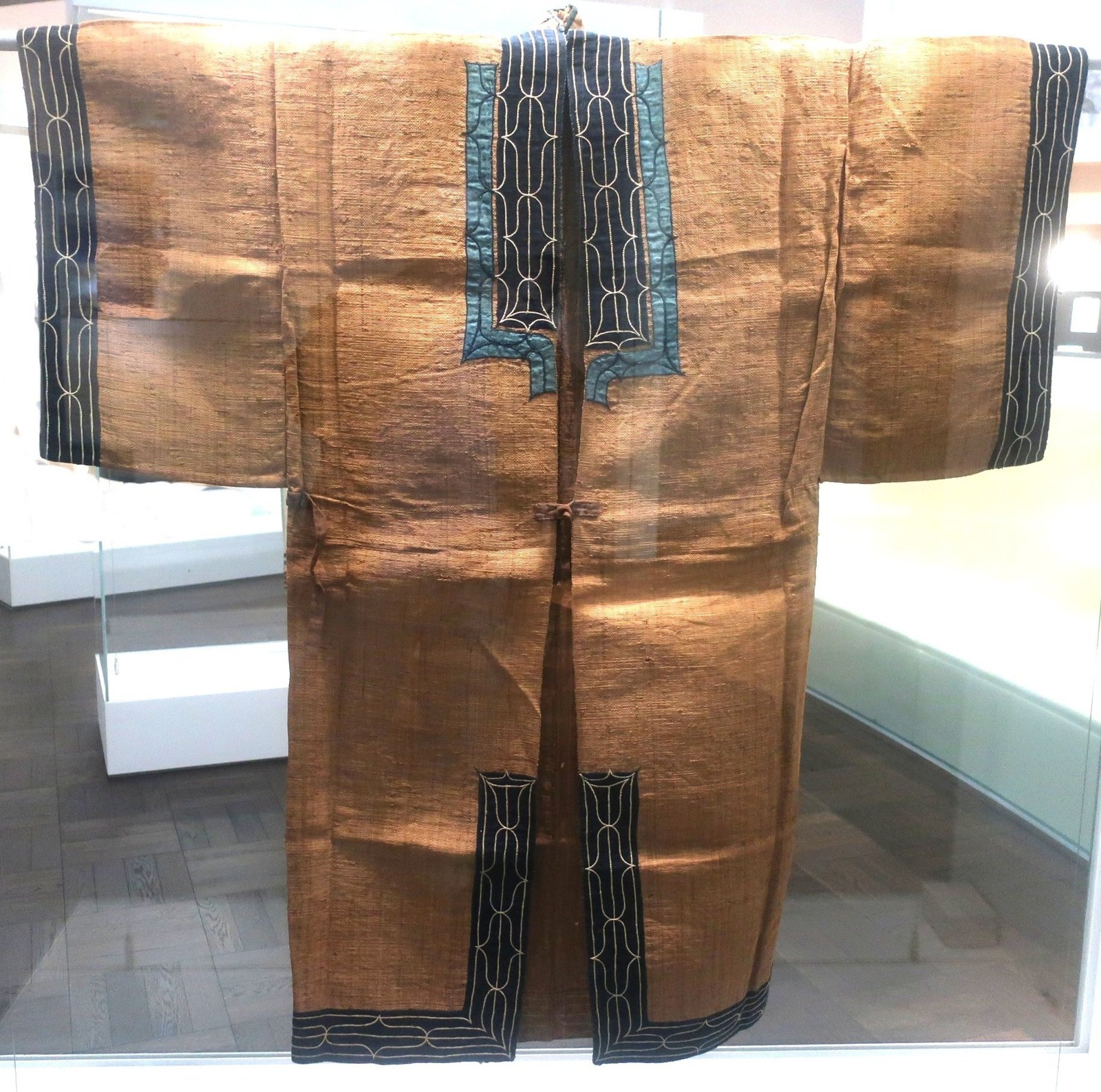
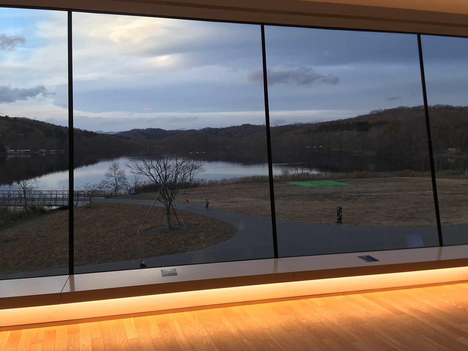
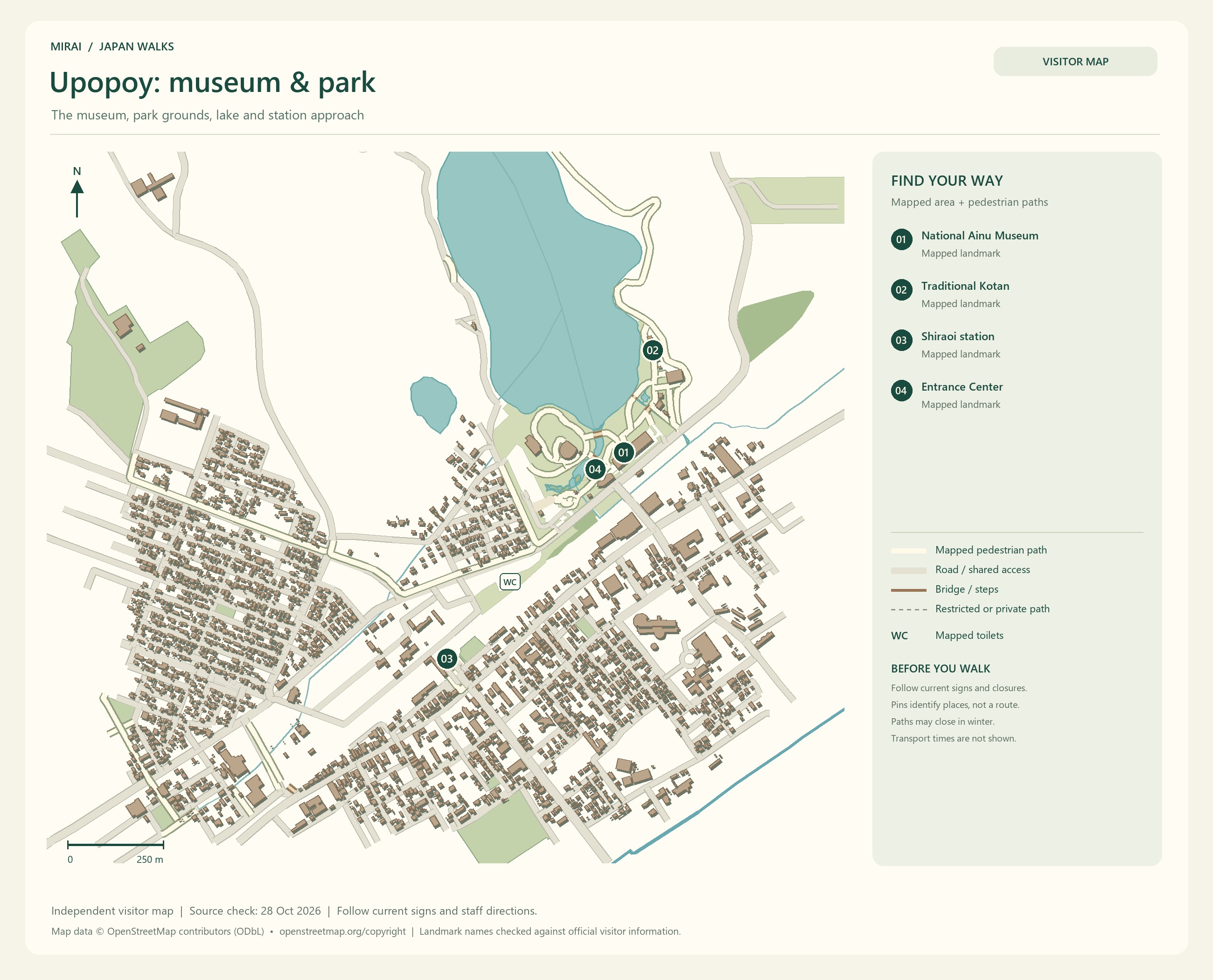
Upopoy, the National Ainu Museum and Park in Shiraoi, includes the National Ainu Museum and National Ainu Park. Exhibitions and cultural experiences offer different ways to learn. Language, crafts, songs or dance: start with something that catches your interest.
‘What does this pattern mean?’ ‘I’d like to listen to that sound a little longer.’ I would be happy if a small moment of curiosity led us to learn more about its background.
If a performance or activity is part of your plan, check the day’s times and participation arrangements first. Leave room to explore a question that interests you, rather than rushing through the exhibits before the next stop.
Listening to people who continue to share and develop Ainu culture today can give your journey through Hokkaido a little more depth.
Maps follow the photos. They show the areas named in their titles, not a single route connecting every place in this gallery. Follow current signs and access conditions.
Photo and map credits
National Ainu Museum 20260822a.jpg — 掬茶. https://commons.wikimedia.org/wiki/File:National_Ainu_Museum_20260822a.jpg | CC BY-SA 4.0 https://creativecommons.org/licenses/by-sa/4.0. Resized/re-encoded for web display; no crop or retouch.
Entrance square of UPOPOY.jpg — 掬茶. https://commons.wikimedia.org/wiki/File:Entrance_square_of_UPOPOY.jpg | CC BY-SA 4.0 https://creativecommons.org/licenses/by-sa/4.0. Resized/re-encoded for web display; no crop or retouch.
Ainu box, National Ainu Museum.jpg — Hiart. https://commons.wikimedia.org/wiki/File:Ainu_box,_National_Ainu_Museum.jpg | CC0 http://creativecommons.org/publicdomain/zero/1.0/deed.en. Resized/re-encoded for web display; no crop or retouch.
Bark fiber garment, National Ainu Museum and Park.jpg — Hiart. https://commons.wikimedia.org/wiki/File:Bark_fiber_garment,_National_Ainu_Museum_and_Park.jpg | CC0 http://creativecommons.org/publicdomain/zero/1.0/deed.en. Resized/re-encoded for web display; no crop or retouch.
Shiraoi-upopoy 40.jpg — Higa4. https://commons.wikimedia.org/wiki/File:Shiraoi-upopoy_40.jpg | CC0 http://creativecommons.org/publicdomain/zero/1.0/deed.en. Resized/re-encoded for web display; no crop or retouch.
Has all this exploring made you hungry? I am already starting to think about our meals.
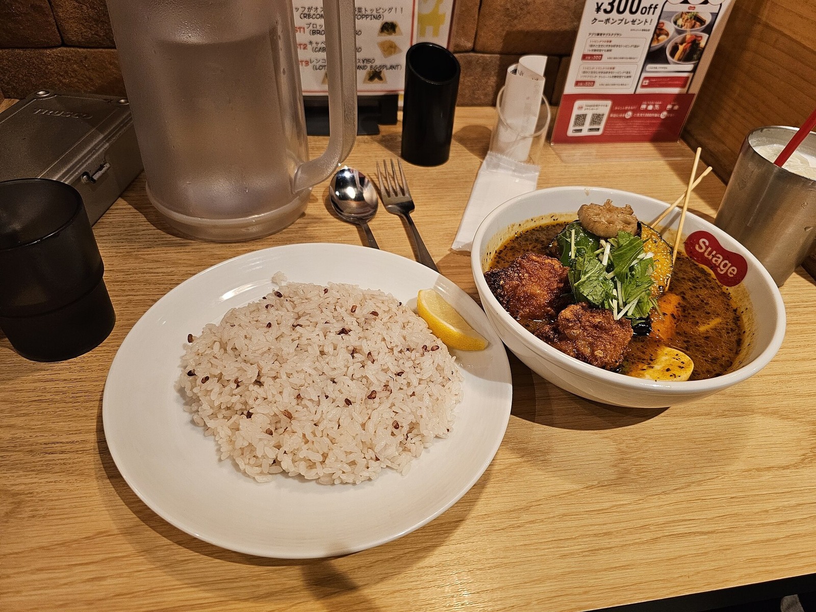
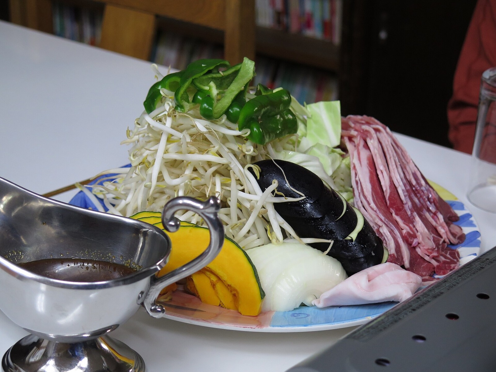
Seafood could be a highlight, and I would like time to share jingisukan, Hokkaido-style grilled lamb or mutton, too. Sapporo soup curry and Obihiro’s pork rice bowls are other dishes to choose around the town you are visiting.
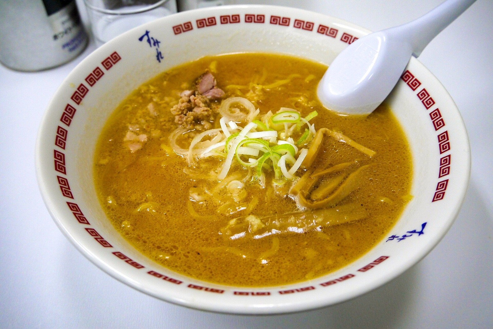
Ramen has its own regional pleasures. Sapporo’s miso, Hakodate’s salt-based broth and Asahikawa’s soy-sauce ramen are well known, with plenty of variation from shop to shop. Let’s look for a bowl that catches our eye.
For seafood and vegetables, pay attention to the place and the season. An ingredient you saw in a photograph may not always be available, so asking what is recommended that day can be part of the fun.
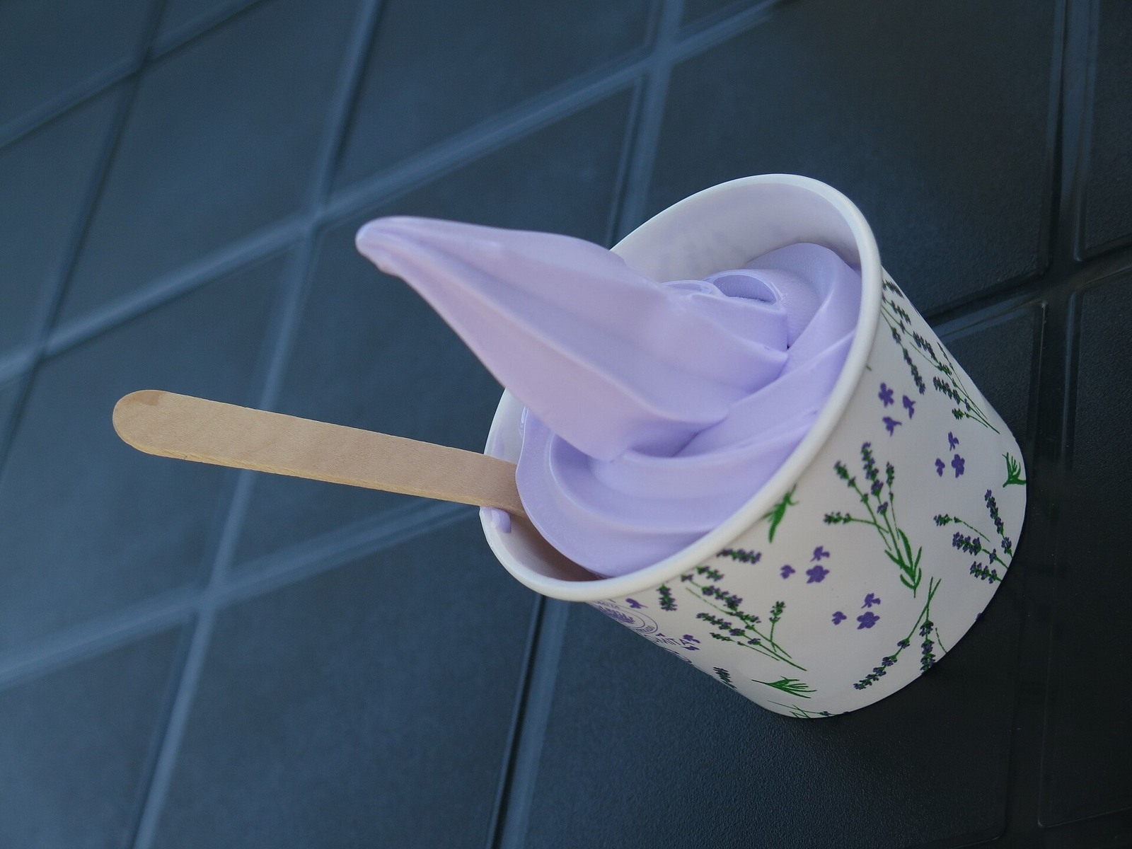
Then there is soft-serve ice cream, cheese and sweets. Between the things to enjoy here and the gifts to take home… hehe, our food list alone could make the trip longer.
When choosing food souvenirs to take abroad, check the ingredients and storage instructions. Whether they can enter your destination country is something we will revisit in the summary below.
Hokkaido food
Soup curry with rice at Suage in Sapporo.Photo date: 2024-09-07 · NZ 토끼들 · CC BY-SA 4.0Miso ramen at Sumire.Photo date: 2014-04-02 · くろふね · CC BY-SA 4.0Lavender soft-serve ice cream at Farm Tomita.Photo date: 2015-08-15 · Douglas Perkins · CC BY 4.0A Tokachi-style pork rice bowl at Ippin.Photo date: 2011-08-22 · カイロス · Public domainMeat and vegetables prepared for a jingisukan meal.Photo date: 2015-08-18 · Douglas Perkins · CC0
Photo credits
20240907 Soup Curry (スープカレー) from Suage.jpg — NZ 토끼들. https://commons.wikimedia.org/wiki/File:20240907_Soup_Curry_(%E3%82%B9%E3%83%BC%E3%83%97%E3%82%AB%E3%83%AC%E3%83%BC)_from_Suage.jpg | CC BY-SA 4.0 https://creativecommons.org/licenses/by-sa/4.0. Resized/re-encoded for web display; no crop or retouch.
味噌ラーメン(すみれ).jpg — くろふね. https://commons.wikimedia.org/wiki/File:%E5%91%B3%E5%99%8C%E3%83%A9%E3%83%BC%E3%83%A1%E3%83%B3%EF%BC%88%E3%81%99%E3%81%BF%E3%82%8C%EF%BC%89.jpg | CC BY-SA 4.0 https://creativecommons.org/licenses/by-sa/4.0. Resized/re-encoded for web display; no crop or retouch.
Lavender soft serve at Farm Tomita.jpg — Douglas Perkins. https://commons.wikimedia.org/wiki/File:Lavender_soft_serve_at_Farm_Tomita.jpg | CC BY 4.0 https://creativecommons.org/licenses/by/4.0. Resized/re-encoded for web display; no crop or retouch.
Tokachi Butadon Ippin Butadon.jpg — カイロス. https://commons.wikimedia.org/wiki/File:Tokachi_Butadon_Ippin_Butadon.jpg | Public domain . Resized/re-encoded for web display; no crop or retouch.
Genghis Khan dish.jpg — Douglas Perkins. https://commons.wikimedia.org/wiki/File:Genghis_Khan_dish.jpg | CC0 http://creativecommons.org/publicdomain/zero/1.0/deed.en. Resized/re-encoded for web display; no crop or retouch.
The same place in Hokkaido looks different from season to season. Consider summer for flowers and greenery, autumn for colour around mountains and lakes, and winter for snow and seasonal events. Start with the view you want, then check its local timing. A spring trip for cherry blossoms sounds lovely, too.
Pack for the area you are visiting and the temperatures in the morning and evening. A city walk in Sapporo and a day beside the sea or in the mountains may call for different things in the same month. Summer can bring cool days as well as days when heat precautions matter.
If you are flying, choose your arrival airport around your destination. For example, consider New Chitose for Sapporo and Otaru, Hakodate Airport for Hakodate, or Asahikawa Airport for Biei and Asahikawa. Compare the flights available to you with transport for the journey after landing.
For trains and buses, check more than whether you can reach a place: look at the return service and how far you can move around once you arrive. Accommodation shuttles may have operating days, advance-booking requirements or eligibility conditions, so confirm those before your stay.
A car gives you flexibility, but the distances do not become shorter. Include driving and rest time. If you are unfamiliar with snowy roads, consider public transport, accommodation transfers or tours as ways to travel.
Winter weather can delay or cancel trains, buses and flights. Avoid filling the day of your flight home with distant sightseeing, and leave room to change plans when the weather changes. A warm drink and a little break deserve a place in the trip, too.
Hokkaido · Travel notes
Let’s go over your Hokkaido trip with MIRAI
Let’s go over a few things before you pack!
01
When to visit
Consider summer for flowers and greenery, autumn for changing leaves, and winter for snow and the Snow Festival. Spring cherry blossoms are another delight. Flowering, autumn colour, snowfall and drift ice vary by area and year: check the particular places you want to visit.
02
Local flavours & souvenirs
Seafood, dairy, sweetcorn and regional sweets offer plenty to choose from. Enjoy local dishes on the journey, from Sapporo miso ramen and soup curry to Hakodate salt ramen, Asahikawa soy-sauce ramen and Obihiro pork rice bowls. For gifts, check ingredients, shelf life and refrigeration or freezing requirements.
03
Getting around & planning your days
Choose your main region first, then connect your arrival airport, overnight base and local transport. Check the return bus or train, and seasonal ferry timetables for island trips. Meals, sightseeing and breaks need time too, so do not fill a day using map distances alone.
04
Before you go
Pack for the area, season and time of day. In winter, prepare for icy surfaces and leave room for transport delays before your flight home. Check opening days, seasonal closures, reservations and guide requirements. Stay out of farmland and private property, and follow local instructions in natural areas.
Which place made you think, ‘I’d love to go’?
A day among seasonal flowers, a walk through a harbour town, a slow soak in a hot spring: Hokkaido offers so many different things to look forward to.
You do not have to choose everything at once. This view for this trip, another town for the next. Wouldn’t it be lovely to keep adding things to look forward to?
Which Hokkaido caught your heart? Let’s take that ‘I’d love to go’ and start planning together.